
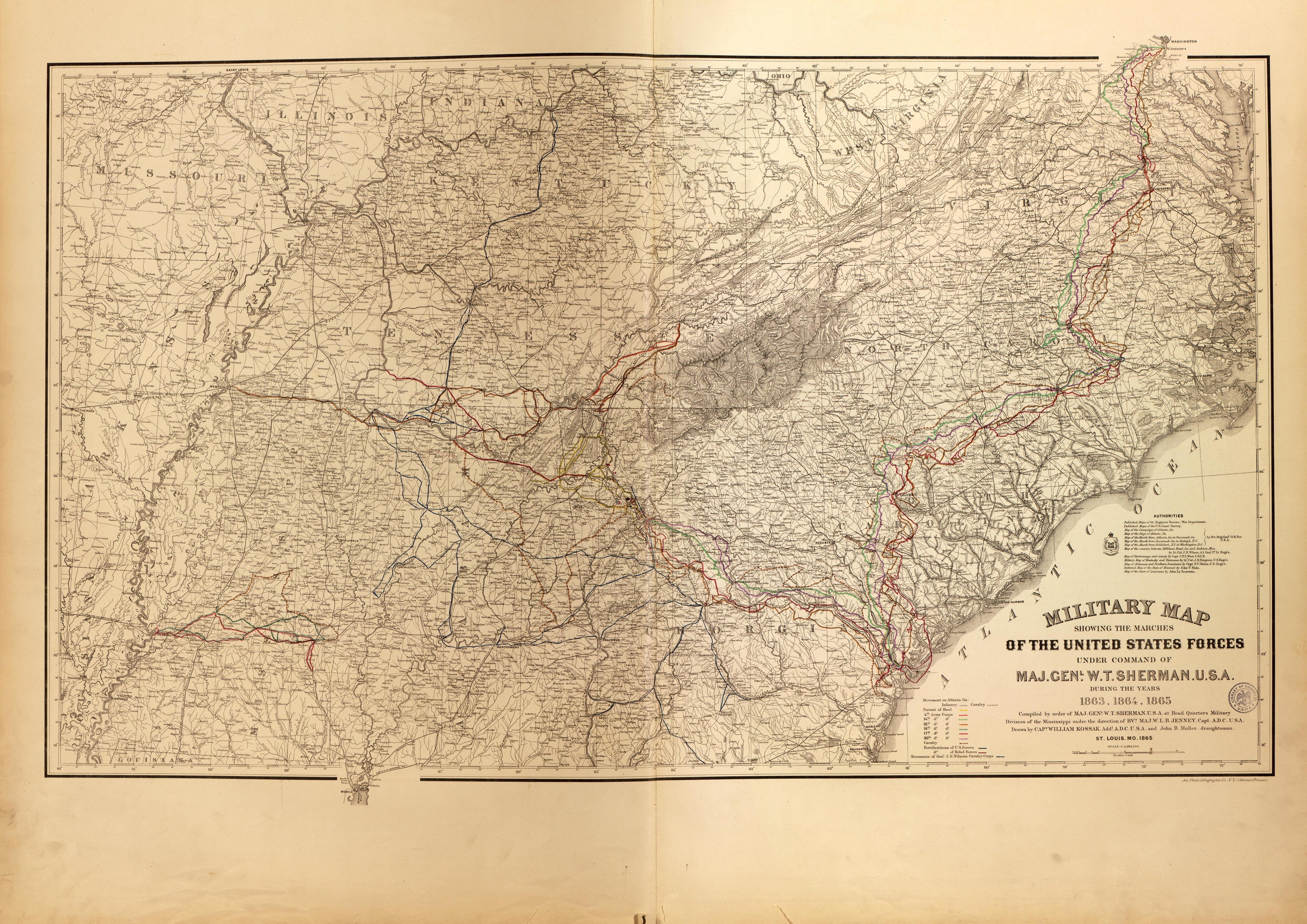
Military Map of Marches of United States Under Maj. Gen. W.T. Sherman,1863-65 from Military Maps of the United States 1883
- Regular price
-
$49.95 - Regular price
-
$36.95 - Sale price
-
$49.95
Buy one map, get any other map in our collection for 50% OFF! Add to cart to see discount.
Couldn't load pickup availability
About This Map
Discover the timeless beauty of our fine art quality printed reproduction of this antique map. Perfect for history enthusiasts, collectors, and interior decorators.
Restored with meticulous attention to detail by our team with over a decade of experience, this stunning reproduction captures the intricate artistry and historical significance of the original map.
Whether you're a collector or seeking a unique decor piece, this archival-quality map reproduction is a timeless addition to any space. Order now to bring history to life!
Created by United States. Army. Corps of Engineers in 1883.- Relief shown by contours, hachures, and spot heights on some maps. Depths shown by contours on some maps.
- Title from spine.
- Maps dated from 1862 to 1883.
- Includes list of contents affixed to blank page preceeding map sheets.
- Bound collection of maps including a "Military map showing the marches of the United States forces under command of Maj. Genl. W. T. Sherman, U.S.A., during the years 1863, 1864, 1865," and maps of the battles of Knoxville, Chattanooga, Atlanta, Blakely, Nashville, Shiloh, Fort Fisher, South Mountain, Vicksburg, Franklin, Antietam, Harpers Ferry, Fredericksburg, Chancellorsville, Wilderness, Spotsylvania, North Anna, Totopotomoy, Cold Harbor, Bermuda Hundred, Richmond, Petersburg and Five Forks, Jetersville and Sailors Creek, High Bridge and Farmville, and Appomattox Court House.
- LeGear. Atlases of the United States, 10674
Map Subjects
19th Century
Atlases
Campaigns
Civil War
Fortification
History
History Military
United States
Allamakee County
Virginia
United States. Army. Corps Of Engineers
1883
Military Map Of Marches Of United States Under Maj. Gen. W.T. Sherman,1863-65
Military Maps Of The United States
- For the best legibility, order your map in the original size or larger. Most maps have intricate detail and small text that is best appreciated when the print size hasn't been reduced.
- Sizes labeled "Fits a Standard Frame" will drop right into any frame that you purchase in that size. The sizes that we offer are commonly available online and at most retail stores.
- Our standard sizes are recommendations based on the aspect ratio of the original map, but still may require some added "white space" in one dimension to fit.
- Non-standard sizes will require custom framing, and we suggest taking your print to the frame shop of your choice after you receive it for the best results.
- Custom sizes are available, simply contact us for a quote.
Below is an approximation of the scale of a few standard sizes, and how they might appear in your space.

