
Sichuan, Hubei Shui Dao Tu. (四川湖北水道图, Min Jiang Tu Shuo, Map of the Waterways In Sichuan and Hubei Provinces) 1735
- Regular price
-
$49.95 - Regular price
-
$29.95 - Sale price
-
$49.95
Buy one map, get any other map in our collection for 50% OFF! Add to cart to see discount.
Couldn't load pickup availability
About This Map
Discover the timeless beauty of our fine art quality printed reproduction of this antique map. Perfect for history enthusiasts, collectors, and interior decorators.
Restored with meticulous attention to detail by our team with over a decade of experience, this stunning reproduction captures the intricate artistry and historical significance of the original map.
Whether you're a collector or seeking a unique decor piece, this archival-quality map reproduction is a timeless addition to any space. Order now to bring history to life!
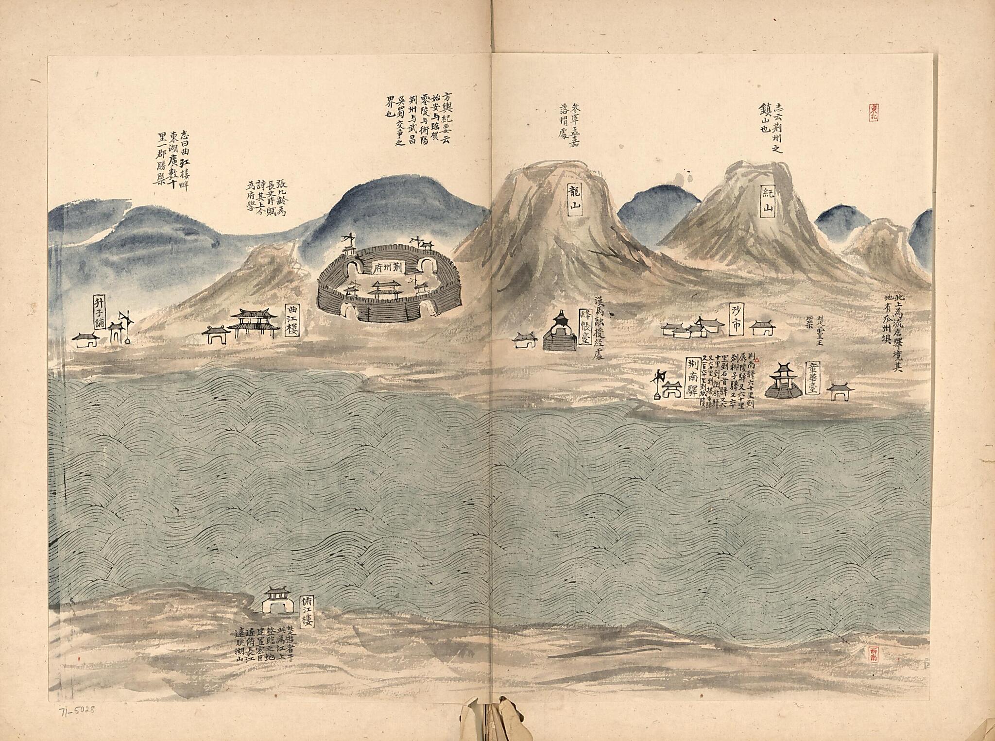
Old early map / pictorial map / manuscript map of China, Min River, Sichuan Sheng, Yangtze River.- Scale not given.
- Title supplied.
- Previous supplied title: Min Jiang tu shuo.
- Relief shown pictorially.
- Pictorial map.
- Hummel purchase 1934, no. 4.
- Shows the waterways and points of interest of Min and Yangtze Rivers from Songpan, Sichuan to Jingzhou, Hubei.
- Includes text.
- Previous call number: G7822.Y3A5 1733 .M5 Vault Shelf
Map Subjects
China
Early Maps
Early Works To 1800
Manuscript Maps
Min River
Min River (Sichuan Sheng China)
Pictorial Maps
Sichuan Sheng
Yangtze River
Yangtze River (China)
1735
- For the best legibility, order your map in the original size or larger. Most maps have intricate detail and small text that is best appreciated when the print size hasn't been reduced.
- Sizes labeled "Fits a Standard Frame" will drop right into any frame that you purchase in that size. The sizes that we offer are commonly available online and at most retail stores.
- Our standard sizes are recommendations based on the aspect ratio of the original map, but still may require some added "white space" in one dimension to fit.
- Non-standard sizes will require custom framing, and we suggest taking your print to the frame shop of your choice after you receive it for the best results.
- Custom sizes are available, simply contact us for a quote.
Below is an approximation of the scale of a few standard sizes, and how they might appear in your space.

