
Miscellaneous Lithographed Proof Sheets of Areas In Virginia : Field Surveys Compiled and Printed by the Engineer Department, Army of the Potomac 1863
- Regular price
-
$56.95 - Regular price
-
$39.95 - Sale price
-
$56.95
Buy one map, get any other map in our collection for 50% OFF! Add to cart to see discount.
Couldn't load pickup availability
About This Map
Discover the timeless beauty of our fine art quality printed reproduction of this antique map. Perfect for history enthusiasts, collectors, and interior decorators.
Restored with meticulous attention to detail by our team with over a decade of experience, this stunning reproduction captures the intricate artistry and historical significance of the original map.
Whether you're a collector or seeking a unique decor piece, this archival-quality map reproduction is a timeless addition to any space. Order now to bring history to life!
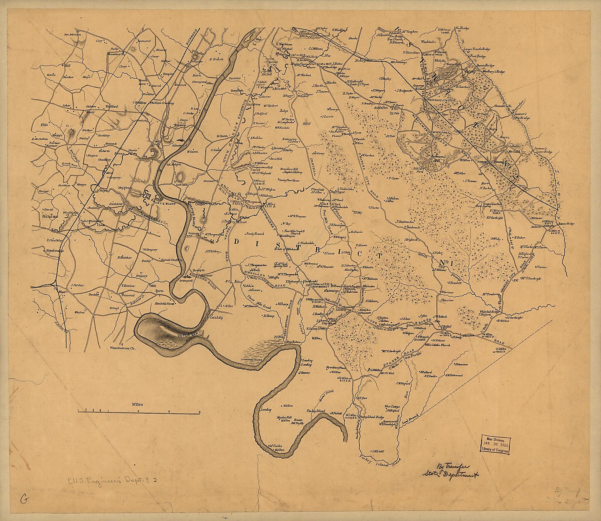
Old topographic map of United States, Virginia.Created by J. F. Gedney, United States. Army of the Potomac. Engineer Department, United States. Army of the Potomac. Office of Surveys and Maps in 1863.
- Shows towns, roads, railroads, rivers, and houses with names of residents.
- Relief shown by hachures.
- Title derived from R.W. Stephenson's: Civil War maps, 2nd ed., 1989.
- Sheets are unnumbered and untitled.
- Some sheets are mounted on cloth backing and are torn in margins with holes and water stains throughout.
- The sheet covering the environs of Dumfries, Acquia, and Stafford is marked "Proof sheet issued June 12th 1863 Hd. Qr. Army of the Potomac, Engineers Department"; the sheet covering the Warrenton and Bristoe Station area is marked "Office of Surveys and Maps for the Army of the Potomac, 78 Winder's Building, Sept. 15th 1863."
- Sheets covering Culpeper C.H. and vicinity, ed. Nov. 10, 1863, and Morrisville, Tackett's Mill, and vicinity, ed. Nov. 12, 1863 Gift; Summit Enterprises; June 2003.
- Civil War Map
Map Subjects
Civil War
History
Military Topography
Topographic Maps
United States
Virginia
J. F. Gedney
United States. Army Of The Potomac. Engineer Department
United States. Army Of The Potomac. Office Of Surveys And Maps
1863
- For the best legibility, order your map in the original size or larger. Most maps have intricate detail and small text that is best appreciated when the print size hasn't been reduced.
- Sizes labeled "Fits a Standard Frame" will drop right into any frame that you purchase in that size. The sizes that we offer are commonly available online and at most retail stores.
- Our standard sizes are recommendations based on the aspect ratio of the original map, but still may require some added "white space" in one dimension to fit.
- Non-standard sizes will require custom framing, and we suggest taking your print to the frame shop of your choice after you receive it for the best results.
- Custom sizes are available, simply contact us for a quote.
Below is an approximation of the scale of a few standard sizes, and how they might appear in your space.

