
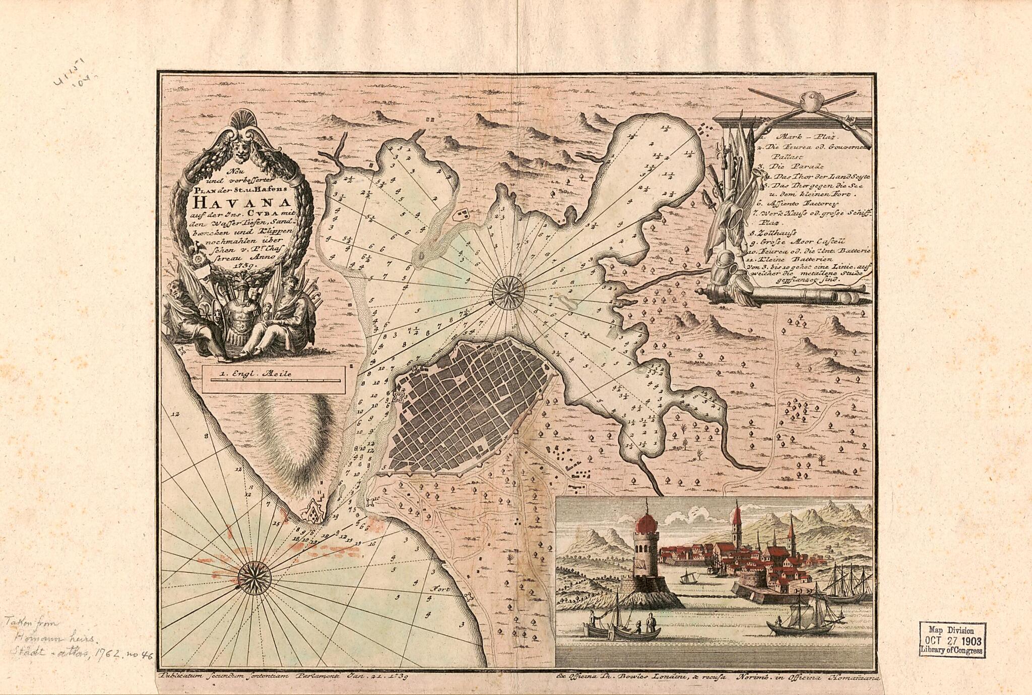
Neu Und Verbesserter Plan Der St. U. Hafens Havana Auf Der Ins. Cvba Mit Den Wasser Tiefen, Sand Bæncken Und Klippen Nochmahten übersehen V. Pr. Chassereau Anno 1739 1740
- Regular price
-
$49.95 - Regular price
-
$34.95 - Sale price
-
$49.95
Buy one map, get any other map in our collection for 50% OFF! Add to cart to see discount.
Couldn't load pickup availability
About This Map
Discover the timeless beauty of our fine art quality printed reproduction of this antique map. Perfect for history enthusiasts, collectors, and interior decorators.
Restored with meticulous attention to detail by our team with over a decade of experience, this stunning reproduction captures the intricate artistry and historical significance of the original map.
Whether you're a collector or seeking a unique decor piece, this archival-quality map reproduction is a timeless addition to any space. Order now to bring history to life!
Old map of Bay of Cartagena, Cartagen, Bay Of., Cartagena Bay, Colombia, Cuba, Havana.Created by Thomas Bowles, Homann Erben (Firm) in 1740.
- Hand colored.
- Relief shown pictorially and by hachures. Depths shown by soundings.
- "Eoc officina Th. Bowles Londini, & recusa. Norimb. in officina Homaniana."
- Appears in the author's Städt-Atlas; oder, Schaüplatz berühmter Städte, Vestungen, Prospeckte, Gegenden, Grundrisse, Belagerungen, etc. ... 1762.
- Includes index to points of interest, descriptive note, and view of entrance to the harbor.
Map Subjects
Cartagen Bay Of
Cartagena Bay
Cartagena Bay Of (Colombia)
Colombia
Cuba
Early Works To 1800
Harbors
Havana
Havana (Cuba)
Nautical Charts
Bay Of Cartagena
Cartagen Bay Of.
Thomas Bowles
Homann Erben (Firm)
1740
- For the best legibility, order your map in the original size or larger. Most maps have intricate detail and small text that is best appreciated when the print size hasn't been reduced.
- Sizes labeled "Fits a Standard Frame" will drop right into any frame that you purchase in that size. The sizes that we offer are commonly available online and at most retail stores.
- Our standard sizes are recommendations based on the aspect ratio of the original map, but still may require some added "white space" in one dimension to fit.
- Non-standard sizes will require custom framing, and we suggest taking your print to the frame shop of your choice after you receive it for the best results.
- Custom sizes are available, simply contact us for a quote.
Below is an approximation of the scale of a few standard sizes, and how they might appear in your space.
