
New York Island and East Jersey. Unfinished in 1770
- Regular price
-
$165.95 - Regular price
-
$160.95 - Sale price
-
$165.95
Buy one map, get any other map in our collection for 50% OFF! Add to cart to see discount.
Couldn't load pickup availability
About This Map
Discover the timeless beauty of our fine art quality printed reproduction of this antique map. Perfect for history enthusiasts, collectors, and interior decorators.
Restored with meticulous attention to detail by our team with over a decade of experience, this stunning reproduction captures the intricate artistry and historical significance of the original map.
Whether you're a collector or seeking a unique decor piece, this archival-quality map reproduction is a timeless addition to any space. Order now to bring history to life!
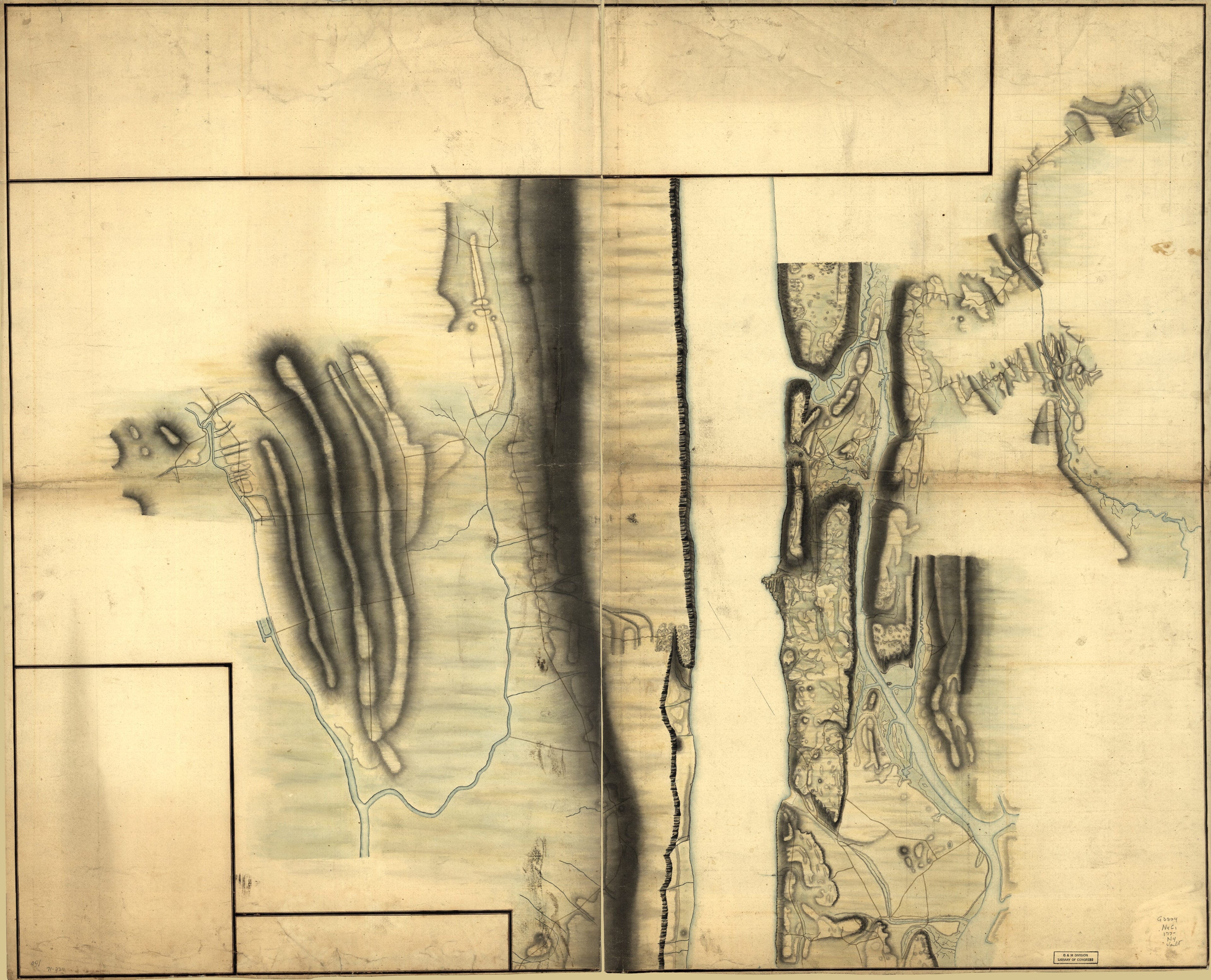
Old map of Bergen County, New Jersey, New York, New York (N.Y.), New York (State), New York City, United States.- Scale ca. 1:17,000.
- Title from manuscript catalog of the Peter Force map collection.
- Variant title in Philip Lee Phillips' A list of maps of America: Topography of upper part of Manhattan Island from about 85th St. to about the Van Cortlandt Manor house, above King's bridge. 1777-1780.
- Manuscript, pen-and-ink and watercolor.
- Relief shown by shading.
- Shows detailed topography of Manhattan Island north of Hell Gate, east of the Harlem River to the Bronx River, and in New Jersey west to the Hackensack River. Without names or military information.
- Note on verso: No. 6. Unfinished drawings. 50 sheets. (2) same as ten other with work on Jersey side and in Westchester County.
- For the best legibility, order your map in the original size or larger. Most maps have intricate detail and small text that is best appreciated when the print size hasn't been reduced.
- Sizes labeled "Fits a Standard Frame" will drop right into any frame that you purchase in that size. The sizes that we offer are commonly available online and at most retail stores.
- Our standard sizes are recommendations based on the aspect ratio of the original map, but still may require some added "white space" in one dimension to fit.
- Non-standard sizes will require custom framing, and we suggest taking your print to the frame shop of your choice after you receive it for the best results.
- Custom sizes are available, simply contact us for a quote.
Below is an approximation of the scale of a few standard sizes, and how they might appear in your space.

