
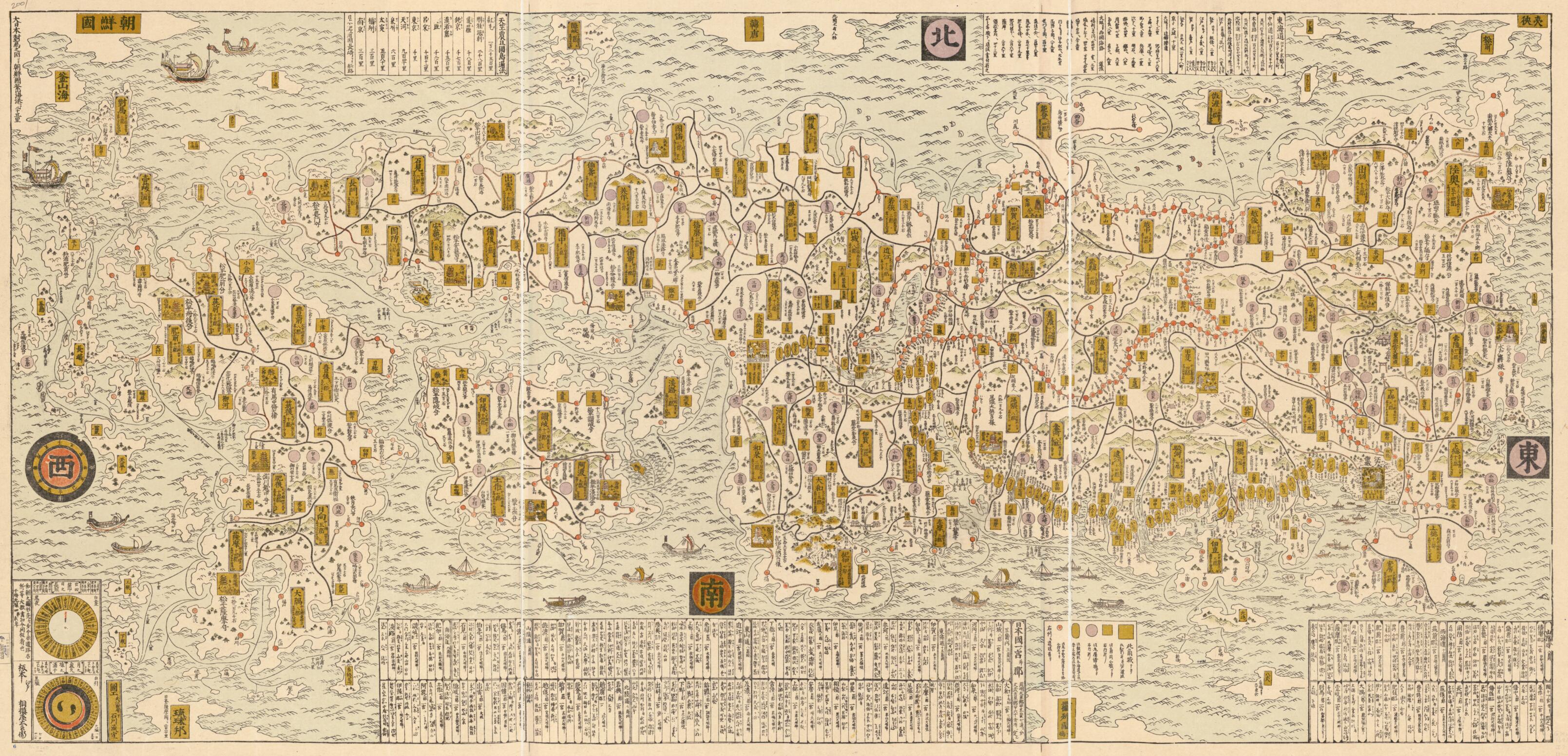
日本海山潮陸図 /, Nihon Sankai Zudō Taizen in 1691
- Regular price
-
$206.95 - Regular price
-
$201.95 - Sale price
-
$206.95
Shipping calculated at checkout.
Buy one map, get any other map in our collection for 50% OFF! Add to cart to see discount.
Couldn't load pickup availability
About This Map
Old early map of Japan.
Created by Tomonobu Ishikawa, Tah Sagamiya in 1691.
Created by Tomonobu Ishikawa, Tah Sagamiya in 1691.
- Title "Nihon sankai zudō taizen" from Nihon koezu shūsei, suppl., p. 103.
- Facsimile.
- Oriented with north toward the upper right.
- Relief shown pictorially.
- Pictorial map.
- "Wachō no zukei sakizaki ōshi ima mata dōro meisho tō taigai kakikuwae kaihan seshimuru mono nari."
- Shows fuedal fiefs.
- Includes distance chart, list of important place names and shrines, and chart of seasonal changes.
- Date on class no. needs to be examined.
Map Sizing Information
- For the best legibility, order your map in the original size or larger. Most maps have intricate detail and small text that is best appreciated when the print size hasn't been reduced.
- Sizes labeled "Fits a Standard Frame" will drop right into any frame that you purchase in that size. The sizes that we offer are commonly available online and at most retail stores.
- Our standard sizes are recommendations based on the aspect ratio of the original map, but still may require some added "white space" in one dimension to fit.
- Non-standard sizes will require custom framing, and we suggest taking your print to the frame shop of your choice after you receive it for the best results.
- Custom sizes are available, simply contact us for a quote.
Below is an approximation of the scale of a few standard sizes, and how they might appear in your space.
