
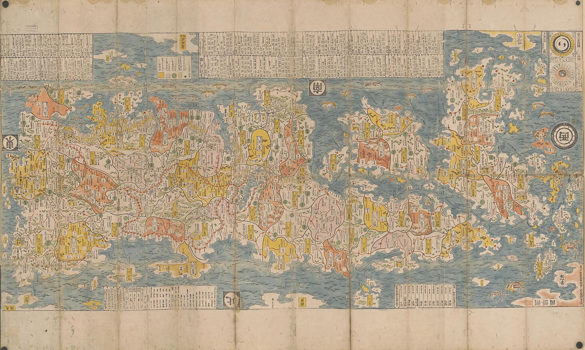
Nihon Kaisan Chōrikuzu (日本海山潮陸図 /, Nihon Sankai Zudō Taizen) 1691
- Regular price
-
$248.95 - Regular price
-
$243.95 - Sale price
-
$248.95
Buy one map, get any other map in our collection for 50% OFF! Add to cart to see discount.
Couldn't load pickup availability
About This Map
Discover the timeless beauty of our fine art quality printed reproduction of this antique map. Perfect for history enthusiasts, collectors, and interior decorators.
Restored with meticulous attention to detail by our team with over a decade of experience, this stunning reproduction captures the intricate artistry and historical significance of the original map.
Whether you're a collector or seeking a unique decor piece, this archival-quality map reproduction is a timeless addition to any space. Order now to bring history to life!
Old early map of Japan.Created by Tomonobu Ishikawa, Tah Sagamiya in 1691.
- Title from Nihon koezu shūsei, suppl., p. 103.
- Title on label mounted on case: Nihon-koku sōzu.
- Wood block print; hand colored.
- Oriented with north toward the upper right.
- Relief shown pictorially.
- Pictorial map.
- Shows feudal fiefs.
- "Wachō no zukei sakizaki ōshi ima mata dōro meisho tō taigai kakikuwae kaihan seshimuru mono nari."
- Includes lists of shrines and place names, 2 seasonal diagrs., and distance charts.
Map Subjects
Early Maps
Early Works To 1800
Japan
Tomonobu Ishikawa
Tah Sagamiya
1691
- For the best legibility, order your map in the original size or larger. Most maps have intricate detail and small text that is best appreciated when the print size hasn't been reduced.
- Sizes labeled "Fits a Standard Frame" will drop right into any frame that you purchase in that size. The sizes that we offer are commonly available online and at most retail stores.
- Our standard sizes are recommendations based on the aspect ratio of the original map, but still may require some added "white space" in one dimension to fit.
- Non-standard sizes will require custom framing, and we suggest taking your print to the frame shop of your choice after you receive it for the best results.
- Custom sizes are available, simply contact us for a quote.
Below is an approximation of the scale of a few standard sizes, and how they might appear in your space.
