
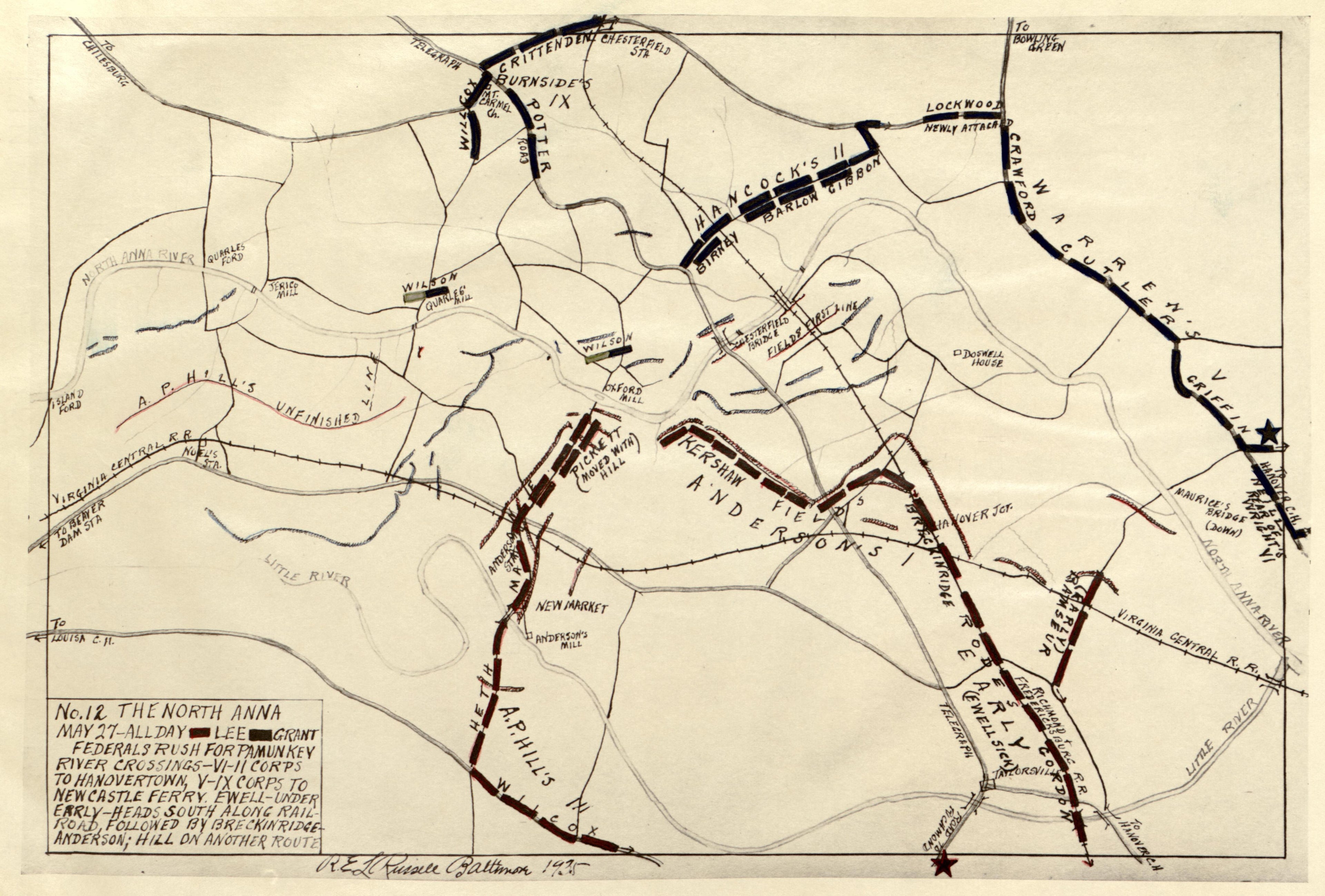
No 12 - the North Anna, May 27 - All Day from the North Anna and Movement from Spottsylvania sic, May 21-26, 1864, Between Lee, 50,000 and Grant, 100,000
- Regular price
-
$49.95 - Regular price
-
$36.95 - Sale price
-
$49.95
Buy one map, get any other map in our collection for 50% OFF! Add to cart to see discount.
Couldn't load pickup availability
About This Map
Discover the timeless beauty of our fine art quality printed reproduction of this antique map. Perfect for history enthusiasts, collectors, and interior decorators.
Restored with meticulous attention to detail by our team with over a decade of experience, this stunning reproduction captures the intricate artistry and historical significance of the original map.
Whether you're a collector or seeking a unique decor piece, this archival-quality map reproduction is a timeless addition to any space. Order now to bring history to life!
Old atlas of North Anna River, , Virginia.Created by Russell, Robert E. L. in 1864.
- "Lee's famous "hog-snout" line."
- "Read numerically."
- Maps 1 to 4 are dated 1933 and maps 5 to 12 dated 1935.
- Annotated in pen-and-ink, crayon and pencil. Confederate troop positions are colored red and Union positions are blue.
- Includes notes.
- LeGear. Atlases of the United States, 10664
Map Subjects
Atlases
Civil War
History
North Anna River
North Anna River (Va.)
North Anna River Battle Of VA
United States
Virginia
Allamakee County
Robert E. L. Russell
1864
No 12 - The North Anna May 27 - All Day
The North Anna And Movement From Spottsylvania [sic] May 21-26 1864 Between Lee 50,000 And Grant 100,000
- For the best legibility, order your map in the original size or larger. Most maps have intricate detail and small text that is best appreciated when the print size hasn't been reduced.
- Sizes labeled "Fits a Standard Frame" will drop right into any frame that you purchase in that size. The sizes that we offer are commonly available online and at most retail stores.
- Our standard sizes are recommendations based on the aspect ratio of the original map, but still may require some added "white space" in one dimension to fit.
- Non-standard sizes will require custom framing, and we suggest taking your print to the frame shop of your choice after you receive it for the best results.
- Custom sizes are available, simply contact us for a quote.
Below is an approximation of the scale of a few standard sizes, and how they might appear in your space.
