
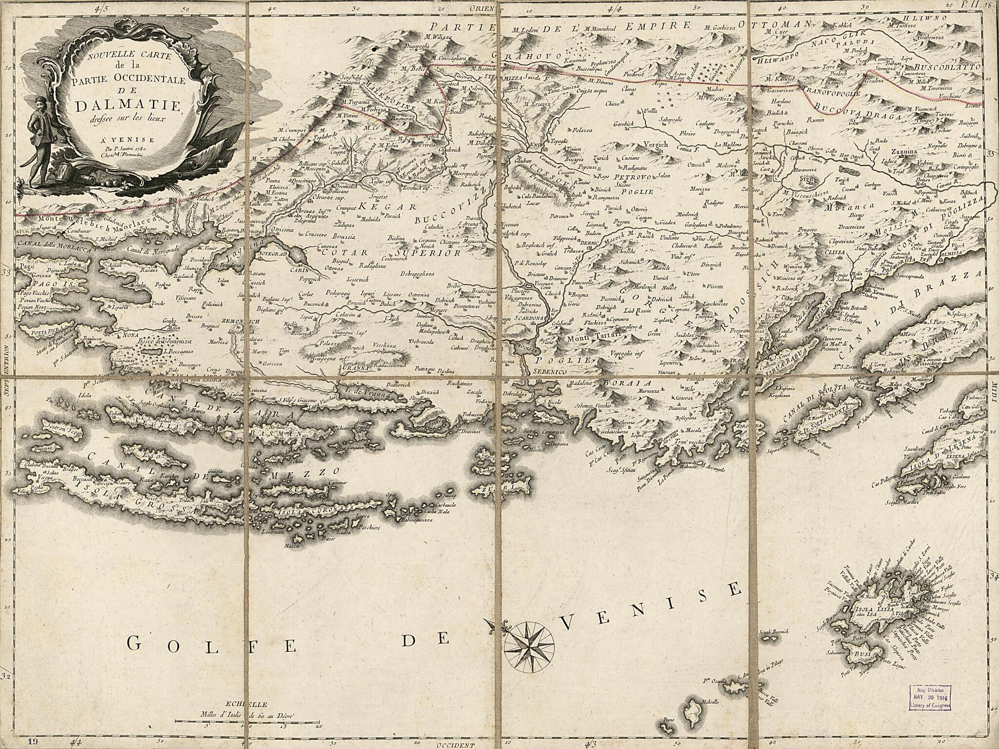
Nouvelle Carte De La Partie Occidentale De Dalmatie : Dressée Sur Les Lieux 1780
- Regular price
-
$54.95 - Regular price
-
$49.95 - Sale price
-
$54.95
Buy one map, get any other map in our collection for 50% OFF! Add to cart to see discount.
Couldn't load pickup availability
About This Map
Discover the timeless beauty of our fine art quality printed reproduction of this antique map. Perfect for history enthusiasts, collectors, and interior decorators.
Restored with meticulous attention to detail by our team with over a decade of experience, this stunning reproduction captures the intricate artistry and historical significance of the original map.
Whether you're a collector or seeking a unique decor piece, this archival-quality map reproduction is a timeless addition to any space. Order now to bring history to life!
Old early map of Croatia, Dalmatia.Created by Giovanni Battista Remondini, P. Santini in 1780.
- Covers the Dalmatian littoral region and the nearby islands.
- Relief shown pictorially.
- Oriented with north toward the upper left.
- Hand colored in red to emphasize the northwestern boundary of Dalmatia.
- Prime meridian: Ferro.
- When affixed to the cloth backing the map sheet was sectioned to 8 panels to enable folding.
- Includes embellished title cartouche and a bar scale of "Milles d'Italie de 60 au Dégré".
- Mapseller's printed advert slip affixed to verso: James Wyld, successor to Mr. Faden, Geographer to his Majesty ...Charing Cross; handwritten in the blank central area of this slip in black ink is "1780, Millard Filllmore [signature] March 27 '55" and in blue ink "3 Jan 12".
- Lower left panel of cloth backing (verso) is annotated in brown ink handwriting: Dalmatia 1780; affixed adjacent to this is an adhesive paper label with the number "234".
Map Subjects
Coasts
Croatia
Dalmatia
Dalmatia (Croatia)
Early Maps
Early Works To 1800
Islands
Giovanni Battista Remondini
P. Santini
1780
- For the best legibility, order your map in the original size or larger. Most maps have intricate detail and small text that is best appreciated when the print size hasn't been reduced.
- Sizes labeled "Fits a Standard Frame" will drop right into any frame that you purchase in that size. The sizes that we offer are commonly available online and at most retail stores.
- Our standard sizes are recommendations based on the aspect ratio of the original map, but still may require some added "white space" in one dimension to fit.
- Non-standard sizes will require custom framing, and we suggest taking your print to the frame shop of your choice after you receive it for the best results.
- Custom sizes are available, simply contact us for a quote.
Below is an approximation of the scale of a few standard sizes, and how they might appear in your space.

