Skip to product information
1 of 1

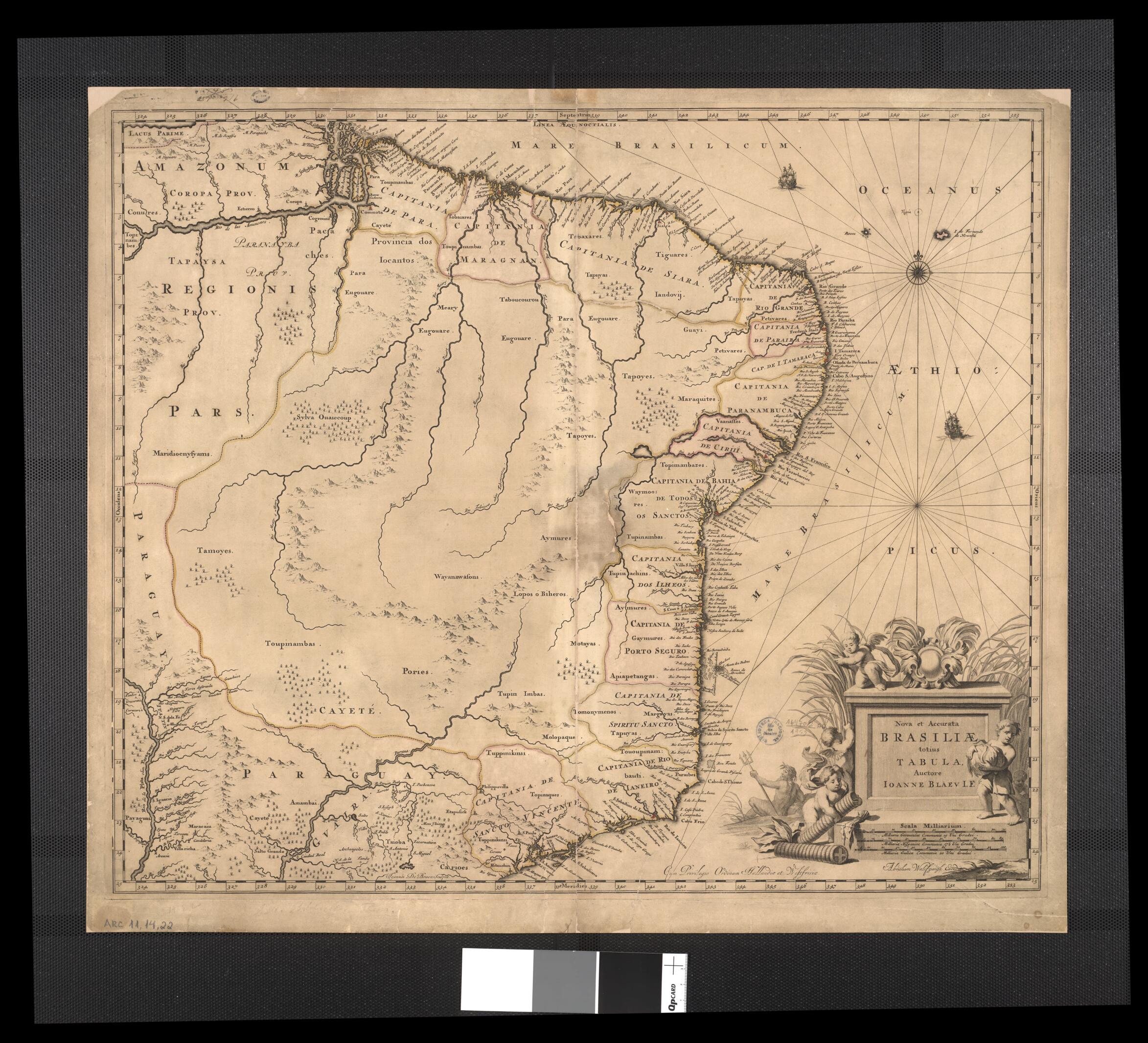
New and Accurate Picture of All Brazil / Johann Blaev I.F.. (Nova Et Accurata Brasiliae Totius Tabula / Ioanne Blaev I.F.) 1680

Regular price
$71.95
Regular price
$114.99
Sale price
$71.95
Map Description
Old map of Brazil.

1673), one of the most important Dutch cartographers. Originally trained as a lawyer, Blaeu joined the Amsterdam business of his father, the cartographer Willem Blaeu (1571-1638). With his father and brother Cornelis (died 1648), Joan Blaeu published the Atlas Novus (New atlas), an 11-volume work consisting of 594 maps. Joan Blaeu later became the official cartographer of the Dutch East India Company. During the 1600s, the Netherlands became a major naval and commercial power, and its maps reflected its seafaring and commercial prowess. Most Dutch maps of the period are the work of family businesses.

Created by Joan Blaeu, Abraham Wolfgangk in 1680.

  • Title devised, in English, by Library staff.
  • Original resource extent: 1 colored map ; 50 x 58 centimeters.
  • Original resource at: National Library of Brazil.
  • Content in Latin.
  • Description based on data extracted from World Digital Library, which may be extracted from partner institutions.

Map Tags

1680

Abraham Wolfgangk

Brazil

Indians Of South America

Joan Blaeu

Map

Missions

Fine Art Quality Printed on heavyweight (230 gsm) archival paper with a classic matte finish
Professionally Restored For the best presentation, your map will be carefully retouched by our experienced team
Free Shipping Orders of $75 or more ship for free and arrive in 3-5 business days
Proudly Made in the USA All of our maps are custom printed to order in Portland, Maine
Help with Choosing a Map Size
Secure Checkout
Lifetime Warranty
Money-Back Guarantee
This old map of New and Accurate Picture of All Brazil / Johann Blaev I.F.. (Nova Et Accurata Brasiliae Totius Tabula / Ioanne Blaev I.F.) from 1680 was created by Joan Blaeu, Abraham Wolfgangk in 1680