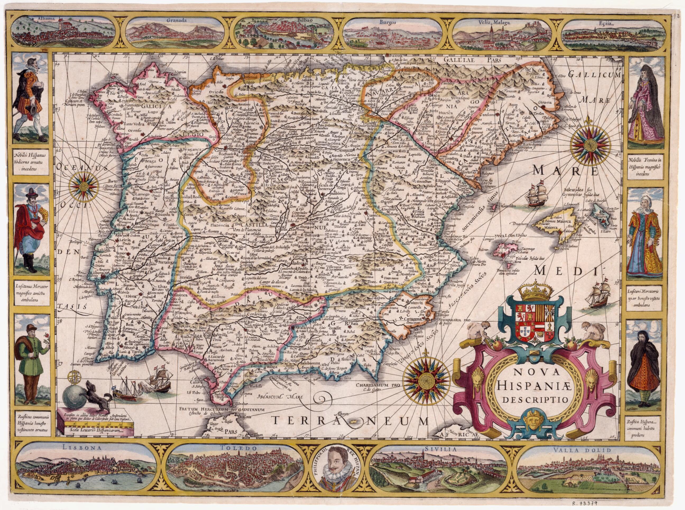
Discover the timeless beauty of our fine art quality printed reproduction of this antique map. Perfect for history enthusiasts, collectors, and interior decorators.
Restored with meticulous attention to detail by our team with over a decade of experience, this stunning reproduction captures the intricate artistry and historical significance of the original map.
Whether you're a collector or seeking a unique decor piece, this archival-quality map reproduction is a timeless addition to any space. Order now to bring history to life!
Old map of Portugal, Spain.
-94), the cartographic image is surrounded by plans, city views, and characters in the dress of the day. The top margin includes views of the cities of Alhama, Granada, Bilbao, Burgos, Vélez-Málaga, and Écija. In the bottom are shown Lisbon, Toledo, Sevilla, and Valladolid. In the bottom right corner is a Renaissance cartouche crowned by the coat of arms of the Kingdom of Spain, flanked with two seated male figures and decorated by three figureheads. On the sides, three female and three male figures in distinctive costumes represent the nobility, merchant, and peasant classes. In the bottom margin is a medallion with the portrait of King Philip III of Spain and an inscription with the king's name. In the bottom left corner, the scale appears in a pedestal below the emblem of the publishing house. The publisher, Jodocus Hondius (1563--1612), was an acclaimed Flemish printer who lived in Amsterdam and specialized in the production of maps and globes. He was a friend of Gerard Mercator and edited his atlas. In 1604, Hondius purchased Mercator's plates from his heirs and published a new edition of the atlas, which was constantly expanded and became quite popular in the 17th century. This map is not dated, but the portrait of King Philip III of Spain (1598--1621) and Hondius's date of death suggest it was published around 1610.
Created by Jodocus Hondius, Gerhard Mercator in 1610.
- Title devised, in English, by Library staff.
- "Scale 1:2.700,000. 30 Leucarum Hispanicarum = 6 centimeters. Relief shown by outlining mountains and hachures. Coasts marked by fine shading."--Note extracted from World Digital Library.
- Original resource extent: 1 map: print, color, 42 x 57 centimeters.
- Original resource at: National Library of Spain.
- Content in Latin.
- Description based on data extracted from World Digital Library, which may be extracted from partner institutions.
Map Tags


