
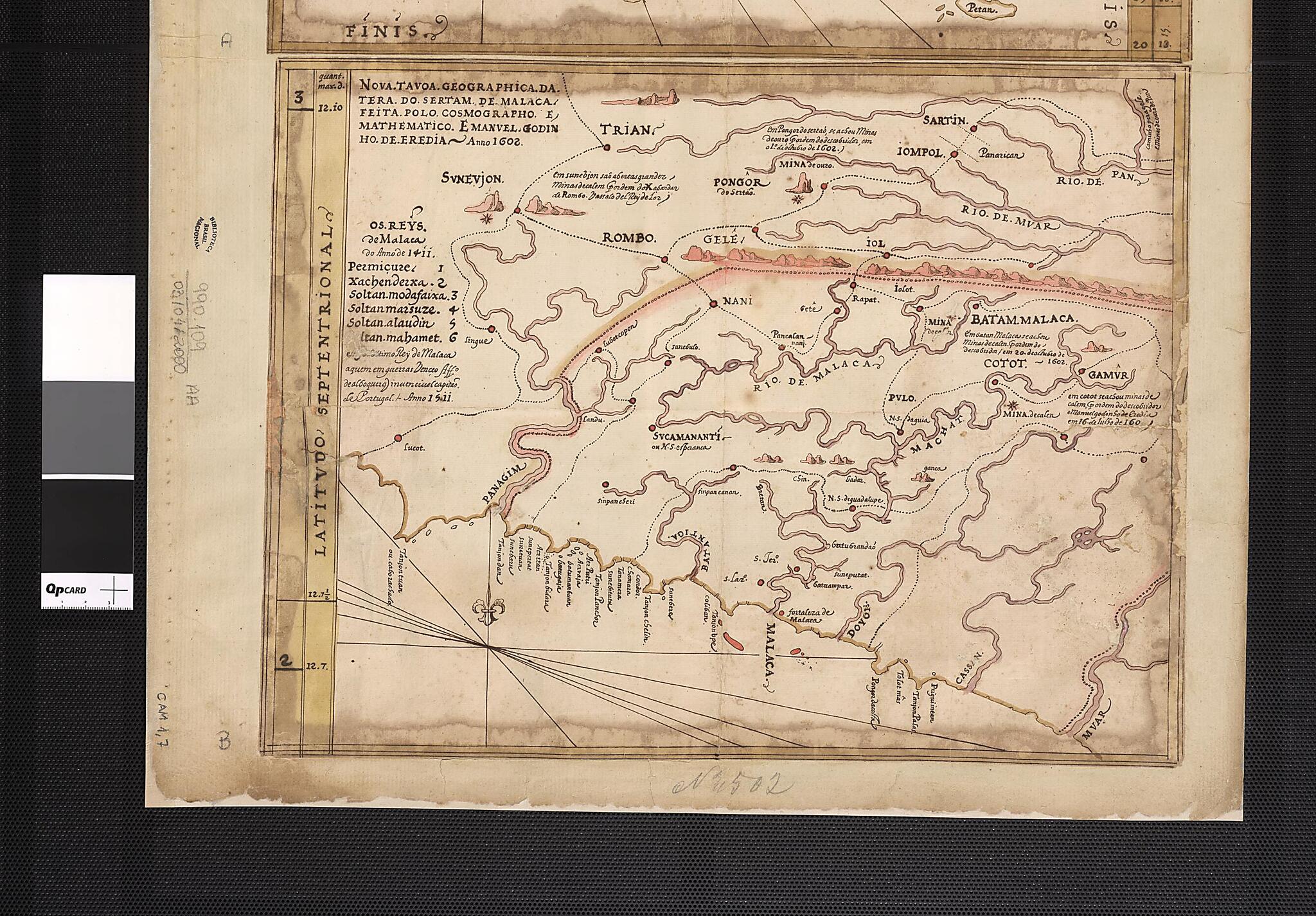
New Geographic Map of the Interior of Malaca. (Nova Tavoa Geographica Da Tera Do Sertam De Malaca) 1602
- Regular price
-
$49.95 - Regular price
-
$34.95 - Sale price
-
$49.95
Buy one map, get any other map in our collection for 50% OFF! Add to cart to see discount.
Couldn't load pickup availability
About This Map
Discover the timeless beauty of our fine art quality printed reproduction of this antique map. Perfect for history enthusiasts, collectors, and interior decorators.
Restored with meticulous attention to detail by our team with over a decade of experience, this stunning reproduction captures the intricate artistry and historical significance of the original map.
Whether you're a collector or seeking a unique decor piece, this archival-quality map reproduction is a timeless addition to any space. Order now to bring history to life!
Old map of Malacca, Malaysia.Portuguese cartographer Emanuel Godinho de Eredia (1563-1623). At the turn of the 17th century, the Portuguese were exploring southeast Asia from their base in Malacca, searching for the "Islands of Gold" that figured prominently in Malaysian legends. Around 1602, the viceroy of Portuguese India commissioned an expedition around the islands south of Malaysia and India. Eredia served as a soldier and engineer on the mission and completed this map around the same time. His work, however, is suspected to be based more on the writings of Ptolemy and Marco Polo than on his own experience.
Created by Manuel Godinho De Eredia in 1602.
- Title devised, in English, by Library staff.
- Original resource extent: 1 pen-and-ink and watercolor manuscript map ; 30 x 39.5 centimeters.
- Original resource at: National Library of Brazil.
- Content in Portuguese.
- Description based on data extracted from World Digital Library, which may be extracted from partner institutions.
Map Subjects
Malacca
Malaysia
Manuel Godinho De Eredia
1602
- For the best legibility, order your map in the original size or larger. Most maps have intricate detail and small text that is best appreciated when the print size hasn't been reduced.
- Sizes labeled "Fits a Standard Frame" will drop right into any frame that you purchase in that size. The sizes that we offer are commonly available online and at most retail stores.
- Our standard sizes are recommendations based on the aspect ratio of the original map, but still may require some added "white space" in one dimension to fit.
- Non-standard sizes will require custom framing, and we suggest taking your print to the frame shop of your choice after you receive it for the best results.
- Custom sizes are available, simply contact us for a quote.
Below is an approximation of the scale of a few standard sizes, and how they might appear in your space.
