
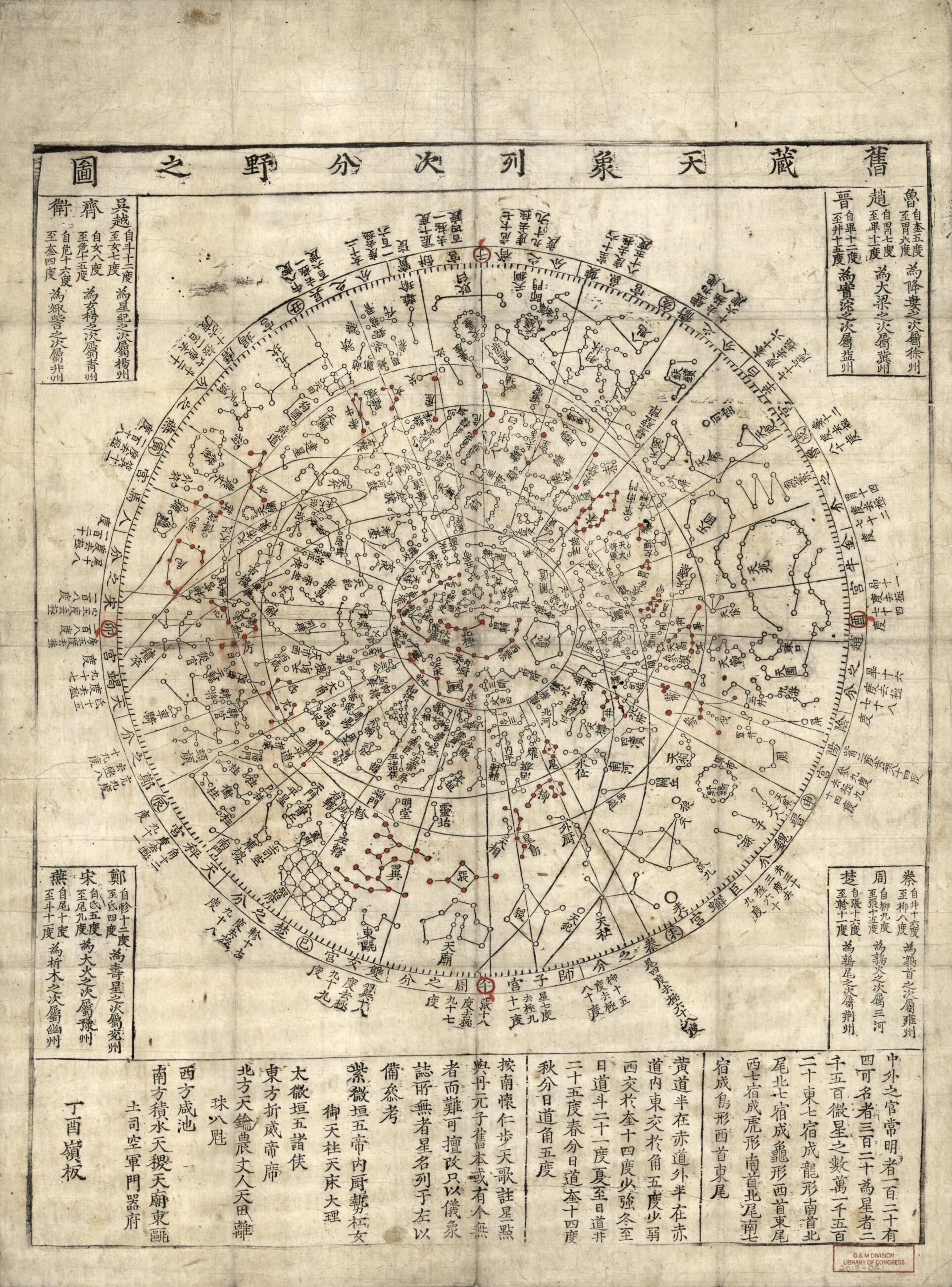
舊藏 天象 列次 分野 之圖, Old Sky Chart Showing Rank and Distribution of Stars in 1777
- Regular price
-
$52.95 - Regular price
-
$47.95 - Sale price
-
$52.95
Shipping calculated at checkout.
Buy one map, get any other map in our collection for 50% OFF! Add to cart to see discount.
Couldn't load pickup availability
About This Map
Old celestial chart of Universe.
- Originally engraved in a stone stele in A.D. 1395.
- Several Korean scholars studied the chart and estimated the observational epoch of the stars dating between B.C. 1C and A.D. 6C. Changbom Park found that the epoch of the stars in chart is combined from the first and fourteenth centuries. Most stars with declination lower than 50 degrees represent the night sky of the first century, the era of Koguryo, while stars located higher than 50 degrees are positioned to represent the epoch close to the fourteenth century, the era of early Chosŏn dynasty.
- Dealer: Martayan Lan, New York
- Acquisition contol no. 2013-021
Map Sizing Information
- For the best legibility, order your map in the original size or larger. Most maps have intricate detail and small text that is best appreciated when the print size hasn't been reduced.
- Sizes labeled "Fits a Standard Frame" will drop right into any frame that you purchase in that size. The sizes that we offer are commonly available online and at most retail stores.
- Our standard sizes are recommendations based on the aspect ratio of the original map, but still may require some added "white space" in one dimension to fit.
- Non-standard sizes will require custom framing, and we suggest taking your print to the frame shop of your choice after you receive it for the best results.
- Custom sizes are available, simply contact us for a quote.
Below is an approximation of the scale of a few standard sizes, and how they might appear in your space.

