
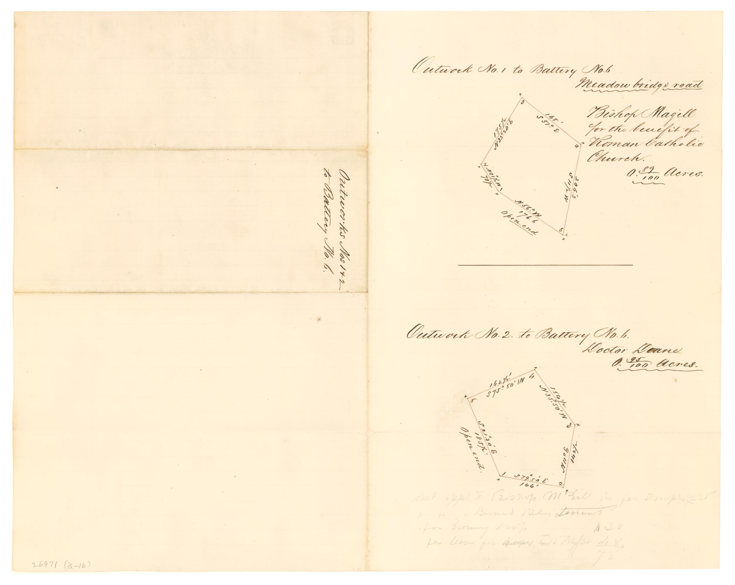
Outworks Nos. 1 & 2 to Battery No. 6 1861
- Regular price
-
$49.95 - Regular price
-
$34.95 - Sale price
-
$49.95
Buy one map, get any other map in our collection for 50% OFF! Add to cart to see discount.
Couldn't load pickup availability
About This Map
Discover the timeless beauty of our fine art quality printed reproduction of this antique map. Perfect for history enthusiasts, collectors, and interior decorators.
Restored with meticulous attention to detail by our team with over a decade of experience, this stunning reproduction captures the intricate artistry and historical significance of the original map.
Whether you're a collector or seeking a unique decor piece, this archival-quality map reproduction is a timeless addition to any space. Order now to bring history to life!
Old map of Richmond Region, United States, Virginia.Created by B. M. Jones in 1861.
- Components: Outwork no. 1 to battery no. 6, Meadow bridge road -- Outwork no. 2 to battery no. 6.
- Gives measurements and latitude and longitude of perimeters.
- Map annotated with names of land owners: "Bishop Magill [i.e. Mcgill] for the benefit of the Roman Catholic Church" and "Doctor Deane."
- One of a series of ten maps drawn by showing the plats of land appropriated for Batteries 1-10 around Richmond. Original maps are included in Personal Papers Collection, accession 26971, B.M. Jones Papers.
- This item is in the Map Collection of the Library of Virginia; please contact the Library's Archives Research Services department for more information.
- C. 1, March 2003, source unknown; c. 2-3, March 2003, color ink jet print, LVA, Map Cataloging Team.
- Civil War Map Proj. no.: lva00114.
- Digital image available: 15.75 x 12.5 in.
- Original plats are restricted. Please use copies available in the Map Room (755.43 S8 1861).
- For the best legibility, order your map in the original size or larger. Most maps have intricate detail and small text that is best appreciated when the print size hasn't been reduced.
- Sizes labeled "Fits a Standard Frame" will drop right into any frame that you purchase in that size. The sizes that we offer are commonly available online and at most retail stores.
- Our standard sizes are recommendations based on the aspect ratio of the original map, but still may require some added "white space" in one dimension to fit.
- Non-standard sizes will require custom framing, and we suggest taking your print to the frame shop of your choice after you receive it for the best results.
- Custom sizes are available, simply contact us for a quote.
Below is an approximation of the scale of a few standard sizes, and how they might appear in your space.

