
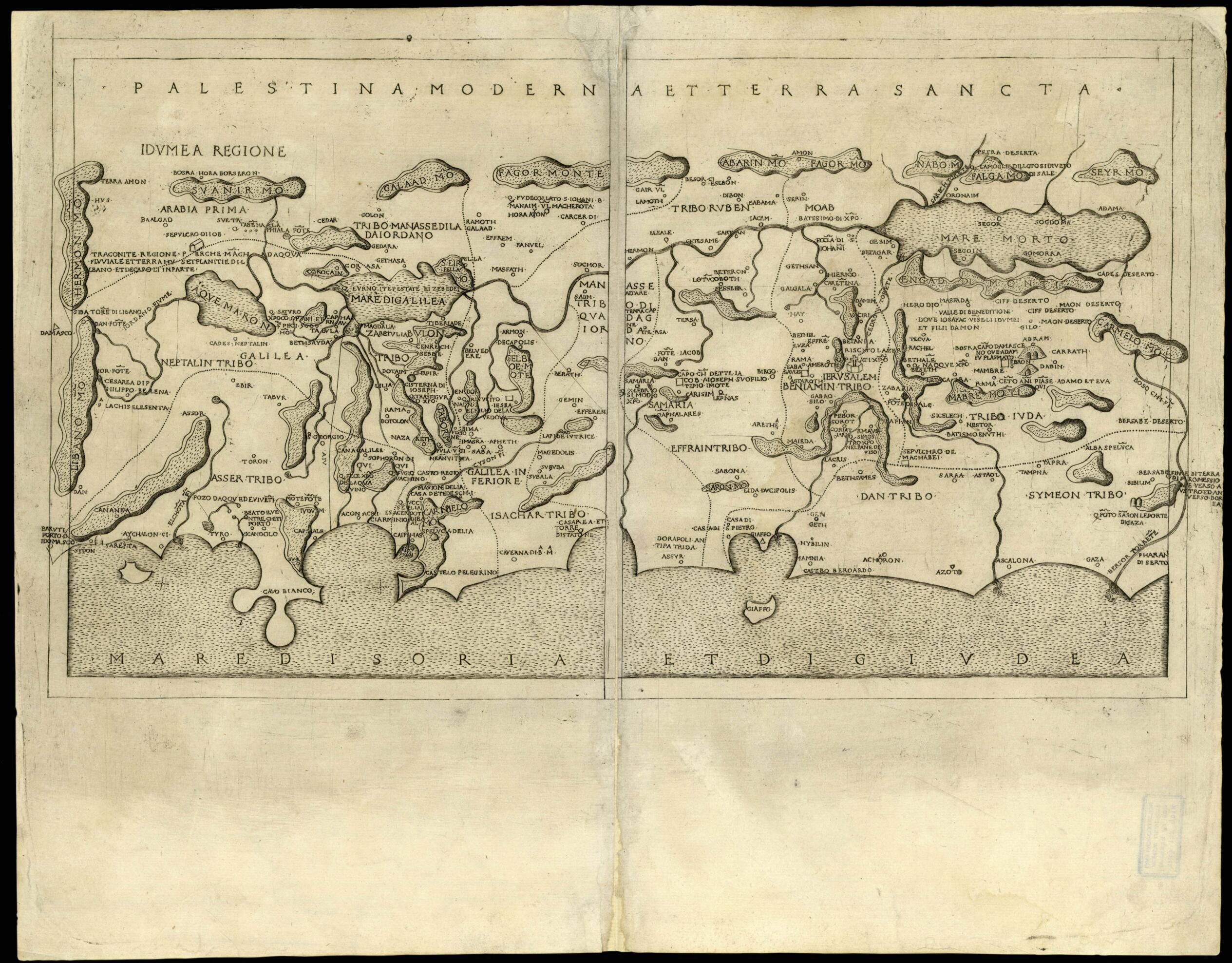
Day Palestine and the Holy Land. (Palestina Moderna Et Terra Sancta) 1480
- Regular price
-
$54.95 - Regular price
-
$49.95 - Sale price
-
$54.95
Buy one map, get any other map in our collection for 50% OFF! Add to cart to see discount.
Couldn't load pickup availability
About This Map
Discover the timeless beauty of our fine art quality printed reproduction of this antique map. Perfect for history enthusiasts, collectors, and interior decorators.
Restored with meticulous attention to detail by our team with over a decade of experience, this stunning reproduction captures the intricate artistry and historical significance of the original map.
Whether you're a collector or seeking a unique decor piece, this archival-quality map reproduction is a timeless addition to any space. Order now to bring history to life!
Old map of Israel.century Greek astronomer and geographer. Nicolo Tedesco, a German printer who worked in Florence, printed Berlinghieri's work as well as engraved the maps. As with all the modern maps of Palestine added to the early printed editions of Ptolemy, this map was copied from the map of Palestine by Petrus Vesconte (flourished 1310-1330) and Marino Sanuto (circa 1260-1338), first published in Venice around 1320. Vesconte was a navigational chart maker from Genoa who worked in Venice. Sanuto was a Venetian merchant and nobleman who traveled to the Holy Land a number of times and drew maps based on his travels.
Created by Francesco Berlinghieri, 2nd Century Ptolemy, Nicolo Todescho in 1480.
- Title devised, in English, by Library staff.
- Original resource extent: Copperplate ; 285 x 490 millimeters.
- Original resource at: National Library of Israel.
- Content in Latin.
- Description based on data extracted from World Digital Library, which may be extracted from partner institutions.
- For the best legibility, order your map in the original size or larger. Most maps have intricate detail and small text that is best appreciated when the print size hasn't been reduced.
- Sizes labeled "Fits a Standard Frame" will drop right into any frame that you purchase in that size. The sizes that we offer are commonly available online and at most retail stores.
- Our standard sizes are recommendations based on the aspect ratio of the original map, but still may require some added "white space" in one dimension to fit.
- Non-standard sizes will require custom framing, and we suggest taking your print to the frame shop of your choice after you receive it for the best results.
- Custom sizes are available, simply contact us for a quote.
Below is an approximation of the scale of a few standard sizes, and how they might appear in your space.

