
Palestine 1475
- Regular price
-
$55.95 - Regular price
-
$50.95 - Sale price
-
$55.95
Shipping calculated at checkout.
Buy one map, get any other map in our collection for 50% OFF! Add to cart to see discount.
Couldn't load pickup availability
About This Map
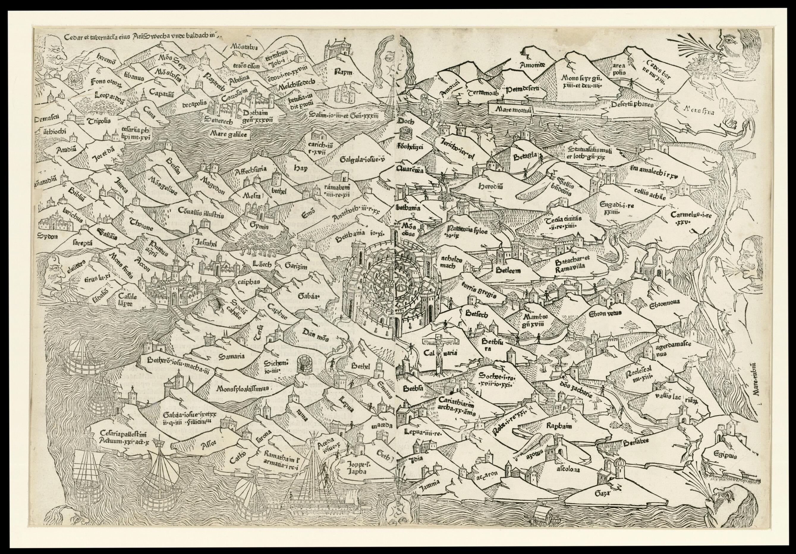
Old map of Israel.
century Dominican priest who traveled extensively through the Holy Land and the Middle East in 1274-84. The map is oriented with west at the bottom. Jerusalem is located at the center, indicating its central significance in Christian theology.
Created by Lucas Brandis De Schass, 13th Century Burchardus De Monte Sion in 1475.
- Title devised, in English, by Library staff.
- Original resource extent: Woodcut; two joined sheets; 388 x 578 millimeters.
- Original resource at: National Library of Israel.
- Content in Latin.
- Description based on data extracted from World Digital Library, which may be extracted from partner institutions.
Map Sizing Information
- For the best legibility, order your map in the original size or larger. Most maps have intricate detail and small text that is best appreciated when the print size hasn't been reduced.
- Sizes labeled "Fits a Standard Frame" will drop right into any frame that you purchase in that size. The sizes that we offer are commonly available online and at most retail stores.
- Our standard sizes are recommendations based on the aspect ratio of the original map, but still may require some added "white space" in one dimension to fit.
- Non-standard sizes will require custom framing, and we suggest taking your print to the frame shop of your choice after you receive it for the best results.
- Custom sizes are available, simply contact us for a quote.
Below is an approximation of the scale of a few standard sizes, and how they might appear in your space.
