
Palestine, With the Hauran, and the Adjacent Districts 1843
- Regular price
-
$49.95 - Regular price
-
$34.95 - Sale price
-
$49.95
Shipping calculated at checkout.
Buy one map, get any other map in our collection for 50% OFF! Add to cart to see discount.
Couldn't load pickup availability
About This Map
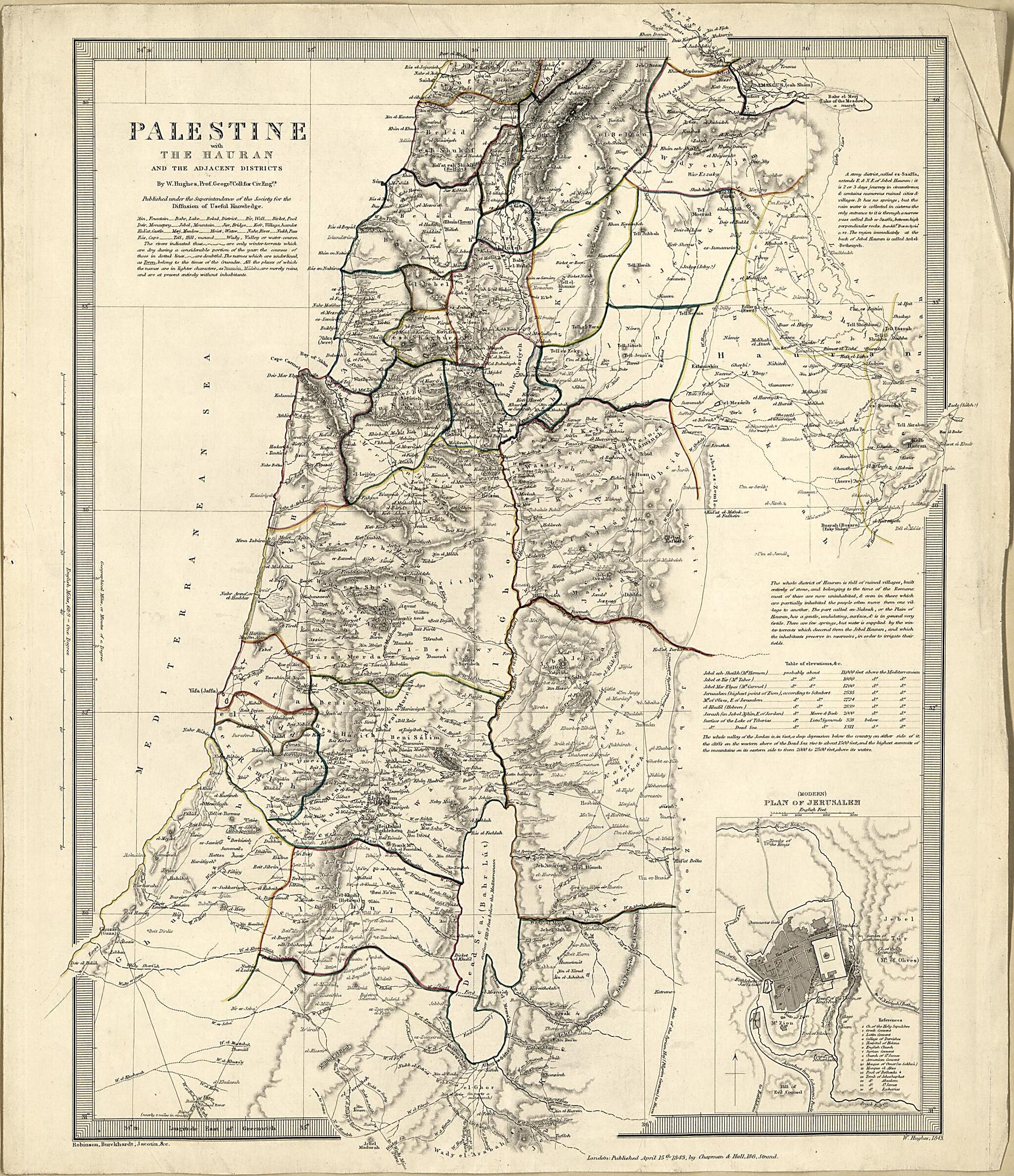
Old map of Israel, Jerusalem, Jordan, Lebanon, Palestine, Syria, Turkey.
Created by John Lewis Burckhardt, Charles Knight & Co, William Hughes, Pierre Jacotin, Edward Robinson, Society for the Diffusion of Useful Knowledge (Great Britain) in 1843.
Created by John Lewis Burckhardt, Charles Knight & Co, William Hughes, Pierre Jacotin, Edward Robinson, Society for the Diffusion of Useful Knowledge (Great Britain) in 1843.
- "Robinson, Bucrckhardt, Jacotin & c. ; London, Charles Knight & Co., 22 Ludgate Street ; W. Hughes, 1843."
- Relief shown by contours and hachures.
- Shows Ottoman Empire administrative divisions, principal towns, roads, and caravan trails,
- Includes inset of "(Modern) Plan of Jerusalem".
Map Subjects
Israel
Jerusalem
Jordan
Lebanon
Palestine
Syria
Turkey
John Lewis Burckhardt
Charles Knight & Co
William Hughes
Pierre Jacotin
Edward Robinson
Society For The Diffusion Of Useful Knowledge (Great Britain)
1843
Map Sizing Information
- For the best legibility, order your map in the original size or larger. Most maps have intricate detail and small text that is best appreciated when the print size hasn't been reduced.
- Sizes labeled "Fits a Standard Frame" will drop right into any frame that you purchase in that size. The sizes that we offer are commonly available online and at most retail stores.
- Our standard sizes are recommendations based on the aspect ratio of the original map, but still may require some added "white space" in one dimension to fit.
- Non-standard sizes will require custom framing, and we suggest taking your print to the frame shop of your choice after you receive it for the best results.
- Custom sizes are available, simply contact us for a quote.
Below is an approximation of the scale of a few standard sizes, and how they might appear in your space.

