
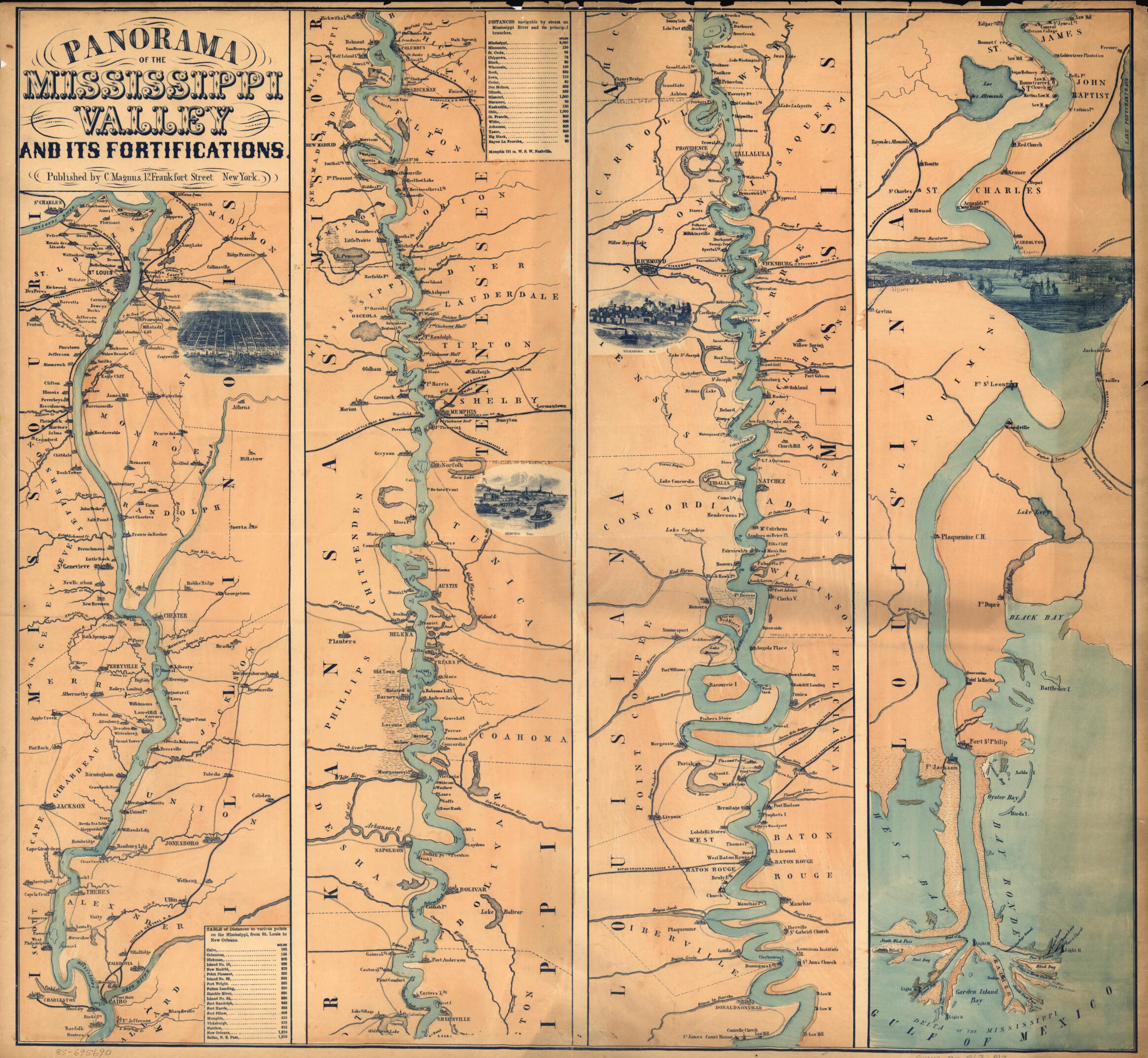
Panorama of the Mississippi Valley : and Its Fortifications in 1863
- Regular price
-
$68.95 - Regular price
-
$63.95 - Sale price
-
$68.95
Shipping calculated at checkout.
Buy one map, get any other map in our collection for 50% OFF! Add to cart to see discount.
Couldn't load pickup availability
About This Map
Old map of Mississippi River, United States.
Created by F. W. Boell, Charles Magnus in 1863.
Created by F. W. Boell, Charles Magnus in 1863.
- Covers Mississippi River, in four 60 x 16 cm. panels, from St. Louis to the Gulf of Mexico.
- Includes distance list, table of "Distances navigable by steam on Mississippi River and its principal branches," and small panoramic views of St. Louis, Memphis, Vicksburg, and New Orleans.
- Civil War Map
- Acquisitions control no. 21-85
Map Sizing Information
- For the best legibility, order your map in the original size or larger. Most maps have intricate detail and small text that is best appreciated when the print size hasn't been reduced.
- Sizes labeled "Fits a Standard Frame" will drop right into any frame that you purchase in that size. The sizes that we offer are commonly available online and at most retail stores.
- Our standard sizes are recommendations based on the aspect ratio of the original map, but still may require some added "white space" in one dimension to fit.
- Non-standard sizes will require custom framing, and we suggest taking your print to the frame shop of your choice after you receive it for the best results.
- Custom sizes are available, simply contact us for a quote.
Below is an approximation of the scale of a few standard sizes, and how they might appear in your space.

