
Panorama of the Seat of War. Birds Eye View of Virginia, Maryland, Delaware, and the District of Columbia (Birds Eye View of Virginia, Maryland, Delaware, and the District of Columbia) 1861
- Regular price
-
$126.95 - Regular price
-
$121.95 - Sale price
-
$126.95
Shipping calculated at checkout.
Buy one map, get any other map in our collection for 50% OFF! Add to cart to see discount.
Couldn't load pickup availability
About This Map
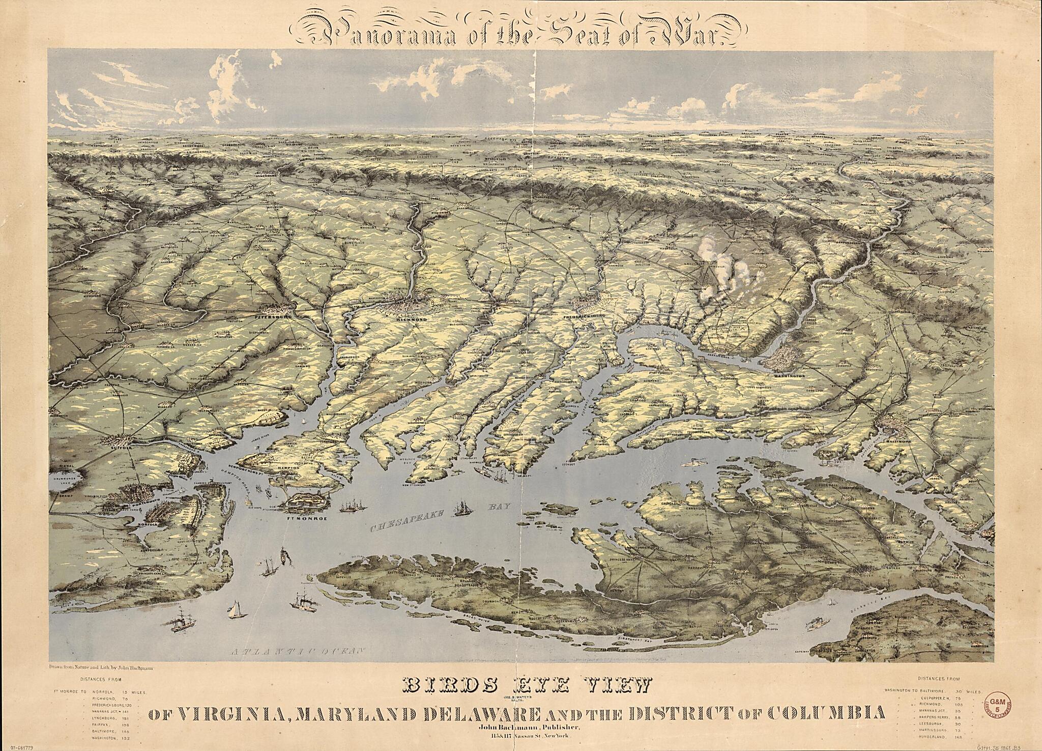
Old map of Middle Atlantic States, United States, Virginia.
Created by John Bachmann in 1861.
Created by John Bachmann in 1861.
- Shows various Civil War fortifications (battle sites noted by crossed swords) and smoke over Manassas (Bull Run) vicinity.
- Oriented with north to the right.
- "Entered according to act of Congress in the year 1861 by John Bachmann ... Southern District of New York."
- Includes distance lists in lower margin.
- CW3
- PM3
Map Subjects
Aerial Views
Civil War
History
Middle Atlantic States
United States
Virginia
John Bachmann
1861
Map Sizing Information
- For the best legibility, order your map in the original size or larger. Most maps have intricate detail and small text that is best appreciated when the print size hasn't been reduced.
- Sizes labeled "Fits a Standard Frame" will drop right into any frame that you purchase in that size. The sizes that we offer are commonly available online and at most retail stores.
- Our standard sizes are recommendations based on the aspect ratio of the original map, but still may require some added "white space" in one dimension to fit.
- Non-standard sizes will require custom framing, and we suggest taking your print to the frame shop of your choice after you receive it for the best results.
- Custom sizes are available, simply contact us for a quote.
Below is an approximation of the scale of a few standard sizes, and how they might appear in your space.

