
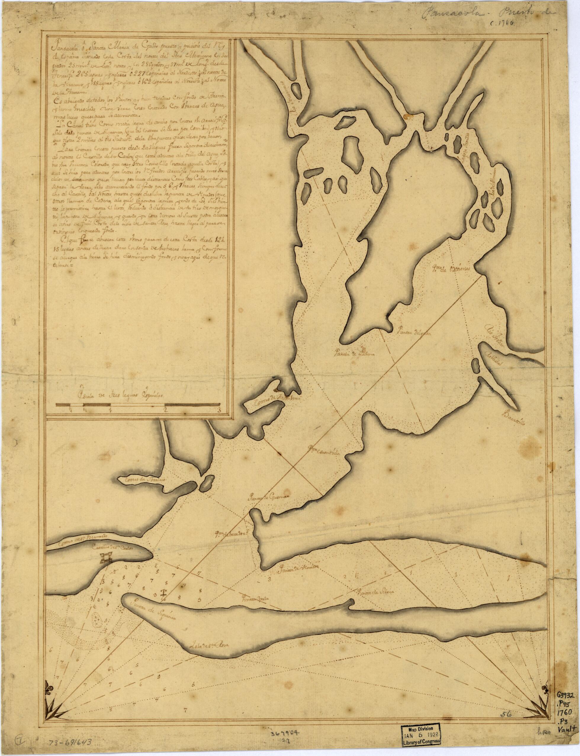
Pansacola O Santta María De Galbe, Puerto Y Presidio Del Ry. De España Situado En La Costa Del Nortte Del Seno Mexicano, Los 30 Grados 25 Mins. De Lattd. Nortte Y Los 286 Grados Y 37 Ms. De Longd. Desde Tenerife 265 Leguas Inglesas O 227 Españolas ...
- Regular price
-
$49.95 - Regular price
-
$34.95 - Sale price
-
$49.95
Shipping calculated at checkout.
Buy one map, get any other map in our collection for 50% OFF! Add to cart to see discount.
Couldn't load pickup availability
About This Map
Old map of Florida, Pensacola Bay, United States.
- Scale ca. 1:165,000.
- Watermarks: I. Honig; and, fleur-de-lis.
- Mounted on cloth backing.
- Manuscript, black and brown inks.
- Prime meridian: Tenerife.
- Soundings shown in fathoms.
- Includes descriptive text.
- Printed label describing the map mounted on verso.
- Maggs number annotated in pencil in lower right corner: 56.
- Order number annotated in pencil in lower margin: 367904/27.
Map Sizing Information
- For the best legibility, order your map in the original size or larger. Most maps have intricate detail and small text that is best appreciated when the print size hasn't been reduced.
- Sizes labeled "Fits a Standard Frame" will drop right into any frame that you purchase in that size. The sizes that we offer are commonly available online and at most retail stores.
- Our standard sizes are recommendations based on the aspect ratio of the original map, but still may require some added "white space" in one dimension to fit.
- Non-standard sizes will require custom framing, and we suggest taking your print to the frame shop of your choice after you receive it for the best results.
- Custom sizes are available, simply contact us for a quote.
Below is an approximation of the scale of a few standard sizes, and how they might appear in your space.

