
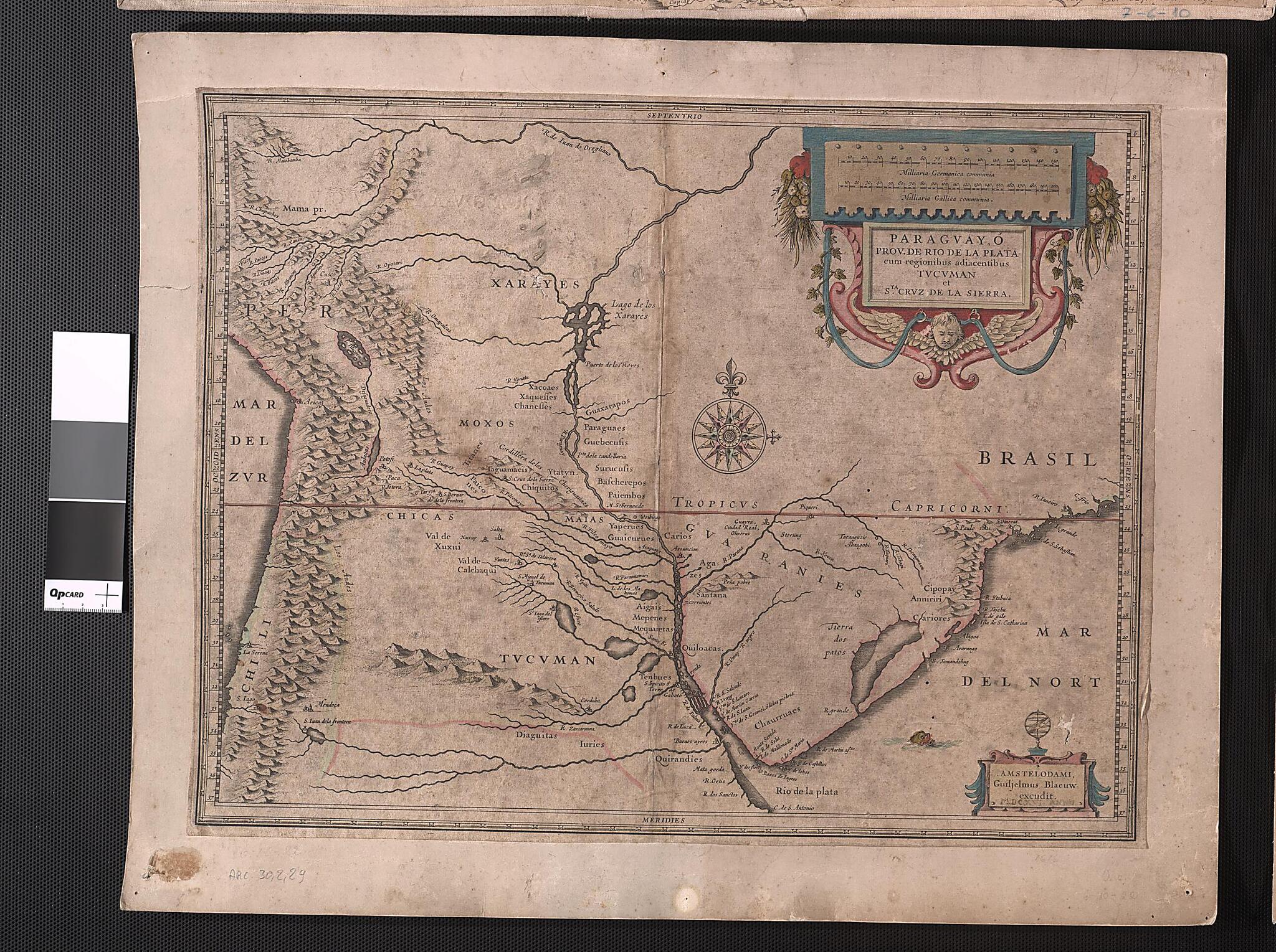
Paraguay, Or the Province of the Rio De La Plata, With the Adjacent Regions Tucamen and Santa Cruz De La Sierra. (Paraguay, ó Prov. De Rio De La Plata, Cum Regionibus Adiacentibus Tucuman Et Sta. Cruz De La Sierra / Guiljelmus Blaeuew Excudit) 1616
- Regular price
-
$49.95 - Regular price
-
$34.95 - Sale price
-
$49.95
Shipping calculated at checkout.
Buy one map, get any other map in our collection for 50% OFF! Add to cart to see discount.
Couldn't load pickup availability
About This Map
Old map of Argentina, Bolivia, Brazil, Chile, Paraguay, Peru.
1638), the founder of a famous Dutch mapmaking dynasty. Blaeu studied astronomy, mathematics, and globe-making with the Danish scholar Tycho Brahe before establishing his mapmaking studio in Amsterdam. In 1633, he was appointed mapmaker of the Dutch East India Company. In 1635, together with his sons Joan and Cornelis, Blaeu published the Atlas Novus (New atlas), an 11-volume work consisting of 594 maps.
Created by Willem Janszoon Blaeu in 1616.
- Title devised, in English, by Library staff.
- Original resource extent: 1 map : colored ; 38 x 49 centimeters.
- Original resource at: National Library of Brazil.
- Content in Latin.
- Description based on data extracted from World Digital Library, which may be extracted from partner institutions.
Map Subjects
Argentina
Bolivia
Brazil
Chile
Indians Of South America
Jesuits
Pantanal
Paraguay
Peru
Rio De La Plata (Argentina And Uruguay)
Willem Janszoon Blaeu
1616
Map Sizing Information
- For the best legibility, order your map in the original size or larger. Most maps have intricate detail and small text that is best appreciated when the print size hasn't been reduced.
- Sizes labeled "Fits a Standard Frame" will drop right into any frame that you purchase in that size. The sizes that we offer are commonly available online and at most retail stores.
- Our standard sizes are recommendations based on the aspect ratio of the original map, but still may require some added "white space" in one dimension to fit.
- Non-standard sizes will require custom framing, and we suggest taking your print to the frame shop of your choice after you receive it for the best results.
- Custom sizes are available, simply contact us for a quote.
Below is an approximation of the scale of a few standard sizes, and how they might appear in your space.

