
Part of Augusta County, Va. 1860
- Regular price
-
$61.95 - Regular price
-
$43.95 - Sale price
-
$61.95
Shipping calculated at checkout.
Buy one map, get any other map in our collection for 50% OFF! Add to cart to see discount.
Couldn't load pickup availability
About This Map
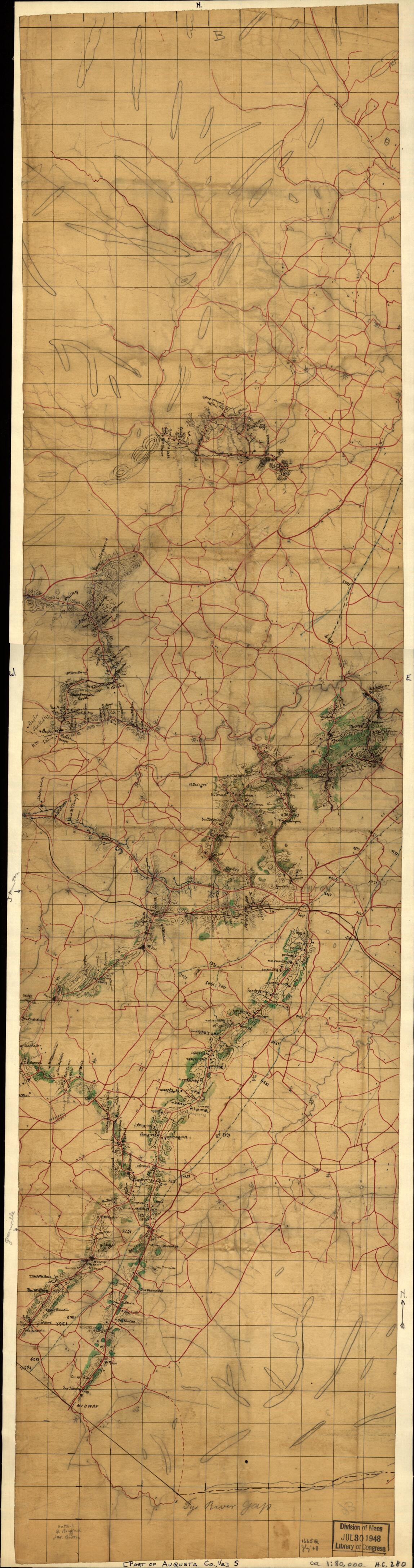
Old map of Augusta County, United States, Virginia.
Created by Jedediah Hotchkiss in 1860.
Created by Jedediah Hotchkiss in 1860.
- Scale ca. 1:80,000.
- Civil War Map
- An incomplete map of an area 12 miles wide through Augusta County, including Staunton. Roads are shown in red, elevations by form lines, and wooded areas in green. The name "Tye River Gap" is written in pencil near the bottom of the map, which shows by blue dashed lines, parts of the surveyed lines of the Valley R. R. and the Shenandoah Valley R. R.
- Description derived from published bibliography.
Map Sizing Information
- For the best legibility, order your map in the original size or larger. Most maps have intricate detail and small text that is best appreciated when the print size hasn't been reduced.
- Sizes labeled "Fits a Standard Frame" will drop right into any frame that you purchase in that size. The sizes that we offer are commonly available online and at most retail stores.
- Our standard sizes are recommendations based on the aspect ratio of the original map, but still may require some added "white space" in one dimension to fit.
- Non-standard sizes will require custom framing, and we suggest taking your print to the frame shop of your choice after you receive it for the best results.
- Custom sizes are available, simply contact us for a quote.
Below is an approximation of the scale of a few standard sizes, and how they might appear in your space.

