
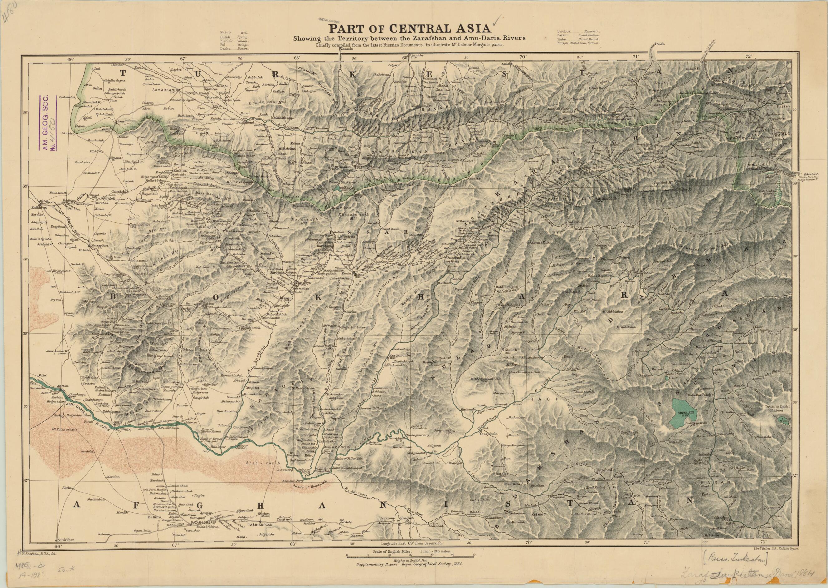
Part of Central Asia, Showing the Territory Between Zarafshan and Amu Darya Rivers, Chiefly Compiled From the Latest Russian Documents to Illustrate Mr. Delmar Morgan's Paper in 1884
- Regular price
-
$65.95 - Regular price
-
$60.95 - Sale price
-
$65.95
Shipping calculated at checkout.
Buy one map, get any other map in our collection for 50% OFF! Add to cart to see discount.
Couldn't load pickup availability
About This Map
Old map of Afghanistan, Kyrgyzstan, Tajikistan, Uzbekistan.
day Tajikistan, Uzbekistan, and Kyrgyzstan). It was meant to accompany an article written by Edward Delmar Morgan (1840--1909) as a supplementary paper published by the Royal Geographical Society. Entitled "Notes on the Recent Geography of Central Asia from Russian Sources," the paper was published in 1884. Morgan was an English explorer and author. As a young man, he lived in Saint Petersburg, where his father was a merchant, and he was fluent in Russian. He translated several notable texts dealing with travel and exploration from Russian to English. Morgan was also a longtime fellow of the Royal Geographical Society, who served on its council and contributed to its journal. The map was drawn by Henry Sharbau (1822-1904), for many years the chief cartographer of the Royal Geographical Society, and lithographed by Edward Weller (1819-84), a London-based cartographer and engraver who was the unofficial geographer of the society.
Created by Royal Geographical Society (Great Britain), Russia. General Staff. Military Topography Directorate, Henry Sharbau, Edward Weller in 1884.
- Title devised, in English, by Library staff.
- "Scale 1:880,000"--Note extracted from World Digital Library.
- Original resource extent: 1 map : color ; 50 x 71 centimeters.
- Original resource at: University of Wisconsin-Milwaukee Libraries.
- Content in English.
- Description based on data extracted from World Digital Library, which may be extracted from partner institutions.
Map Sizing Information
- For the best legibility, order your map in the original size or larger. Most maps have intricate detail and small text that is best appreciated when the print size hasn't been reduced.
- Sizes labeled "Fits a Standard Frame" will drop right into any frame that you purchase in that size. The sizes that we offer are commonly available online and at most retail stores.
- Our standard sizes are recommendations based on the aspect ratio of the original map, but still may require some added "white space" in one dimension to fit.
- Non-standard sizes will require custom framing, and we suggest taking your print to the frame shop of your choice after you receive it for the best results.
- Custom sizes are available, simply contact us for a quote.
Below is an approximation of the scale of a few standard sizes, and how they might appear in your space.

