
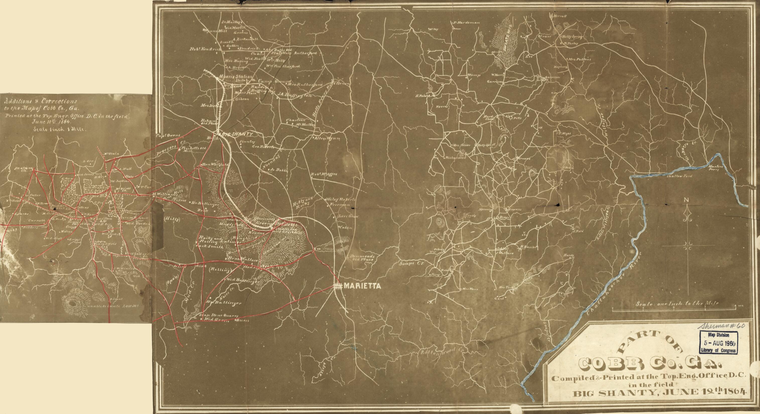
Part of Cobb Co., Georgia (Part of Cobb County, Georgia, Additions & Corrections to the Map of Cobb Co. Ga., Printed at the Top. Engr. Office, D.C., In the Field, June 10th, 1864, Map of Cobb Co., Ga)
- Regular price
-
$54.95 - Regular price
-
$33.95 - Sale price
-
$54.95
Shipping calculated at checkout.
Buy one map, get any other map in our collection for 50% OFF! Add to cart to see discount.
Couldn't load pickup availability
About This Map
Old map of Cobb County, Georgia, United States.
Created by United States. Army. Corps of Topographical Engineers, United States. Army. Department of the Cumberland. Topographical Engineers in 1864.
Created by United States. Army. Corps of Topographical Engineers, United States. Army. Department of the Cumberland. Topographical Engineers in 1864.
- Shows northern Cobb County, Georgia.
- Relief shown by hachures.
- Differs from other 1864 ed. in inclusion of continuation (19 x 12 cm.) attached at left edge.
- Main entry from Stephenson's Civil War maps, 1989.
- Negative photocopy.
- Civil War Map
- Includes names of select landowners.
- Annotations in red pencil and blue pencil.
Map Sizing Information
- For the best legibility, order your map in the original size or larger. Most maps have intricate detail and small text that is best appreciated when the print size hasn't been reduced.
- Sizes labeled "Fits a Standard Frame" will drop right into any frame that you purchase in that size. The sizes that we offer are commonly available online and at most retail stores.
- Our standard sizes are recommendations based on the aspect ratio of the original map, but still may require some added "white space" in one dimension to fit.
- Non-standard sizes will require custom framing, and we suggest taking your print to the frame shop of your choice after you receive it for the best results.
- Custom sizes are available, simply contact us for a quote.
Below is an approximation of the scale of a few standard sizes, and how they might appear in your space.
