
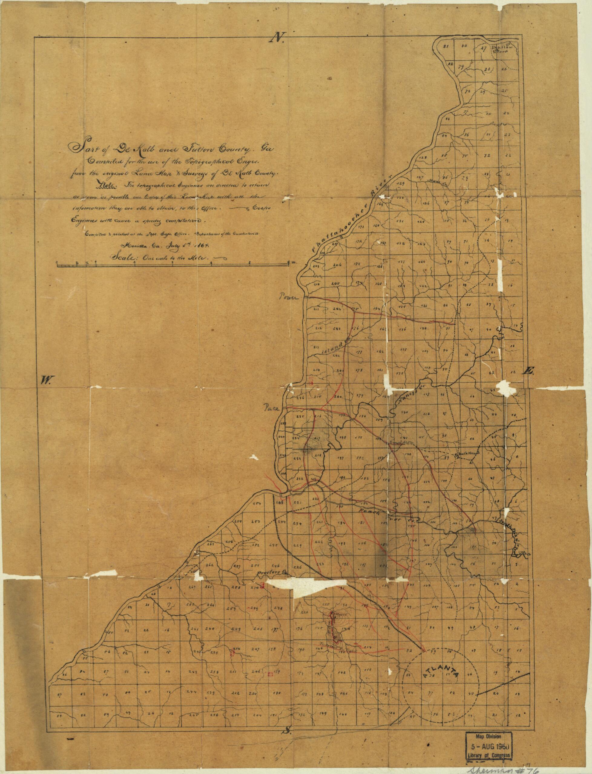
Part of DeKalb and Fulton County, Georgia : Compiled for the Use of the Topographical Engrs. from the Original Land Map & Surveys of DeKalb County 1864
- Regular price
-
$54.95 - Regular price
-
$38.95 - Sale price
-
$54.95
Shipping calculated at checkout.
Buy one map, get any other map in our collection for 50% OFF! Add to cart to see discount.
Couldn't load pickup availability
About This Map
Old map of Dekalb County, Fulton County, Georgia, United States.
Created by United States. Army. Department of the Cumberland. Topographical Engineers in 1864.
Created by United States. Army. Department of the Cumberland. Topographical Engineers in 1864.
- Civil War Map
- Map drawn on a numbered 9/16 in. grid.
- "Note. The topographical engineers are directed to return as soon as possible one copy of this land map with all the information they are able to obtain, to this office. Corps Engineers will cause a speedy compilation."
- Annotations in pencil west of the Chattahoochee River.
- In pencil in upper right margin: 38.
Map Sizing Information
- For the best legibility, order your map in the original size or larger. Most maps have intricate detail and small text that is best appreciated when the print size hasn't been reduced.
- Sizes labeled "Fits a Standard Frame" will drop right into any frame that you purchase in that size. The sizes that we offer are commonly available online and at most retail stores.
- Our standard sizes are recommendations based on the aspect ratio of the original map, but still may require some added "white space" in one dimension to fit.
- Non-standard sizes will require custom framing, and we suggest taking your print to the frame shop of your choice after you receive it for the best results.
- Custom sizes are available, simply contact us for a quote.
Below is an approximation of the scale of a few standard sizes, and how they might appear in your space.

