
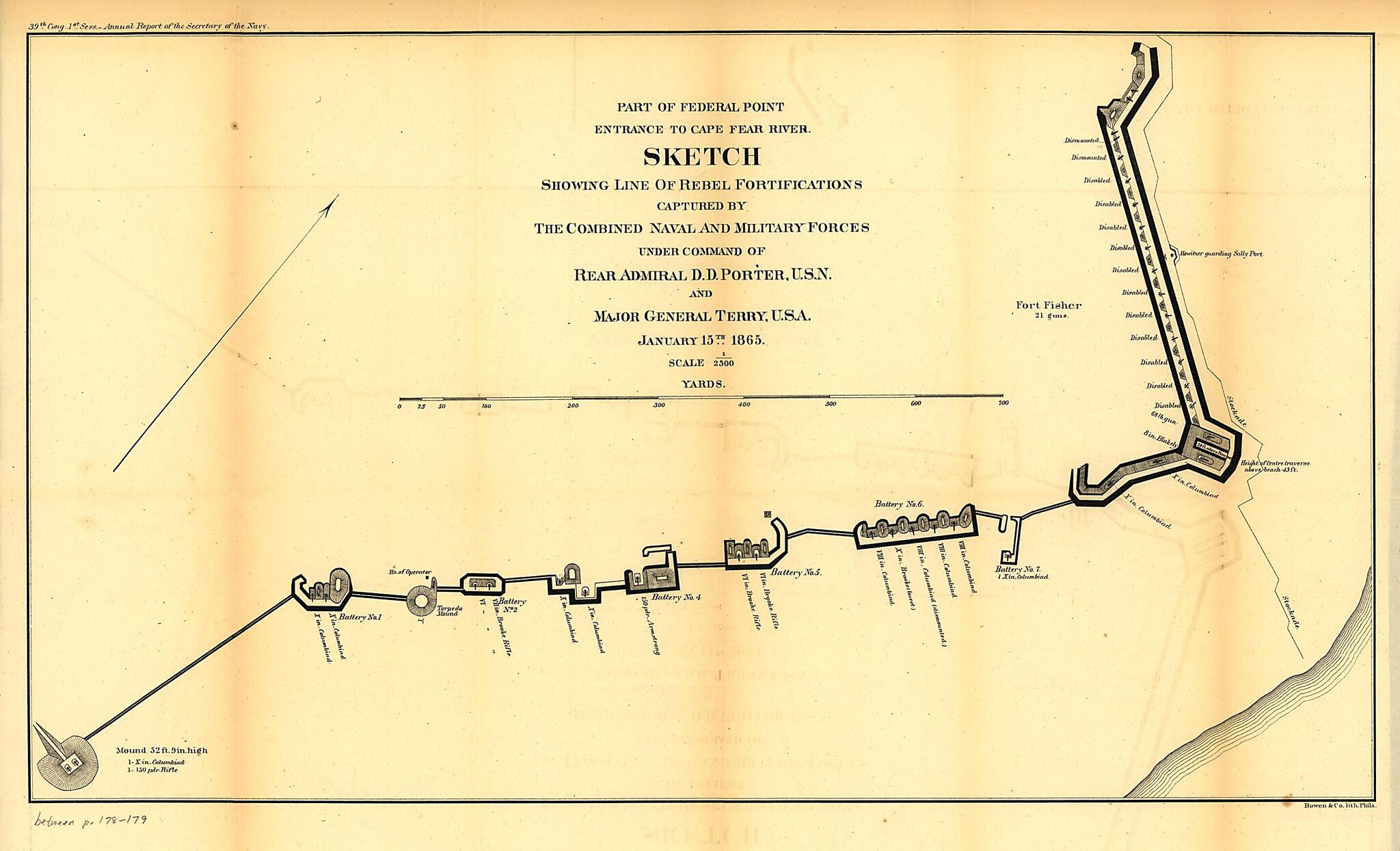
Part of Federal Point Entrance to Cape Fear River. Sketch Showing Line of Rebel Forifications Captured by the Combined Naval and Military Forces 1865
- Regular price
-
$49.95 - Regular price
-
$34.95 - Sale price
-
$49.95
Shipping calculated at checkout.
Buy one map, get any other map in our collection for 50% OFF! Add to cart to see discount.
Couldn't load pickup availability
About This Map
Old map of Fort Fisher, North Carolina, United States.
Created by United States. Navy in 1865.
Created by United States. Navy in 1865.
- Scale ca. 1:2500.
- Civil War Map
- From Message of the President of the United States, and accompanying documents, to the two houses of Congress, at the commencement of the first session of the thirty-ninth Congress.-Report of the Secretary of the Navy (Washington, Government Printing Office, 1865). fol. p. 178.
- Printed in upper left margin: 39th Cong. 1st Sess.-Annual Report of the Secretary of the Navy.
- Description derived from published bibliography.
Map Subjects
Civil War
Fort Fisher
Fort Fisher (N.C.)
History
North Carolina
United States
United States. Navy
1865
Map Sizing Information
- For the best legibility, order your map in the original size or larger. Most maps have intricate detail and small text that is best appreciated when the print size hasn't been reduced.
- Sizes labeled "Fits a Standard Frame" will drop right into any frame that you purchase in that size. The sizes that we offer are commonly available online and at most retail stores.
- Our standard sizes are recommendations based on the aspect ratio of the original map, but still may require some added "white space" in one dimension to fit.
- Non-standard sizes will require custom framing, and we suggest taking your print to the frame shop of your choice after you receive it for the best results.
- Custom sizes are available, simply contact us for a quote.
Below is an approximation of the scale of a few standard sizes, and how they might appear in your space.
