
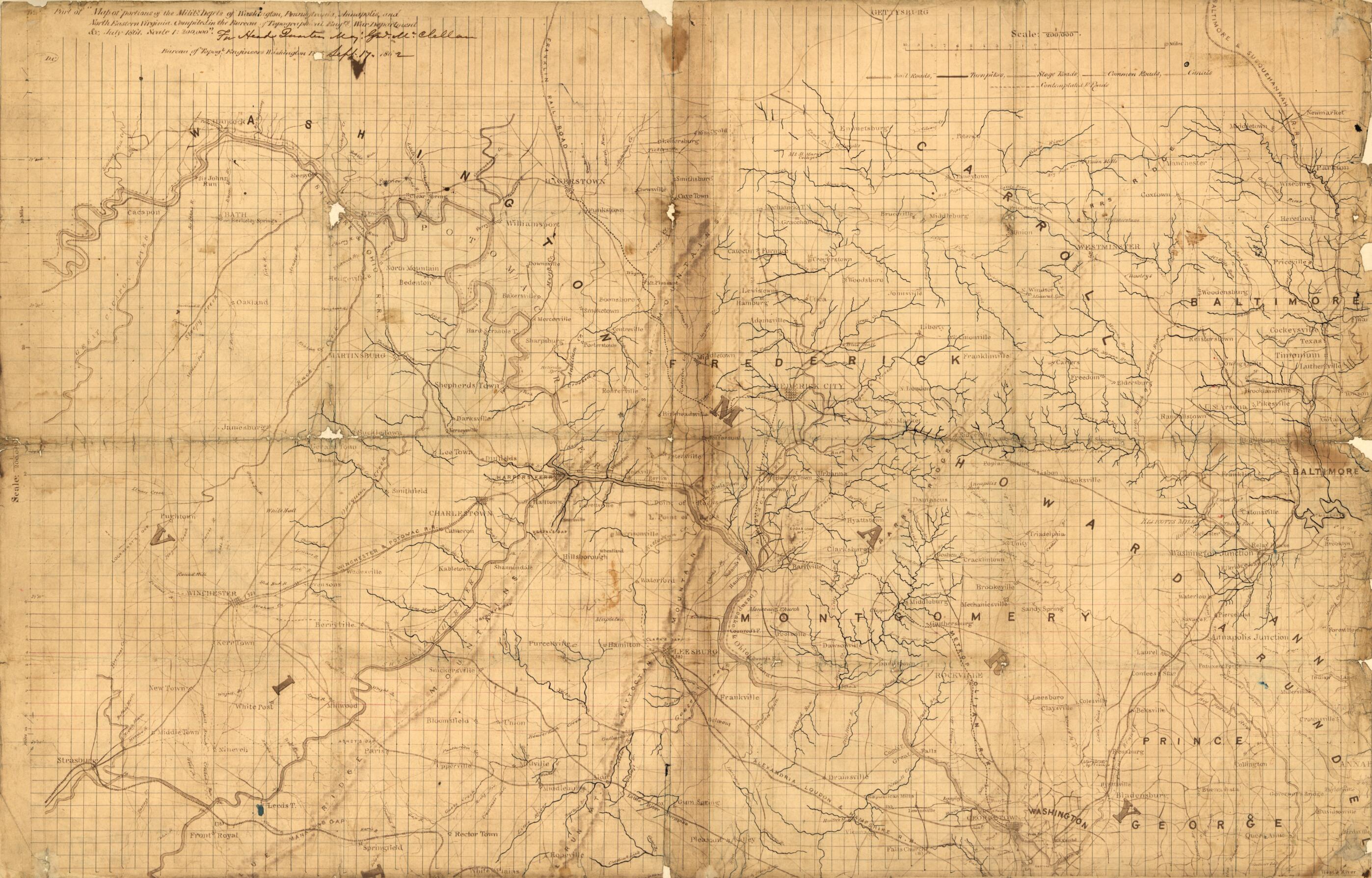
Part of Map of Portions of the Mility. Dep'ts of Washington, Pennsylvania, Annapolis, and North Eastern Virginia (Map of Portions of the Milit'y Dep'ts of Washington, Pennsylvania, Annapolis and North Eastern Virginia) 1862
- Regular price
-
$78.95 - Regular price
-
$73.95 - Sale price
-
$78.95
Shipping calculated at checkout.
Buy one map, get any other map in our collection for 50% OFF! Add to cart to see discount.
Couldn't load pickup availability
About This Map
Old map of Maryland, Middle Atlantic States, United States, Virginia, Washington Region.
Created by George B. (George Brinton) McClellan, United States. Topographical Bureau in 1862.
Created by George B. (George Brinton) McClellan, United States. Topographical Bureau in 1862.
- Relief shown by shading.
- General map showing the Washington D.C. region, including western part of Maryland and northeastern Virginia. Does not show Pennsylvania with the exception of Gettysburg.
- Civil War salted paper maps.
- Acquired in 1948 with the purchase of the papers of Maj. Jedediah Hotchiss.
- Endorsed in ink: For Head Quarters, Maj. Genl. McClellan.
- Sun print on two sheets of paper pasted together with grid added in black and red ink, and drainage emphasized in blue ink. Folded into eighths, with losses along the fold lines, mounted on cloth.
- Civil War Map
Map Sizing Information
- For the best legibility, order your map in the original size or larger. Most maps have intricate detail and small text that is best appreciated when the print size hasn't been reduced.
- Sizes labeled "Fits a Standard Frame" will drop right into any frame that you purchase in that size. The sizes that we offer are commonly available online and at most retail stores.
- Our standard sizes are recommendations based on the aspect ratio of the original map, but still may require some added "white space" in one dimension to fit.
- Non-standard sizes will require custom framing, and we suggest taking your print to the frame shop of your choice after you receive it for the best results.
- Custom sizes are available, simply contact us for a quote.
Below is an approximation of the scale of a few standard sizes, and how they might appear in your space.
