
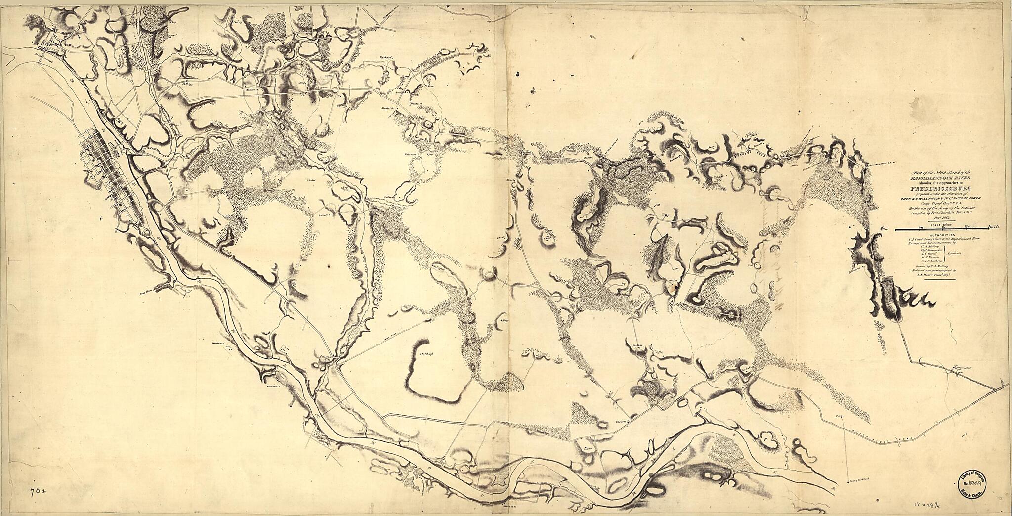
Part of the North Bank of the Rappahannock River Showing the Approaches to Fredericksburg : Prepared Under the Direction of Capt. R.S. Williamson & 1st Lt. Nicolas Bowen, Corps Topogl. Engrs., U.S.A. for the Use of the Army of the Potomac. Compiled by...
- Regular price
-
$69.95 - Regular price
-
$64.95 - Sale price
-
$69.95
Shipping calculated at checkout.
Buy one map, get any other map in our collection for 50% OFF! Add to cart to see discount.
Couldn't load pickup availability
About This Map
Old map of Fredericksburg Region, King George County, Rappahannock River, United States, Virginia.
Created by C. A. Mallory in 1862.
Created by C. A. Mallory in 1862.
- Relief shown by hachures.
- "Photographic reduction by L.E. Walker, Treasury Department."
- "Authorities: U.S. Coast Survey chart of the Rappahannock River [and] surveys and reconnoissances [sic] by C. A. Mallory, Chas. Shoemacker, L.C. Oswell, H.H. Marvin [and] Geo. F. Lathrop, assistants."
- General map showing roads, houses, names of residents, and woodland.
- Sun print.
- Description derived from published bibliography.
- Civil War salted paper maps. AL-14.
- Civil War Map
Map Subjects
Fredericksburg Region
Fredericksburg Region (Va.)
King George County
King George County (Va.)
Rappahannock River
Rappahannock River (Va.)
Salted Paper Prints
United States
Virginia
C. A. Mallory
1862
Map Sizing Information
- For the best legibility, order your map in the original size or larger. Most maps have intricate detail and small text that is best appreciated when the print size hasn't been reduced.
- Sizes labeled "Fits a Standard Frame" will drop right into any frame that you purchase in that size. The sizes that we offer are commonly available online and at most retail stores.
- Our standard sizes are recommendations based on the aspect ratio of the original map, but still may require some added "white space" in one dimension to fit.
- Non-standard sizes will require custom framing, and we suggest taking your print to the frame shop of your choice after you receive it for the best results.
- Custom sizes are available, simply contact us for a quote.
Below is an approximation of the scale of a few standard sizes, and how they might appear in your space.
