
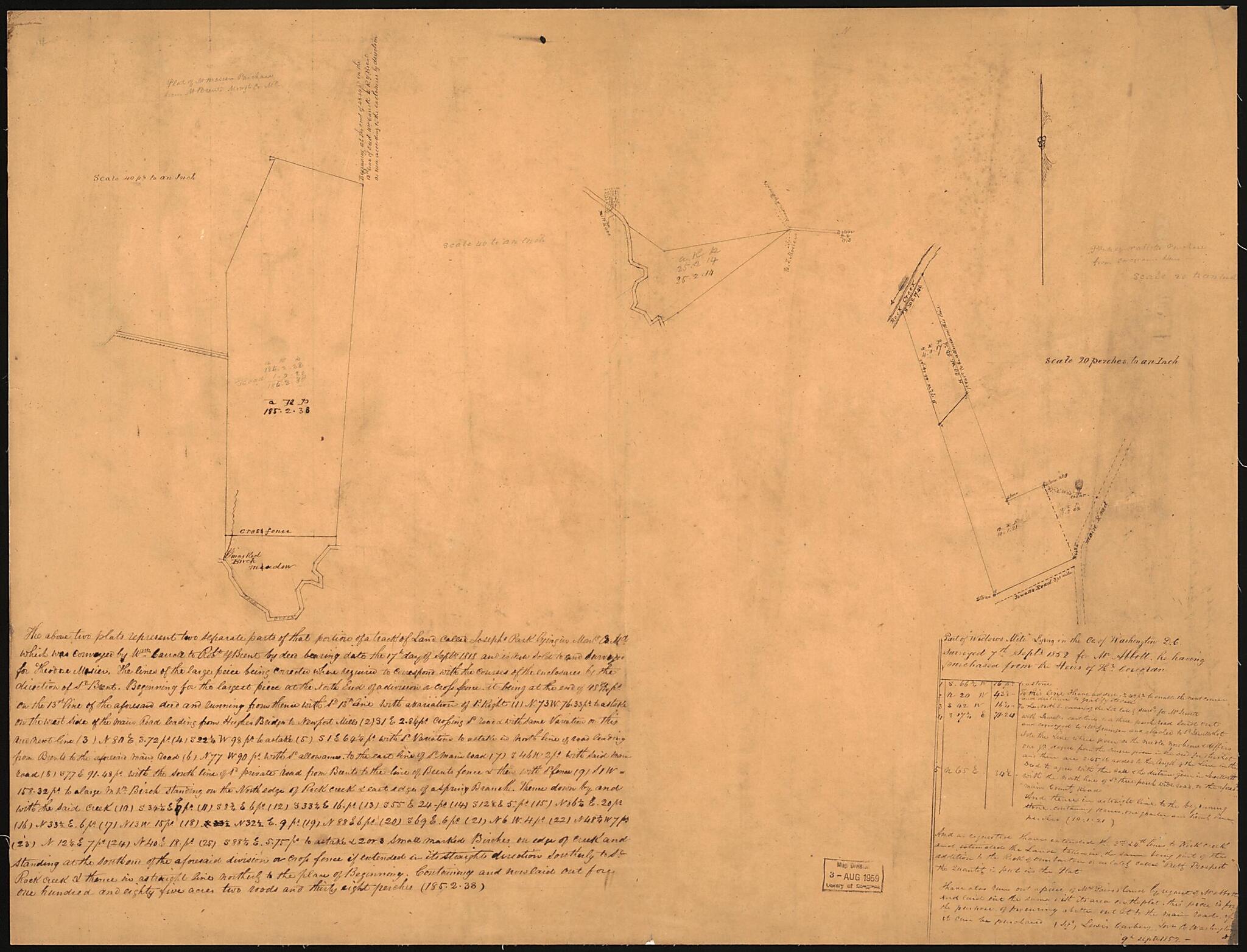
Part of Widows Mite Lying In the County of Washington D.C. ; the Above 2 Plats Represent Two Separate Parts of That Portion of a Tract of Land Called Josephs Park, Lying In Montg. County Md 1852
- Regular price
-
$58.95 - Regular price
-
$41.95 - Sale price
-
$58.95
Shipping calculated at checkout.
Buy one map, get any other map in our collection for 50% OFF! Add to cart to see discount.
Couldn't load pickup availability
About This Map
Old map of District of Columbia, Maryland, Montgomery County, United States, Washington, Washington D.C., Widows Mite.
Created by Lewis Carbery in 1852.
Created by Lewis Carbery in 1852.
- Both tracts border on Rock Creek.
- Titles in lead pencil on cloth backing: No. 1. Theodore Mosier's plat of Josephs Park, purchased of Robert Brent -- No. 2. Abbott's purchase from the heirs of Thomas Corcoran.
- Josephs Park map in 2 parts.
- Pen-and-ink (2 hands) with additions in lead pencil.
- Soiled and mounted on cloth backing.
- Includes text and statistical table.
Map Subjects
District Of Columbia
Manuscript Maps
Maps Manuscript
Maryland
Montgomery County
Real Property
United States
Washington
Washington (D.C.)
Widows Mite
Widows Mite (Washington D.C.)
Washington D.C.
Lewis Carbery
1852
Map Sizing Information
- For the best legibility, order your map in the original size or larger. Most maps have intricate detail and small text that is best appreciated when the print size hasn't been reduced.
- Sizes labeled "Fits a Standard Frame" will drop right into any frame that you purchase in that size. The sizes that we offer are commonly available online and at most retail stores.
- Our standard sizes are recommendations based on the aspect ratio of the original map, but still may require some added "white space" in one dimension to fit.
- Non-standard sizes will require custom framing, and we suggest taking your print to the frame shop of your choice after you receive it for the best results.
- Custom sizes are available, simply contact us for a quote.
Below is an approximation of the scale of a few standard sizes, and how they might appear in your space.

