
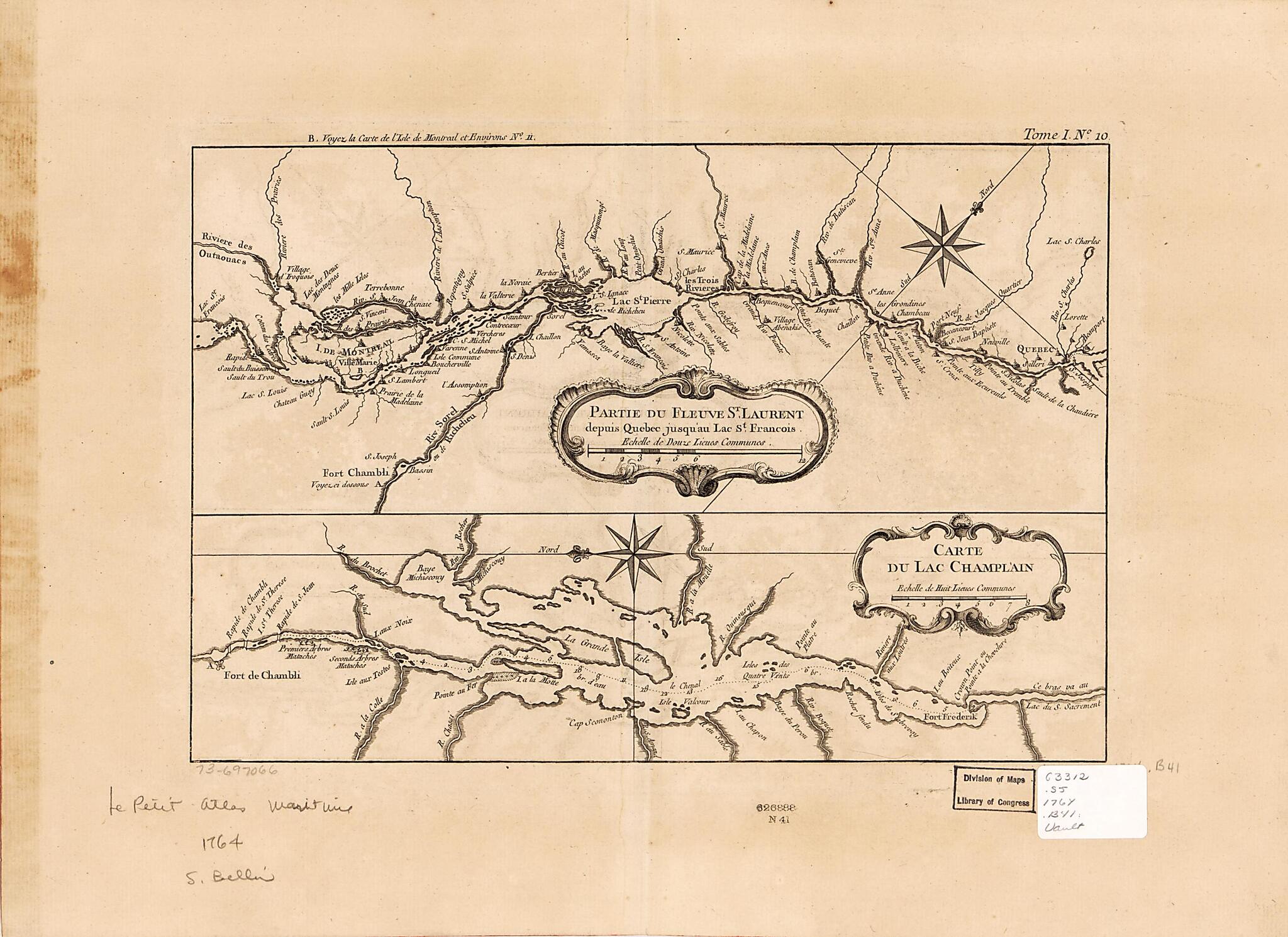
Partie Du Fleuve St. Laurent Depuis Quebec Jusqu'au Lac St. Francois. Carte Du Lac Champlain 1764
- Regular price
-
$49.95 - Regular price
-
$34.95 - Sale price
-
$49.95
Shipping calculated at checkout.
Buy one map, get any other map in our collection for 50% OFF! Add to cart to see discount.
Couldn't load pickup availability
About This Map
Old map of Canada, Champlain, Champlain, Lake, Lake, New York, North America, Québec (Province), Saint Lawrence River, United States, Vermont.
Created by Jacques Nicolas] [Bellin in 1764.
Created by Jacques Nicolas] [Bellin in 1764.
- Scale ca. 1:650,000.
- Soundings shown by fathoms.
- "Tome, I, no. 10."
- From the author's Le petit atlas maritime. 1764.
Map Subjects
Canada
Champlain Lake
Early Works To 1800
New York
North America
Québec (Province)
Saint Lawrence River
United States
Vermont
Champlain
Lake
Jacques Nicolas Bellin
1764
Map Sizing Information
- For the best legibility, order your map in the original size or larger. Most maps have intricate detail and small text that is best appreciated when the print size hasn't been reduced.
- Sizes labeled "Fits a Standard Frame" will drop right into any frame that you purchase in that size. The sizes that we offer are commonly available online and at most retail stores.
- Our standard sizes are recommendations based on the aspect ratio of the original map, but still may require some added "white space" in one dimension to fit.
- Non-standard sizes will require custom framing, and we suggest taking your print to the frame shop of your choice after you receive it for the best results.
- Custom sizes are available, simply contact us for a quote.
Below is an approximation of the scale of a few standard sizes, and how they might appear in your space.

