
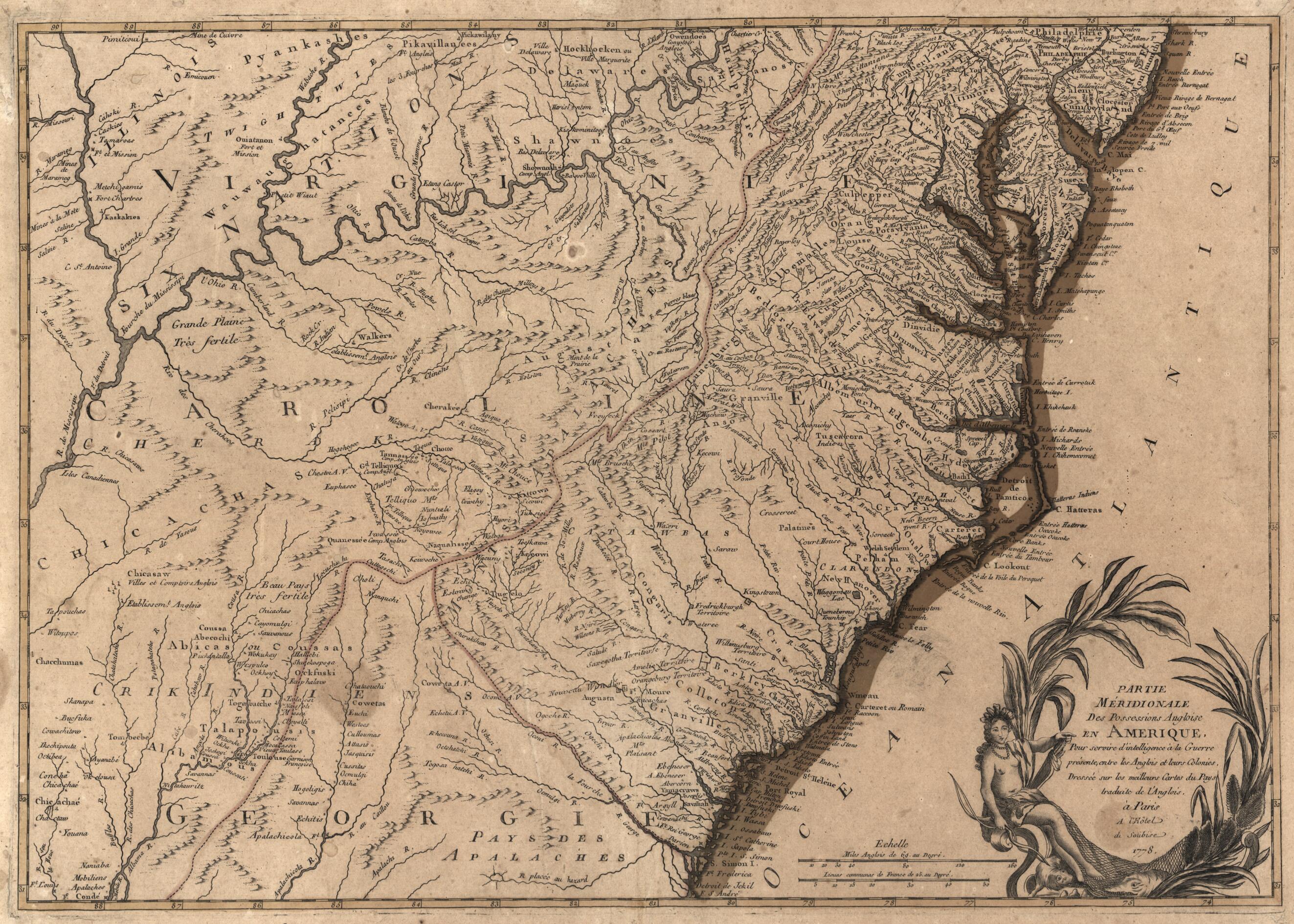
Partie Méridionale Des Possessions Angloise sic En Amérique : Pour Servir D'intelligence à La Guerre Présente Entre Les Anglois Et Leurs Colonies 1778
- Regular price
-
$71.95 - Regular price
-
$66.95 - Sale price
-
$71.95
Shipping calculated at checkout.
Buy one map, get any other map in our collection for 50% OFF! Add to cart to see discount.
Couldn't load pickup availability
About This Map
Old map of Southern States, United States.
Created by Michel in 1778.
Created by Michel in 1778.
- Covers the southern Atlantic coast from Shrewsbury (N.J.) to Jekyll Island (Ga.) including inland territory westward to the Mississippi River. Does not cover Florida or Louisiana.
- Relief shown pictorially.
- Michel is presumed to be the responsible cartographer as he is known to have produced in 1778 the companion northern (septentrionale) sheet of the English colonies.
- Hand col. to show coastlines, boundaries, and map border.
- Includes imaginary ill. in title cartouche.
- Gifts to the Nation donation; Harry J. Gray, James Madison Council; Oct. 2000.
- Acquisitions control no.: 2000-55
Map Sizing Information
- For the best legibility, order your map in the original size or larger. Most maps have intricate detail and small text that is best appreciated when the print size hasn't been reduced.
- Sizes labeled "Fits a Standard Frame" will drop right into any frame that you purchase in that size. The sizes that we offer are commonly available online and at most retail stores.
- Our standard sizes are recommendations based on the aspect ratio of the original map, but still may require some added "white space" in one dimension to fit.
- Non-standard sizes will require custom framing, and we suggest taking your print to the frame shop of your choice after you receive it for the best results.
- Custom sizes are available, simply contact us for a quote.
Below is an approximation of the scale of a few standard sizes, and how they might appear in your space.

