
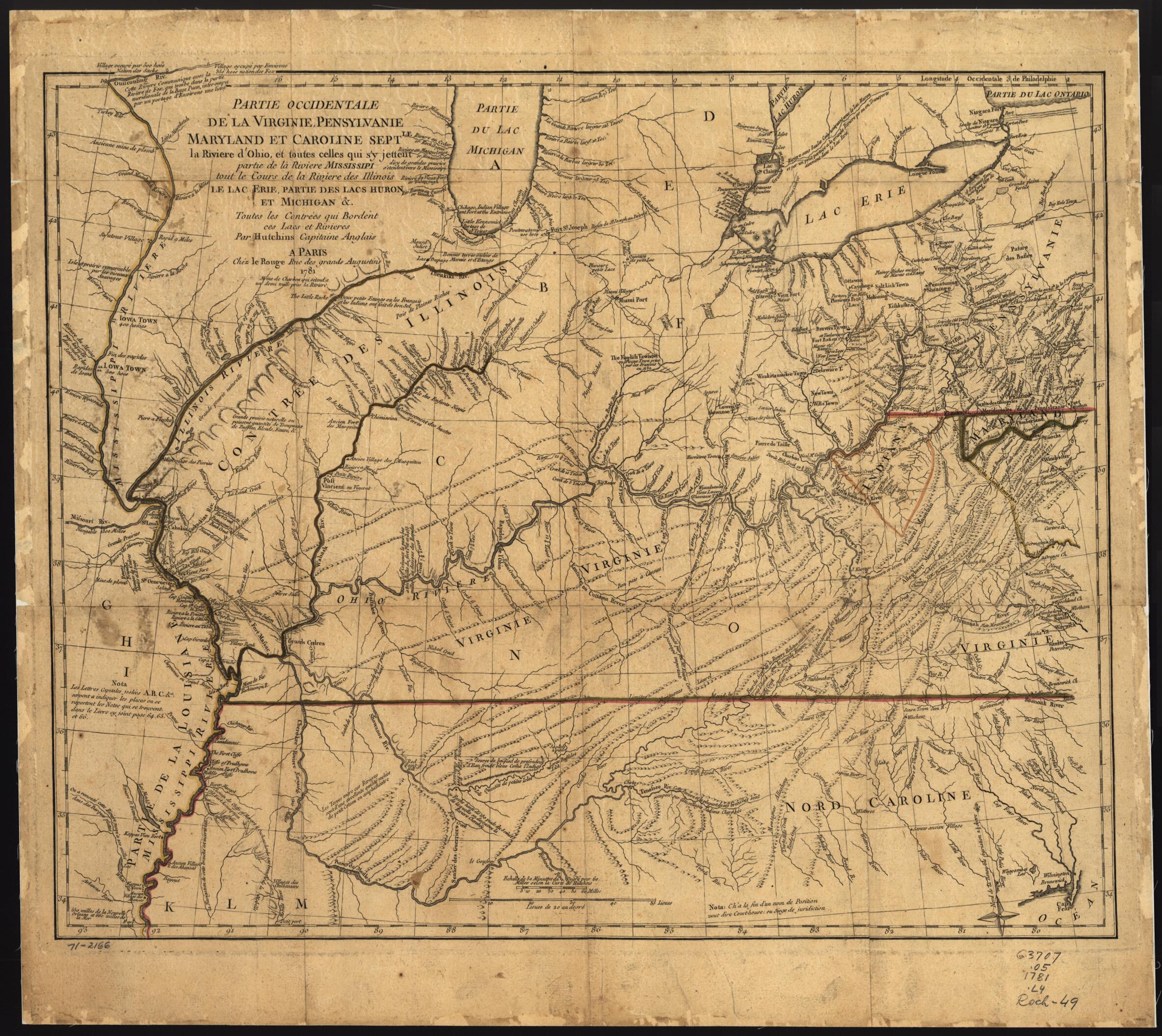
Partie Occidentale De La Virginie, Pensylvanie, Maryland, Et Caroline Septle. La Rivière D'Ohio, Et Toutes Celles Qui S'y Jettent, Partie De La Rivière Mississippi, Tout Le Cours De La Rivière De Illinois, Le Lac Erie, Partie Des Lacs Huron Et Mich...
- Regular price
-
$68.95 - Regular price
-
$63.95 - Sale price
-
$68.95
Shipping calculated at checkout.
Buy one map, get any other map in our collection for 50% OFF! Add to cart to see discount.
Couldn't load pickup availability
About This Map
Old map of Mississippi River Valley, Ohio River Valley, United States.
Created by Thomas Hutchins, Louis in 1781.
Created by Thomas Hutchins, Louis in 1781.
- Scale ca. 1:2,500,000.
- Hand colored.
- Prime meridian: Philadelphia and London.
- Relief shown pictorially and by hachures.
- Translation of Thomas Hutchins' New map of the western part of Virginia, Pennsylvania, Maryland, and North Carolina, 1778.
- Includes descriptive and historical notes.
Map Sizing Information
- For the best legibility, order your map in the original size or larger. Most maps have intricate detail and small text that is best appreciated when the print size hasn't been reduced.
- Sizes labeled "Fits a Standard Frame" will drop right into any frame that you purchase in that size. The sizes that we offer are commonly available online and at most retail stores.
- Our standard sizes are recommendations based on the aspect ratio of the original map, but still may require some added "white space" in one dimension to fit.
- Non-standard sizes will require custom framing, and we suggest taking your print to the frame shop of your choice after you receive it for the best results.
- Custom sizes are available, simply contact us for a quote.
Below is an approximation of the scale of a few standard sizes, and how they might appear in your space.

