
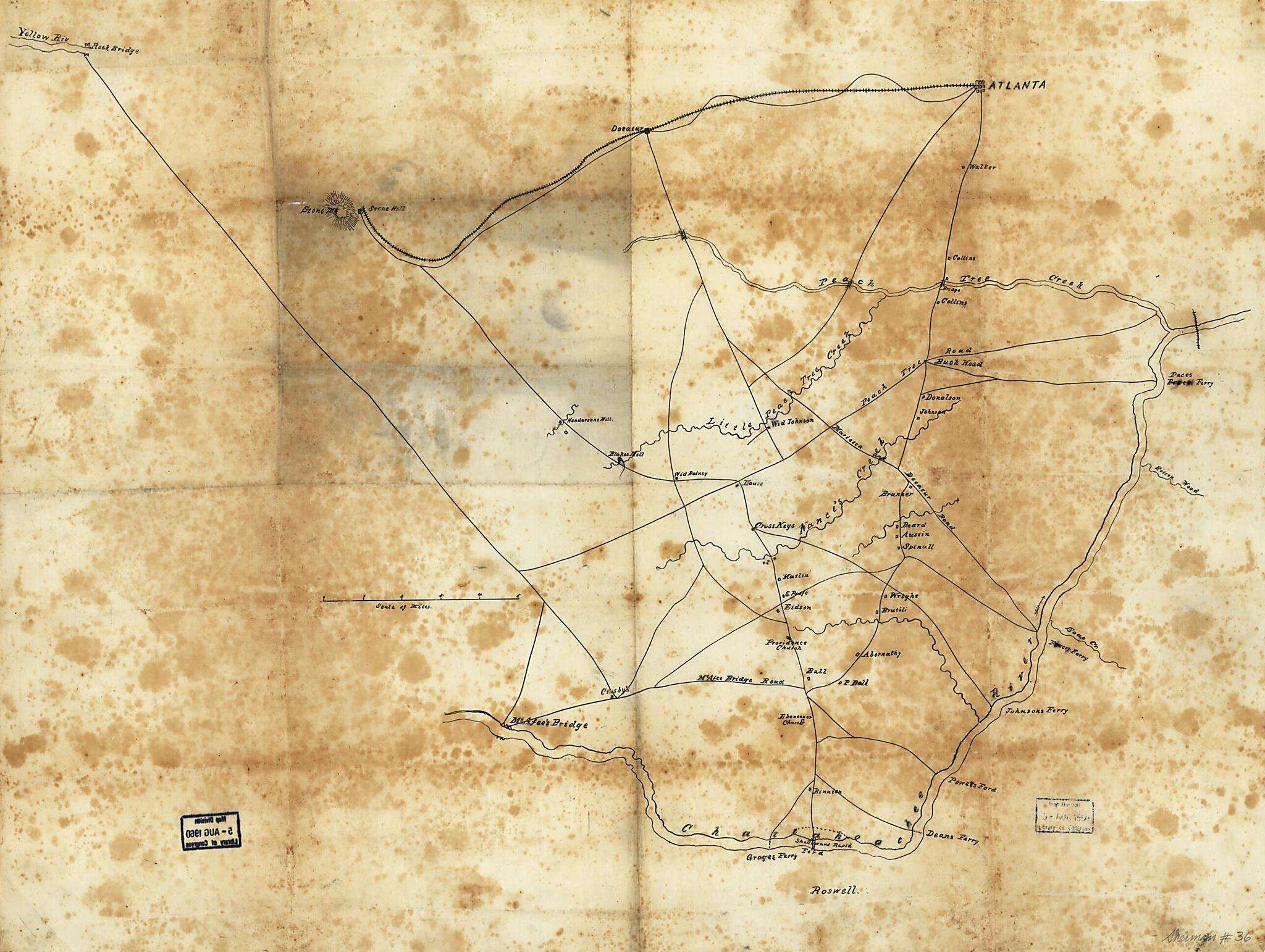
Pen and Ink Sketch Map Drawn On Tracing Cloth, Showing Roads, Streams, Bridges, Ferries, Fords, Houses, Names of Residents, and Towns Between Atlanta and the Chattahoochee River, 1864
- Regular price
-
$62.95 - Regular price
-
$57.95 - Sale price
-
$62.95
Shipping calculated at checkout.
Buy one map, get any other map in our collection for 50% OFF! Add to cart to see discount.
Couldn't load pickup availability
About This Map
Old map of Dekalb County, Fulton County, Georgia, United States.
- Shows DeKalb County northwest of Stone Mountain and Fulton County from Roswell south to Atlanta.
- Relief shown by hachures.
- Title and date from Stephenson's Civil War maps, 1989.
- Oriented with north to the bottom.
- Pen-and-ink on tracing cloth.
- Civil War Map
- Includes names of select landowners.
- This map has some imperfections: fold-lined, pin holes in all corners. We'll do our best to restore the image before printing.
Map Subjects
Dekalb County
Dekalb County (Ga.)
Fulton County
Fulton County (Ga.)
Georgia
Landowners
Maps Manuscript
United States
1864
Map Sizing Information
- For the best legibility, order your map in the original size or larger. Most maps have intricate detail and small text that is best appreciated when the print size hasn't been reduced.
- Sizes labeled "Fits a Standard Frame" will drop right into any frame that you purchase in that size. The sizes that we offer are commonly available online and at most retail stores.
- Our standard sizes are recommendations based on the aspect ratio of the original map, but still may require some added "white space" in one dimension to fit.
- Non-standard sizes will require custom framing, and we suggest taking your print to the frame shop of your choice after you receive it for the best results.
- Custom sizes are available, simply contact us for a quote.
Below is an approximation of the scale of a few standard sizes, and how they might appear in your space.

