
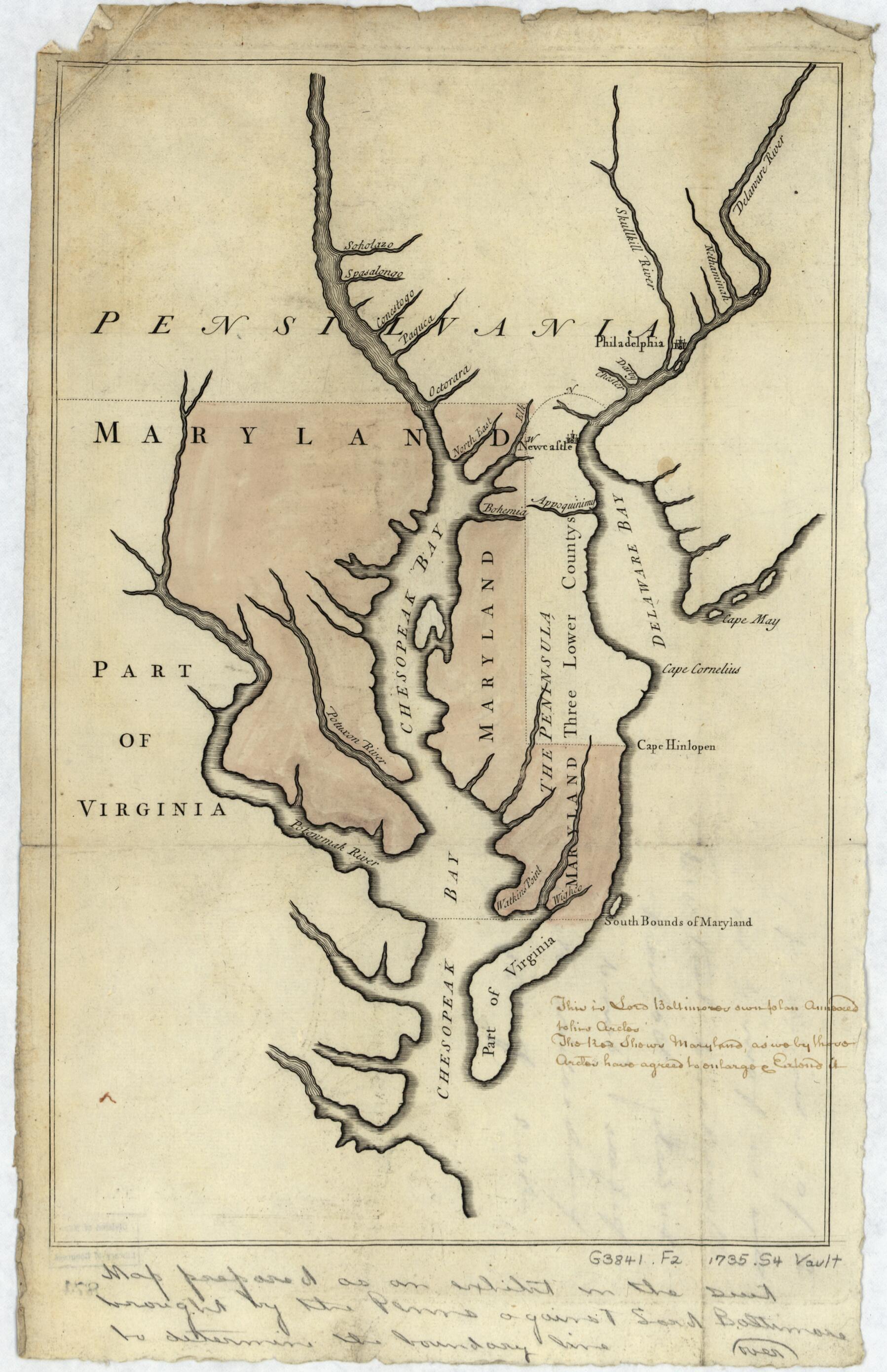
Pennsylvania Boundary Used As Trial Exhibits In the 1735 Court Suit Brought by the Penns Against Lord Baltimore to Determine the Official Interprovincial Boundary Line 1732
- Regular price
-
$49.95 - Regular price
-
$29.95 - Sale price
-
$49.95
Shipping calculated at checkout.
Buy one map, get any other map in our collection for 50% OFF! Add to cart to see discount.
Couldn't load pickup availability
About This Map
Old map of Delaware, Maryland, Pennsylvania, United States.
Created by Ferdinand John Paris, John Senex in 1732.
Created by Ferdinand John Paris, John Senex in 1732.
- The maps also cover the Lower Counties (now the State of Delaware) which at the time were part of Pennsylvania.
- The "Virginia" map shows lines of latitude (identified) and longitude (unidentified).
- Common title devised by cataloger.
- Annotated in ink handwriting on recto by Ferdinand J. Paris (attorney for the Penn Family).
- The "Virginia" map is oriented with north to the right.
- Hand col. (light watercolor) to show the territory of Maryland.
- Both sheets watermarked (stylized figure of duck).
- Accompanied by a col. photocopy of the verso of each map.
- Extensive lead-pencil annotations on verso by Ferdinand J. Paris.
Map Sizing Information
- For the best legibility, order your map in the original size or larger. Most maps have intricate detail and small text that is best appreciated when the print size hasn't been reduced.
- Sizes labeled "Fits a Standard Frame" will drop right into any frame that you purchase in that size. The sizes that we offer are commonly available online and at most retail stores.
- Our standard sizes are recommendations based on the aspect ratio of the original map, but still may require some added "white space" in one dimension to fit.
- Non-standard sizes will require custom framing, and we suggest taking your print to the frame shop of your choice after you receive it for the best results.
- Custom sizes are available, simply contact us for a quote.
Below is an approximation of the scale of a few standard sizes, and how they might appear in your space.

