
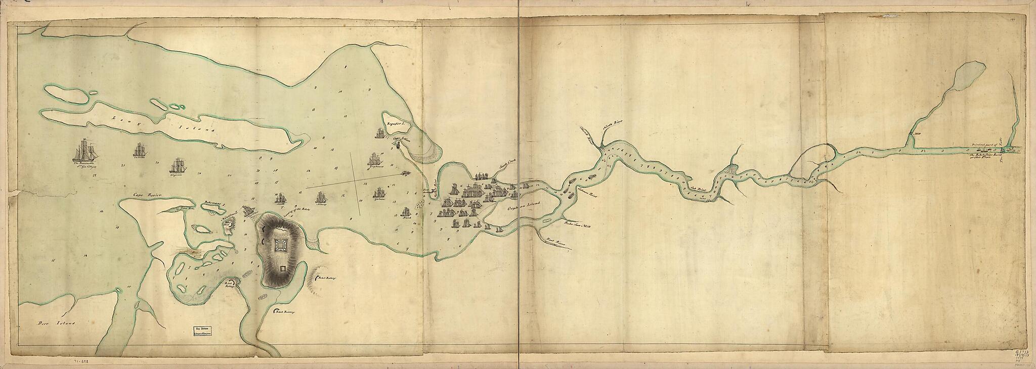
Penobscot River and Bay, With the Operations of the English Fleet, Under Sir George Collyer, Against the Division of Massachusetts Troops Acting Against Fort Castine, August 1779; With Full Soundings Up to the Present Site of Bangor
- Regular price
-
$108.95 - Regular price
-
$103.95 - Sale price
-
$108.95
Shipping calculated at checkout.
Buy one map, get any other map in our collection for 50% OFF! Add to cart to see discount.
Couldn't load pickup availability
About This Map
Old map of Maine, Penobscot Bay Region, United States.
- Scale ca. 1:46,000.
- Title from William Faden's Catalogue of a curious and valuable collection of original maps and plans.
- Manuscript, pen-and-ink and watercolor.
- Has watermarks.
- Oriented with north to the right.
- Relief shown by shading. Depths shown by soundings.
Map Subjects
Defenses
Early Works To 1800
Maine
Maps Manuscript
Penobscot Bay Region
Penobscot Bay Region (Me.)
Penobscot Expedition
United States
1779
Map Sizing Information
- For the best legibility, order your map in the original size or larger. Most maps have intricate detail and small text that is best appreciated when the print size hasn't been reduced.
- Sizes labeled "Fits a Standard Frame" will drop right into any frame that you purchase in that size. The sizes that we offer are commonly available online and at most retail stores.
- Our standard sizes are recommendations based on the aspect ratio of the original map, but still may require some added "white space" in one dimension to fit.
- Non-standard sizes will require custom framing, and we suggest taking your print to the frame shop of your choice after you receive it for the best results.
- Custom sizes are available, simply contact us for a quote.
Below is an approximation of the scale of a few standard sizes, and how they might appear in your space.
