
Perrine's New Topographical War Map of the Southern States 1863
- Regular price
-
$126.95 - Regular price
-
$121.95 - Sale price
-
$126.95
Shipping calculated at checkout.
Buy one map, get any other map in our collection for 50% OFF! Add to cart to see discount.
Couldn't load pickup availability
About This Map
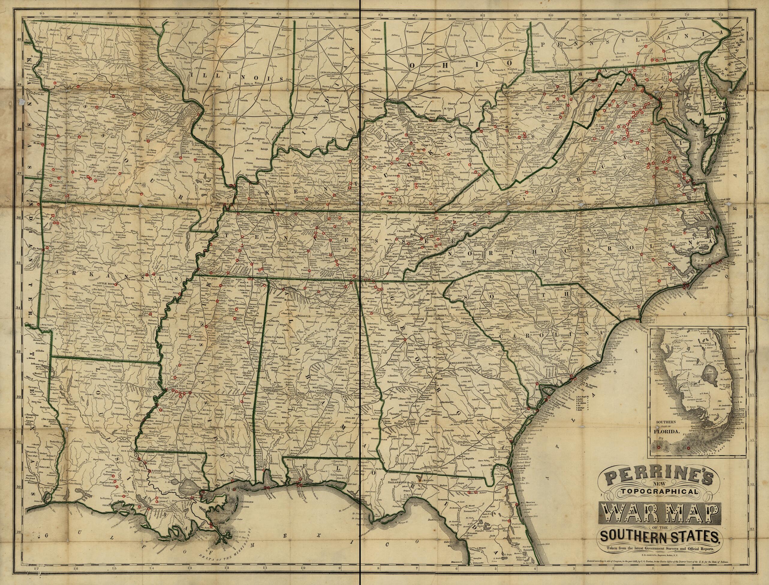
Old map of Southern States, United States.
Created by C. O. (Charles O.) Perrine in 1863.
Created by C. O. (Charles O.) Perrine in 1863.
- Scale ca. 1:2,000,000.
- Civil War Map
- Accompanies John S. Bishop's A Concise History of the War. Designed to Accompany Perrine's New War Map of the Southern States, with an Introduction and Statistical Appendix, Compiled from Authentic Sources (Indianapolis, Charles O. Perrine [c;1864]), 132, 9 p. 15 x 10 cm.
- Map indicates state boundaries and shore lines in green and battle and engagements by small red circles.
- Inset: Southern part Florida. 17 x 13 cm.
- The Geography and Map Division has two additional issues, without accompaniment, that indicate fewer battle sites.
- Description derived from published bibliography.
Map Sizing Information
- For the best legibility, order your map in the original size or larger. Most maps have intricate detail and small text that is best appreciated when the print size hasn't been reduced.
- Sizes labeled "Fits a Standard Frame" will drop right into any frame that you purchase in that size. The sizes that we offer are commonly available online and at most retail stores.
- Our standard sizes are recommendations based on the aspect ratio of the original map, but still may require some added "white space" in one dimension to fit.
- Non-standard sizes will require custom framing, and we suggest taking your print to the frame shop of your choice after you receive it for the best results.
- Custom sizes are available, simply contact us for a quote.
Below is an approximation of the scale of a few standard sizes, and how they might appear in your space.

