
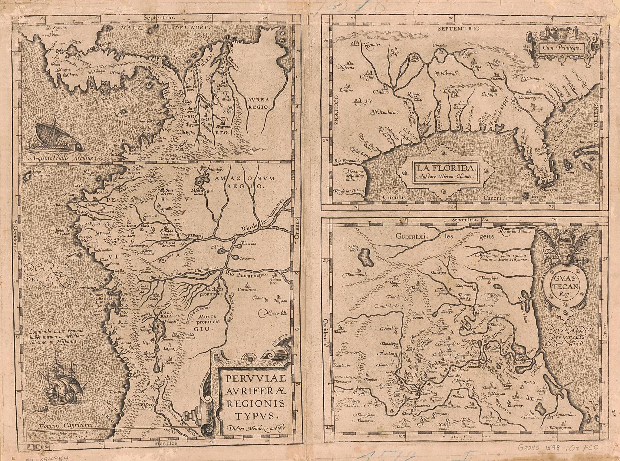
Pervviae Avriferae Regionis Typvs / La Florida / Auctore Hieron. Chiaues ; Gvastecan Reg. (Peruuiae Auriferae Regionis Typus, Florida, Gvastecan Reg, Guastecan Reg) 1598
- Regular price
-
$49.95 - Regular price
-
$34.95 - Sale price
-
$49.95
Shipping calculated at checkout.
Buy one map, get any other map in our collection for 50% OFF! Add to cart to see discount.
Couldn't load pickup availability
About This Map
Old early map of America.
Created by Museum, Geronimo Chaves, Diego Hurtado De Mendoza, Abraham Ortelius in 1598.
Created by Museum, Geronimo Chaves, Diego Hurtado De Mendoza, Abraham Ortelius in 1598.
- Shows portion of Central America, northwestern South America, southern United States, and coast of Tamaulipas in Mexico.
- Relief shown pictorially.
- Includes illustrations.
- Transferred from the collection of the Canal Zone Library-Museum, 1980.
- Map in Latin. French text on verso.
- Annotated in pencil, on verso, with Canal Zone Library map checklist number: 28.
Map Subjects
America
Early Maps
Early Works To 1800
Early Maps
Museum
Geronimo Chaves
Diego Hurtado De Mendoza
Abraham Ortelius
1598
Map Sizing Information
- For the best legibility, order your map in the original size or larger. Most maps have intricate detail and small text that is best appreciated when the print size hasn't been reduced.
- Sizes labeled "Fits a Standard Frame" will drop right into any frame that you purchase in that size. The sizes that we offer are commonly available online and at most retail stores.
- Our standard sizes are recommendations based on the aspect ratio of the original map, but still may require some added "white space" in one dimension to fit.
- Non-standard sizes will require custom framing, and we suggest taking your print to the frame shop of your choice after you receive it for the best results.
- Custom sizes are available, simply contact us for a quote.
Below is an approximation of the scale of a few standard sizes, and how they might appear in your space.

