
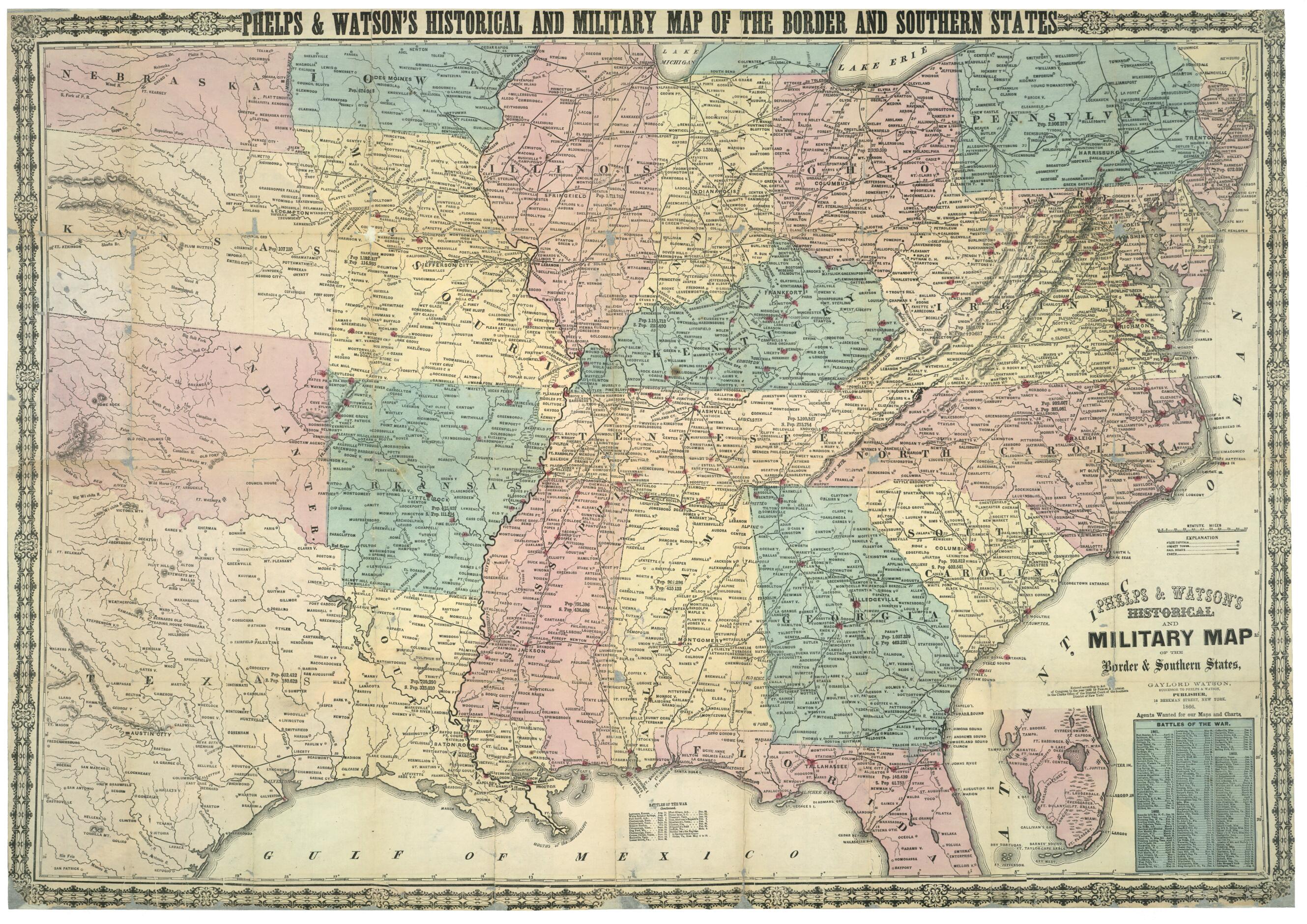
Phelps & Watson Historical and Military Map of the Border & Southern States in 1866
- Regular price
-
$98.95 - Regular price
-
$93.95 - Sale price
-
$98.95
Shipping calculated at checkout.
Buy one map, get any other map in our collection for 50% OFF! Add to cart to see discount.
Couldn't load pickup availability
About This Map
Old map of Southern States, United States.
Created by Phelps & Watson in 1866.
Created by Phelps & Watson in 1866.
- "Entered according to Act of Congress; in the year 1862 by Phelps & Watson; in the Clerk's Office of the District Court of the Southern District of New York."
- Accompanied by booklet describing battles and skirmishes of the war: New historical war map (36 p. ; 18 cm.).
- Includes list of "Battles of the war" from Apr. 12, 1861 to May 12, 1864 and inset of the southern tip of Florida.
- This item is in the Map Collection of the Library of Virginia; please contact the Library's Archives Research Services department for more information.
- Nov. 1999, Carter Yeatman, gift, ALE.
Map Sizing Information
- For the best legibility, order your map in the original size or larger. Most maps have intricate detail and small text that is best appreciated when the print size hasn't been reduced.
- Sizes labeled "Fits a Standard Frame" will drop right into any frame that you purchase in that size. The sizes that we offer are commonly available online and at most retail stores.
- Our standard sizes are recommendations based on the aspect ratio of the original map, but still may require some added "white space" in one dimension to fit.
- Non-standard sizes will require custom framing, and we suggest taking your print to the frame shop of your choice after you receive it for the best results.
- Custom sizes are available, simply contact us for a quote.
Below is an approximation of the scale of a few standard sizes, and how they might appear in your space.

