
Phelps's National Map of the United States : a Traveller's Guide : Embracing the Principal Rail Roads, Canals, Steam Boat & Stage Routes, Throughout the Union in 1852
- Regular price
-
$57.95 - Regular price
-
$40.95 - Sale price
-
$57.95
Shipping calculated at checkout.
Buy one map, get any other map in our collection for 50% OFF! Add to cart to see discount.
Couldn't load pickup availability
About This Map
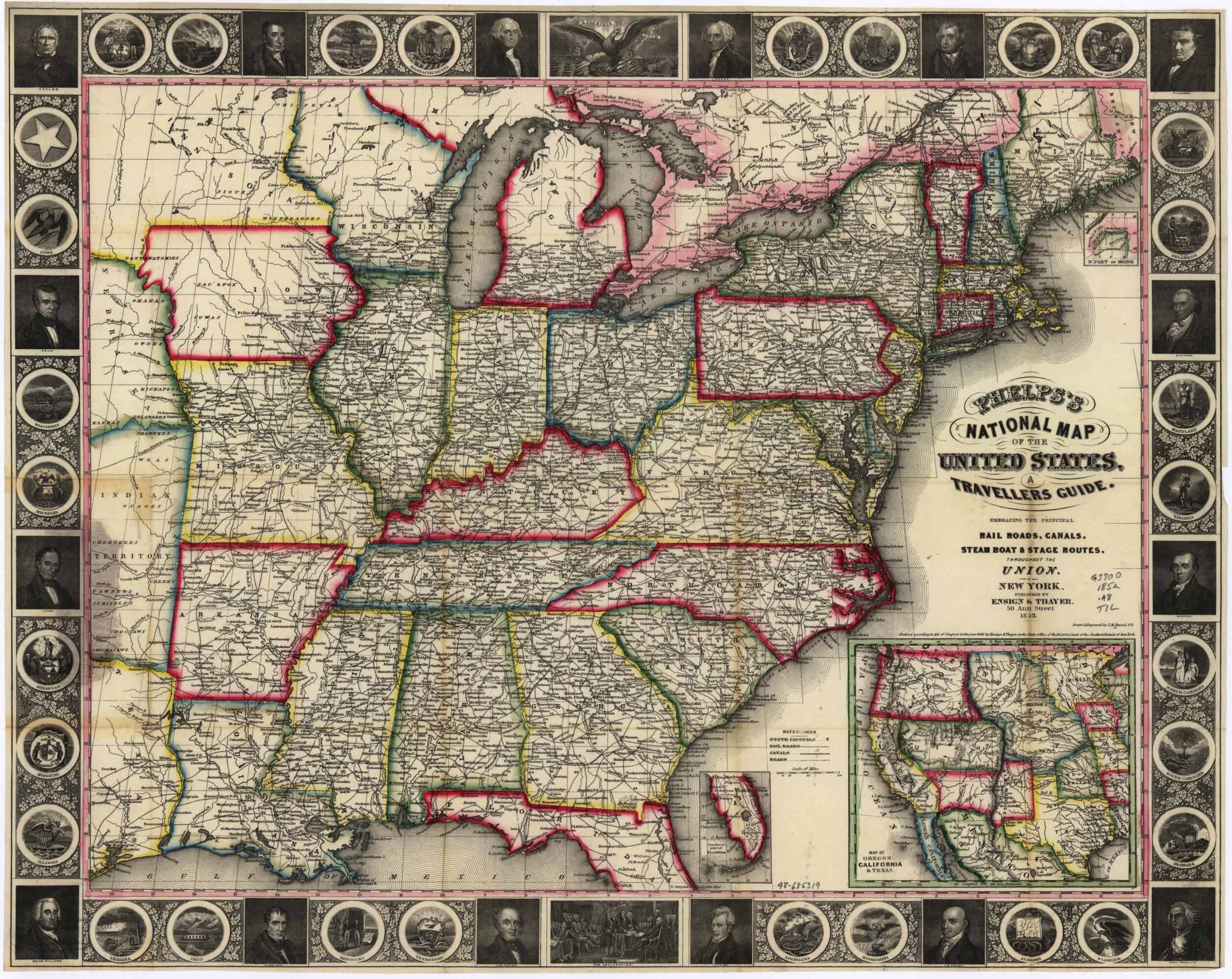
Old map of United States.
Created by John M. Atwood, Ensigns & Thayer in 1852.
Created by John M. Atwood, Ensigns & Thayer in 1852.
- "Entered according to act of Congress in the year 1849 by Ensign & Thayer ... southern district of New York."
- Prime meridian: Washington D.C.
- Includes insets "Map of Oregon, California & Texas", "Southern part of Florida", "N. part of Maine", and portraits of U.S. presidents and statesmen and state emblems.
Map Sizing Information
- For the best legibility, order your map in the original size or larger. Most maps have intricate detail and small text that is best appreciated when the print size hasn't been reduced.
- Sizes labeled "Fits a Standard Frame" will drop right into any frame that you purchase in that size. The sizes that we offer are commonly available online and at most retail stores.
- Our standard sizes are recommendations based on the aspect ratio of the original map, but still may require some added "white space" in one dimension to fit.
- Non-standard sizes will require custom framing, and we suggest taking your print to the frame shop of your choice after you receive it for the best results.
- Custom sizes are available, simply contact us for a quote.
Below is an approximation of the scale of a few standard sizes, and how they might appear in your space.

