
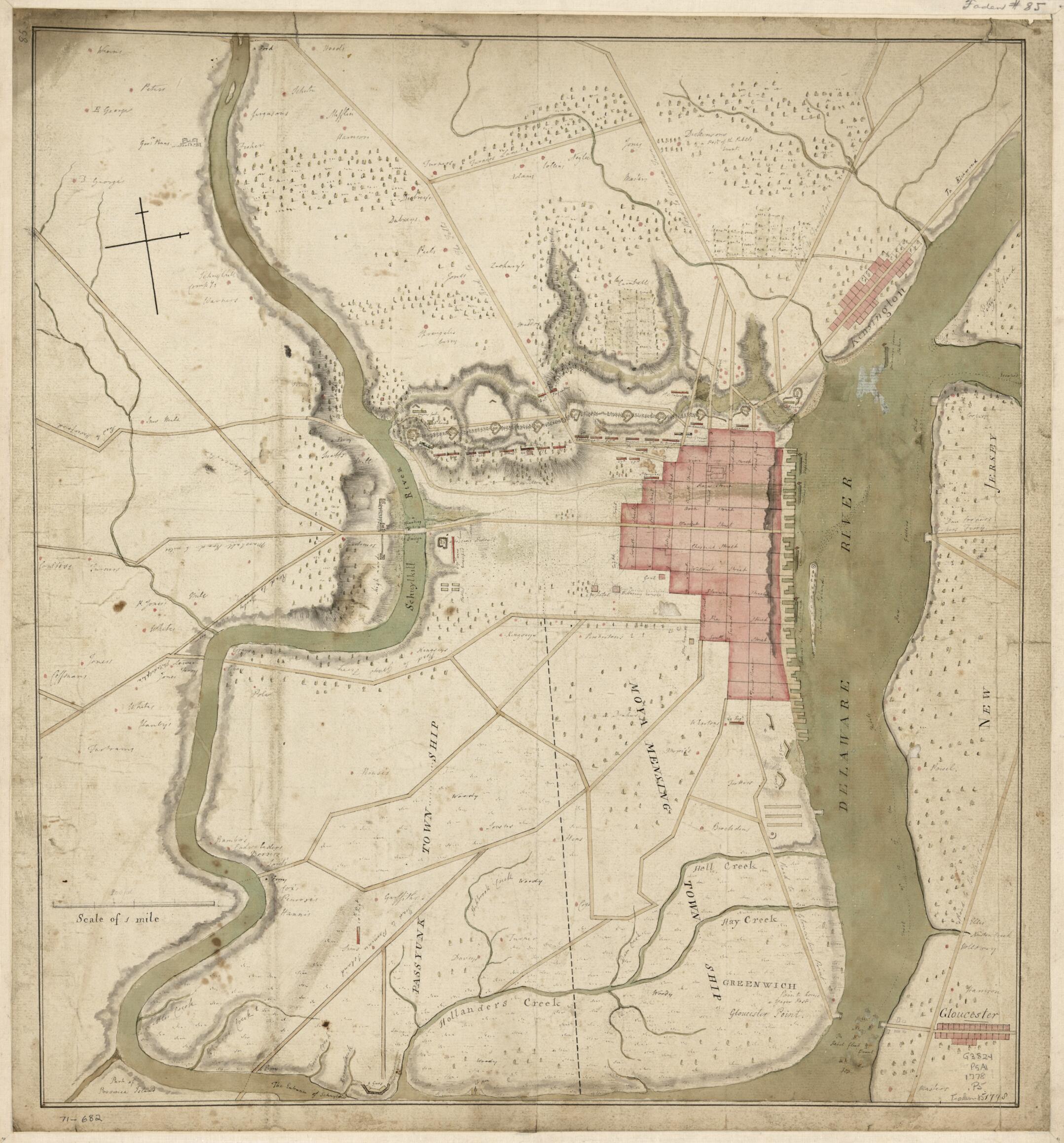
Philadelphia and Neighborhood in 1778
- Regular price
-
$53.95 - Regular price
-
$48.95 - Sale price
-
$53.95
Shipping calculated at checkout.
Buy one map, get any other map in our collection for 50% OFF! Add to cart to see discount.
Couldn't load pickup availability
About This Map
Old early map / manuscript map of Pennsylvania, Philadelphia, Philadelphia Region, United States.
- Scale ca. 1:20,400.
- Title from William Faden's Catalogue of a curious and valuable collection of original maps and plans.
- Manuscript, pen-and-ink and watercolor.
- Relief shown by hachures and shading.
- Shows line of defense and troops between Schuylkill and Delaware Rivers north of the city, and other fortifications. Also shows names of suburban land owners.
Map Sizing Information
- For the best legibility, order your map in the original size or larger. Most maps have intricate detail and small text that is best appreciated when the print size hasn't been reduced.
- Sizes labeled "Fits a Standard Frame" will drop right into any frame that you purchase in that size. The sizes that we offer are commonly available online and at most retail stores.
- Our standard sizes are recommendations based on the aspect ratio of the original map, but still may require some added "white space" in one dimension to fit.
- Non-standard sizes will require custom framing, and we suggest taking your print to the frame shop of your choice after you receive it for the best results.
- Custom sizes are available, simply contact us for a quote.
Below is an approximation of the scale of a few standard sizes, and how they might appear in your space.

