
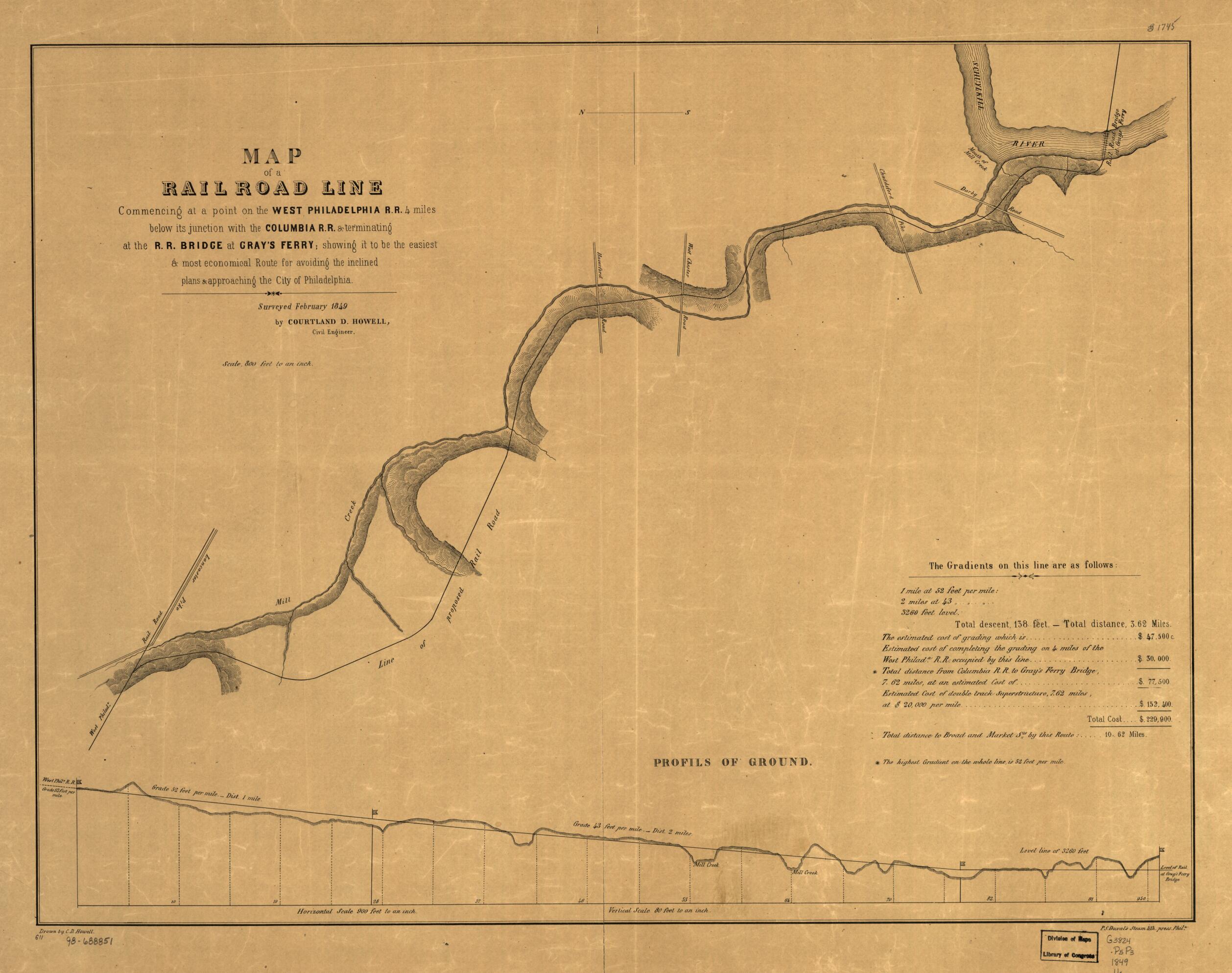
Philadelphia R.R. 4 Miles Below Its Junction With the Columbia R.R. & Terminating at the R.R. Bridge at Gray's Ferry; Showing It to Be the Easiest & Most Economical Route for Avoiding the Inclined Plans & Approaching the City of Philadelphia; Surveyed...
- Regular price
-
$53.95 - Regular price
-
$48.95 - Sale price
-
$53.95
Shipping calculated at checkout.
Buy one map, get any other map in our collection for 50% OFF! Add to cart to see discount.
Couldn't load pickup availability
About This Map
Old map of Pennsylvania, Philadelphia, United States.
The distance and cost of grading is tabulated at the lower right of the map. The area covered is along Mill Creek and from the Lancaster Pike to Schuylkill River.
Created by Courtland D. Howell, West Philadelphia Rail Road Company in 1849.
The distance and cost of grading is tabulated at the lower right of the map. The area covered is along Mill Creek and from the Lancaster Pike to Schuylkill River.
Created by Courtland D. Howell, West Philadelphia Rail Road Company in 1849.
- Scale 1:9,600.
- Across bottom of map: "Profiles of ground." 6 x 56 cm.
- Description derived from published bibliography.
Map Sizing Information
- For the best legibility, order your map in the original size or larger. Most maps have intricate detail and small text that is best appreciated when the print size hasn't been reduced.
- Sizes labeled "Fits a Standard Frame" will drop right into any frame that you purchase in that size. The sizes that we offer are commonly available online and at most retail stores.
- Our standard sizes are recommendations based on the aspect ratio of the original map, but still may require some added "white space" in one dimension to fit.
- Non-standard sizes will require custom framing, and we suggest taking your print to the frame shop of your choice after you receive it for the best results.
- Custom sizes are available, simply contact us for a quote.
Below is an approximation of the scale of a few standard sizes, and how they might appear in your space.

