
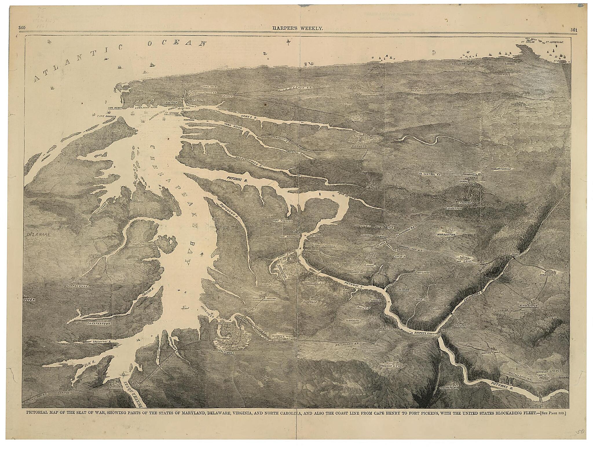
Pictorial Map of the Seat of War, Showing Parts of the States of Maryland, Delaware, Virginia, and North Carolina, and Also the Coast Line from Cape Henry to Fort Pickens, With the United States Blockading Fleet 1861
- Regular price
-
$56.95 - Regular price
-
$39.95 - Sale price
-
$56.95
Shipping calculated at checkout.
Buy one map, get any other map in our collection for 50% OFF! Add to cart to see discount.
Couldn't load pickup availability
About This Map
Old map of Atlantic States, Delaware, Maryland, North Carolina, United States, Virginia.
- From: Harper's weekly, June 8, 1861, p. 360-361.
- Relief shown by shading.
- This item is in the Map Collection of the Library of Virginia; please contact the Library's Archives Research Services department for more information.
- C. 1 Mar. 2002; Mrs. Cora Wilson, 1941, i; Map Cataloging Team; c. 2 Nov. 2002; Mrs. Cora Wilson, 1945, b; Map Cataloging Team.
Map Subjects
Atlantic States
Civil War
Delaware
History
Maryland
North Carolina
United States
Virginia
1861
Map Sizing Information
- For the best legibility, order your map in the original size or larger. Most maps have intricate detail and small text that is best appreciated when the print size hasn't been reduced.
- Sizes labeled "Fits a Standard Frame" will drop right into any frame that you purchase in that size. The sizes that we offer are commonly available online and at most retail stores.
- Our standard sizes are recommendations based on the aspect ratio of the original map, but still may require some added "white space" in one dimension to fit.
- Non-standard sizes will require custom framing, and we suggest taking your print to the frame shop of your choice after you receive it for the best results.
- Custom sizes are available, simply contact us for a quote.
Below is an approximation of the scale of a few standard sizes, and how they might appear in your space.

