
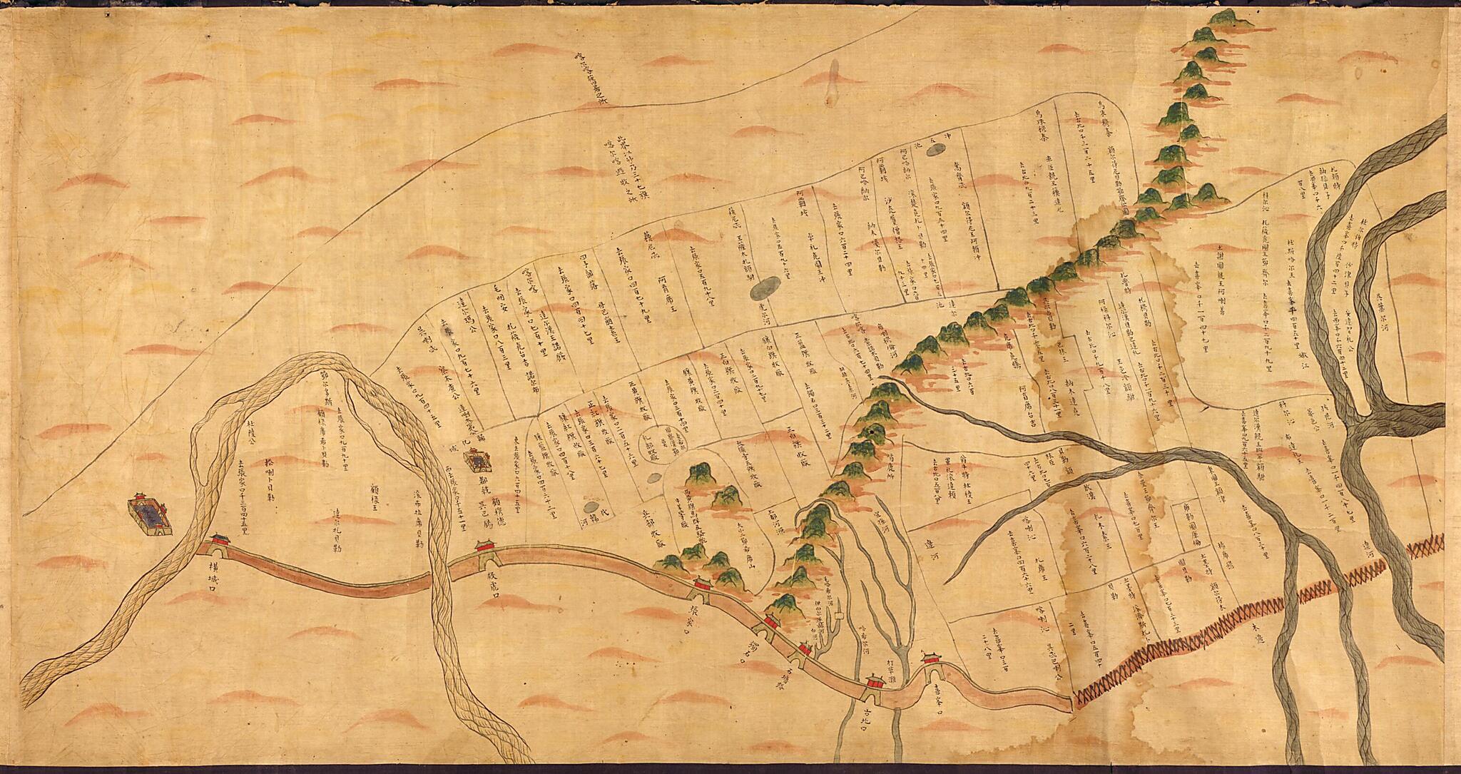
Aihun, Luosha, Taiwan, Nei Menggu Tu (艾渾,羅刹,台灣,蒙古圖, Pictorical Maps of Aihun, Russia, Taiwan and Mongolia) 1697
- Regular price
-
$97.95 - Regular price
-
$92.95 - Sale price
-
$97.95
Buy one map, get any other map in our collection for 50% OFF! Add to cart to see discount.
Couldn't load pickup availability
About This Map
Discover the timeless beauty of our fine art quality printed reproduction of this antique map. Perfect for history enthusiasts, collectors, and interior decorators.
Restored with meticulous attention to detail by our team with over a decade of experience, this stunning reproduction captures the intricate artistry and historical significance of the original map.
Whether you're a collector or seeking a unique decor piece, this archival-quality map reproduction is a timeless addition to any space. Order now to bring history to life!
Old pictorial map / early map of China, East Asia, Eastern, Heihe Shi, Inner Mongolia, Russia, Siberia, Siberia, Eastern, Taiwan.- Scales differ.
- Manuscript on silk.
- Relief shown pictorially.
- Pictorial map.
- Bird's-eye view.
- Covers four frontier regions of the Manchu Dynasty, Aihun area, a military colony since the middle of the 17th century on the north banks of the Amur, Russian camp in eastern Siberia, Taiwan and Pescadores Islands, and Inner Mongolia.
- Shows military installations and defenses in Aihun (Which is now a district in Heihe Shi, Heilongjiang Sheng), Russian camp in eastern Siberia, Taiwan and Inner Mongolia.
- Hummel purchase 1930, no. 6.
Map Subjects
China
Early Maps
Early Works To 1800
East Asia
Fortification
Heihe Shi
Heihe Shi (China)
Inner Mongolia
Inner Mongolia (China)
Pictorial Maps
Russia
Siberia Eastern
Siberia Eastern (Russia)
Taiwan
Eastern
Siberia
1697
- For the best legibility, order your map in the original size or larger. Most maps have intricate detail and small text that is best appreciated when the print size hasn't been reduced.
- Sizes labeled "Fits a Standard Frame" will drop right into any frame that you purchase in that size. The sizes that we offer are commonly available online and at most retail stores.
- Our standard sizes are recommendations based on the aspect ratio of the original map, but still may require some added "white space" in one dimension to fit.
- Non-standard sizes will require custom framing, and we suggest taking your print to the frame shop of your choice after you receive it for the best results.
- Custom sizes are available, simply contact us for a quote.
Below is an approximation of the scale of a few standard sizes, and how they might appear in your space.
