
Pilot Chart of the South Atlantic (South Atlantic) 1850
- Regular price
-
$89.95 - Regular price
-
$84.95 - Sale price
-
$89.95
Shipping calculated at checkout.
Buy one map, get any other map in our collection for 50% OFF! Add to cart to see discount.
Couldn't load pickup availability
About This Map
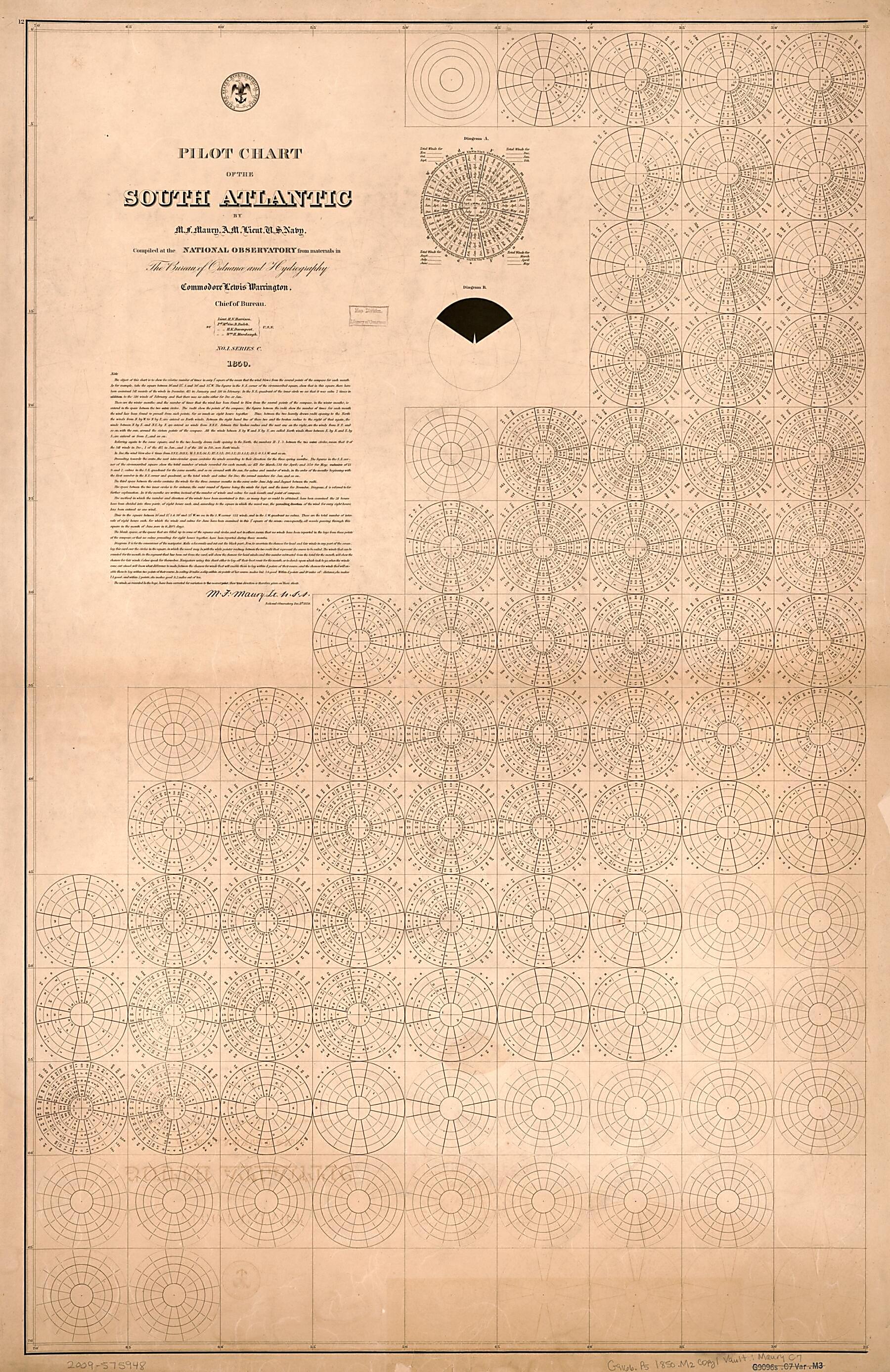
Old nautical chart of South Atlantic Ocean.
Created by Matthew Fontaine Maury, United States Naval Observatory, United States. Bureau of Ordnance and Hydrography, United States. Hydrographic Office, L. (Lewis) Warrington in 1850.
Created by Matthew Fontaine Maury, United States Naval Observatory, United States. Bureau of Ordnance and Hydrography, United States. Hydrographic Office, L. (Lewis) Warrington in 1850.
- Shows prevailing wind direction by month.
- "No. 1. Series C."
- The pilot charts were released as series C a part of Maury's "Wind and current charts", series A-F. These charts were designed for sailing ships and recorded wind direction observations made by mariners on previous voyages. For complete discussion, see "The wind and current chart series produced by Matthew Fontaine Maury," by Marc I. Pinsel, in Navigation : Journal of the Institute of Navigation, v. 28, no. 2 (Summer, 1981), p. 123-137.
- In upper left margin: 12.
- Includes diagrams and notes in map area with signature of M.F. Maury.
- Copy This map has some imperfections: discoloration throughout, mounted on cloth backing. We'll do our best to restore the image before printing.
Map Subjects
Charts Diagrams Etc
Nautical Charts
South Atlantic Ocean
Winds
Matthew Fontaine Maury
United States Naval Observatory
United States. Bureau Of Ordnance And Hydrography
United States. Hydrographic Office
L. (Lewis) Warrington
1850
Map Sizing Information
- For the best legibility, order your map in the original size or larger. Most maps have intricate detail and small text that is best appreciated when the print size hasn't been reduced.
- Sizes labeled "Fits a Standard Frame" will drop right into any frame that you purchase in that size. The sizes that we offer are commonly available online and at most retail stores.
- Our standard sizes are recommendations based on the aspect ratio of the original map, but still may require some added "white space" in one dimension to fit.
- Non-standard sizes will require custom framing, and we suggest taking your print to the frame shop of your choice after you receive it for the best results.
- Custom sizes are available, simply contact us for a quote.
Below is an approximation of the scale of a few standard sizes, and how they might appear in your space.

