
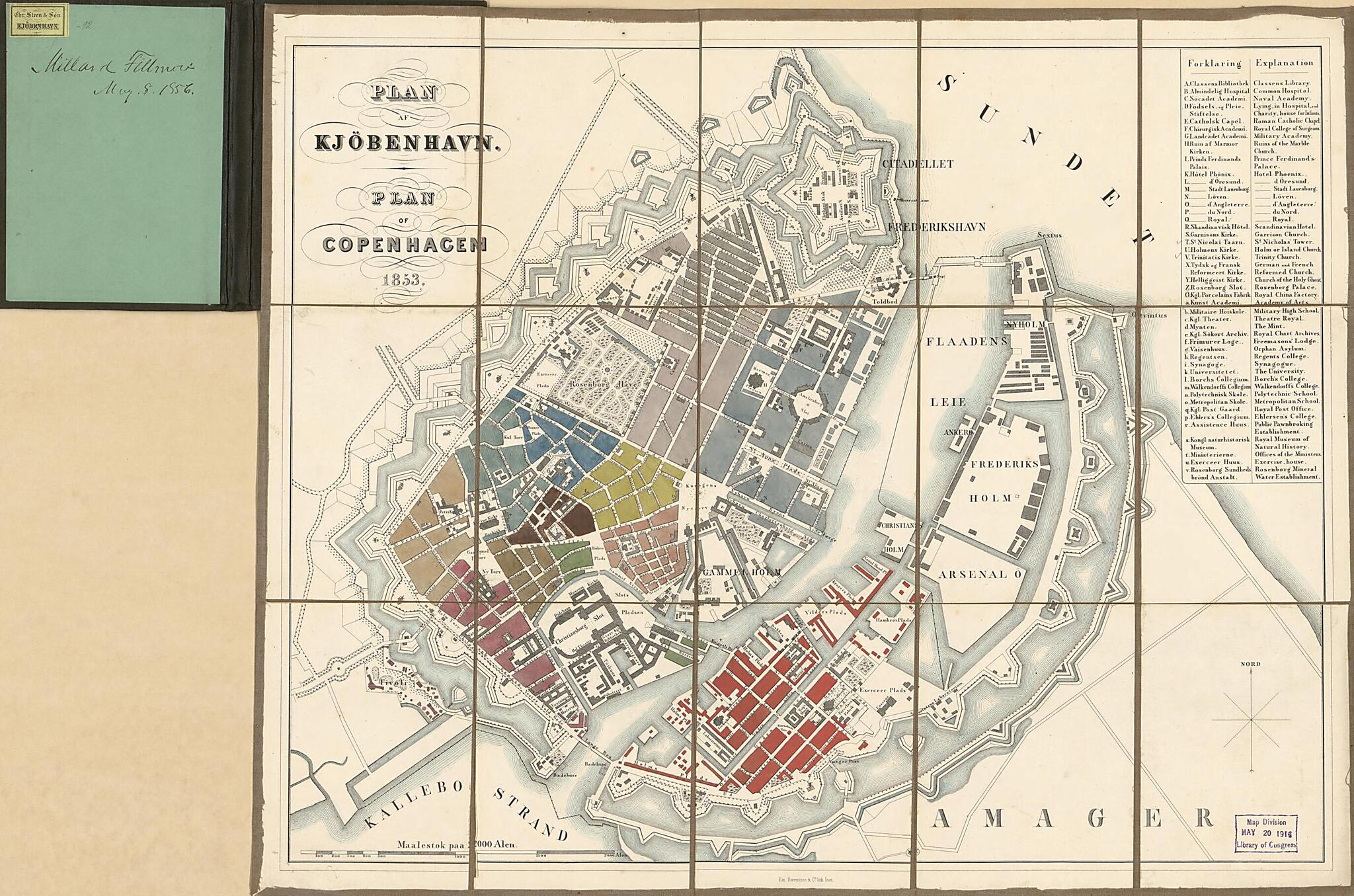
Plan Af Kjöbenhavn = Plan of Copenhagen (Plan of Copenhagen, Kjöbenhavn) 1853
- Regular price
-
$51.95 - Regular price
-
$35.95 - Sale price
-
$51.95
Shipping calculated at checkout.
Buy one map, get any other map in our collection for 50% OFF! Add to cart to see discount.
Couldn't load pickup availability
About This Map
Old map of Copenhagen, Denmark.
Created by Emilius Bærentzen & Co, Millard Fillmore in 1853.
Created by Emilius Bærentzen & Co, Millard Fillmore in 1853.
- City street map showing principal buildings, administrative wards, circumferential military fortifications (ramparts/bastions/canals, moats), and port facilities.
- Title on sheet and index in Danish and English.
- Signed in ink script on label affixed to cover title panel: City of Copenhagen, Millard Fillmore, May 8th, 1856, No. 36; and on inside of cover: Millard Fillmore, May 8, 1856.
- Seller's name label affixed to inside of cover.
- Sheet sectioned to 15 panels to enable folding; cloth hemmed.
- Includes index to official institutions and points of interest.
Map Subjects
Copenhagen
Copenhagen (Denmark)
Denmark
Fortification
Harbors
Emilius Bærentzen & Co
Millard Fillmore
1853
Map Sizing Information
- For the best legibility, order your map in the original size or larger. Most maps have intricate detail and small text that is best appreciated when the print size hasn't been reduced.
- Sizes labeled "Fits a Standard Frame" will drop right into any frame that you purchase in that size. The sizes that we offer are commonly available online and at most retail stores.
- Our standard sizes are recommendations based on the aspect ratio of the original map, but still may require some added "white space" in one dimension to fit.
- Non-standard sizes will require custom framing, and we suggest taking your print to the frame shop of your choice after you receive it for the best results.
- Custom sizes are available, simply contact us for a quote.
Below is an approximation of the scale of a few standard sizes, and how they might appear in your space.
