
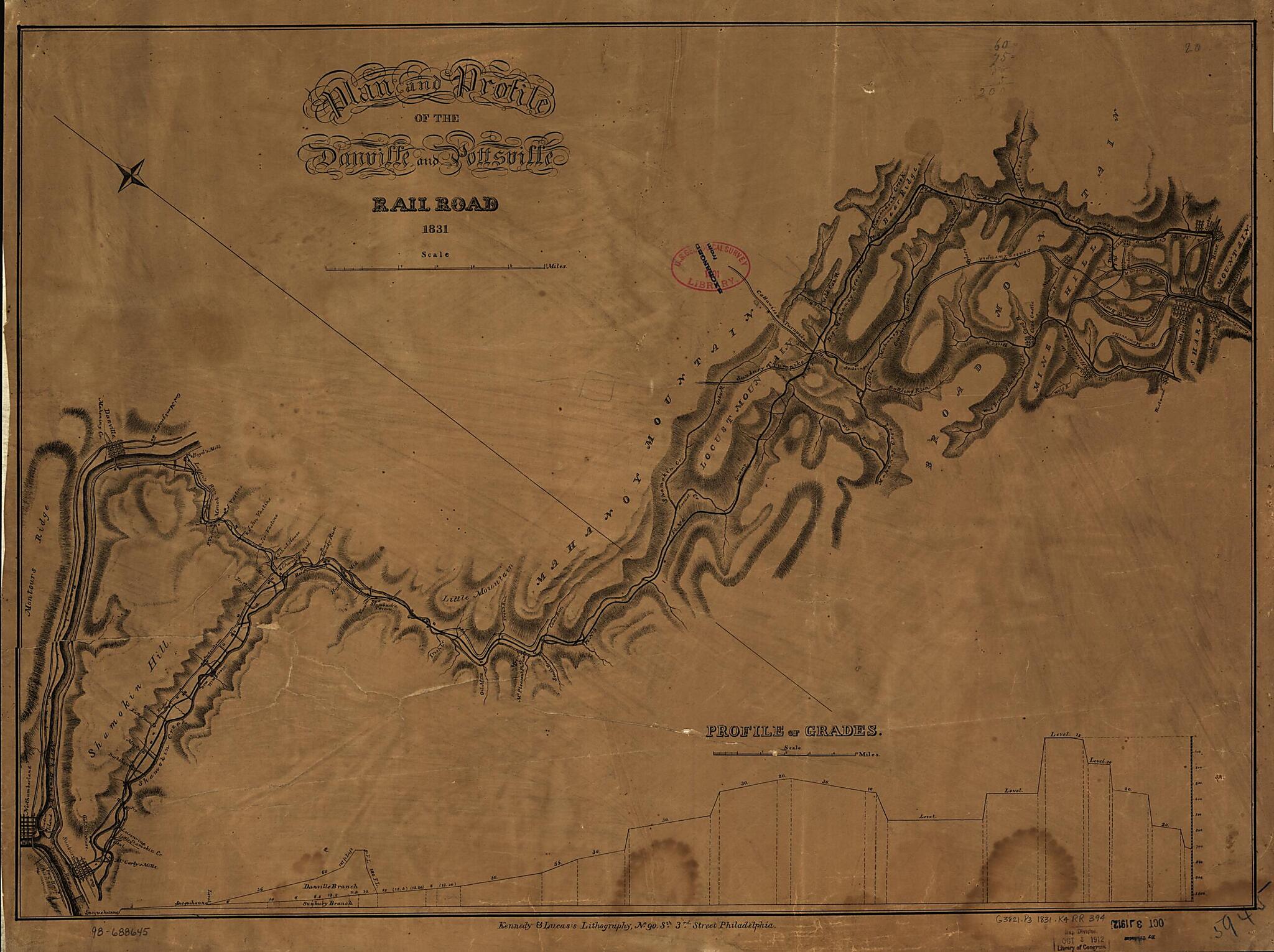
Plan and Profile of the Danville and Pottsville Rail Road 1831
- Regular price
-
$59.95 - Regular price
-
$54.95 - Sale price
-
$59.95
Shipping calculated at checkout.
Buy one map, get any other map in our collection for 50% OFF! Add to cart to see discount.
Couldn't load pickup availability
About This Map
Old map of Pennsylvania, United States.
Detailed map of part of Pennsylvania between Sharp Mountain and the Susquehanna River showing roads, drainage, and relief by hachures along the survey route. Shows the east and west branches of the Mount Carbon Railroad and the Mill Creek Railroad, which began operation in 1829. Chartered on April 8, 1826. Name changed in 1851 to the Philadelphia and Sunbury Rail Road.
Created by Danville and Pottsville Rail Road Company, David K. Kennedy, William B. Lucas in 1831.
- Scale ca. 1:85,000.
- Description derived from published bibliography.
- Across bottom of map: "Profiles of grades."
Map Subjects
Danville And Pottsville Rail Road Company
Pennsylvania
Railroads
United States
David K. Kennedy
William B. Lucas
1831
Map Sizing Information
- For the best legibility, order your map in the original size or larger. Most maps have intricate detail and small text that is best appreciated when the print size hasn't been reduced.
- Sizes labeled "Fits a Standard Frame" will drop right into any frame that you purchase in that size. The sizes that we offer are commonly available online and at most retail stores.
- Our standard sizes are recommendations based on the aspect ratio of the original map, but still may require some added "white space" in one dimension to fit.
- Non-standard sizes will require custom framing, and we suggest taking your print to the frame shop of your choice after you receive it for the best results.
- Custom sizes are available, simply contact us for a quote.
Below is an approximation of the scale of a few standard sizes, and how they might appear in your space.

