
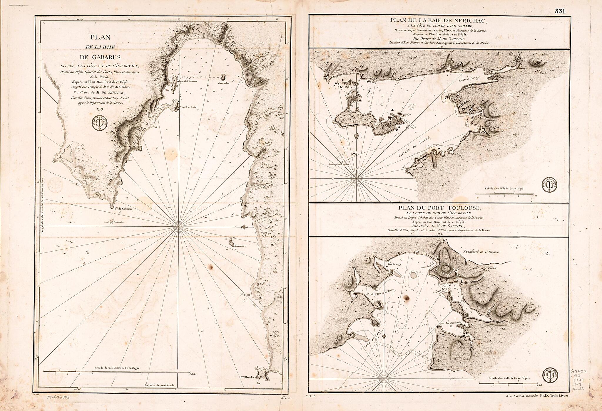
Plan De La Baie De Gabarus Située a La Côte S.E. De L'Île Royale 1779
- Regular price
-
$95.95 - Regular price
-
$90.95 - Sale price
-
$95.95
Shipping calculated at checkout.
Buy one map, get any other map in our collection for 50% OFF! Add to cart to see discount.
Couldn't load pickup availability
About This Map
Old early map of Canada, Gabarus Bay, Nova Scotia, Saint Peters Bay.
Created by Joseph Bernard Chabert, France. Dépôt Des Cartes Et Plans De La Marine, Petit, Antoine De Sartine in 1779.
Created by Joseph Bernard Chabert, France. Dépôt Des Cartes Et Plans De La Marine, Petit, Antoine De Sartine in 1779.
- Relief shown by hachures. Depths shown by soundings.
- "331" located in upper right corner of sheet.
- "N. 1. A. et 2. A. ensemble prix trois livres" located in lower right corner of sheet.
- "No. 1. A." and "N. 2. A." located in lower middle part of sheet.
Map Subjects
Canada
Early Maps
Early Works To 1800
Gabarus Bay
Gabarus Bay (N.S.)
Nova Scotia
Saint Peters Bay
Saint Peters Bay (N.S.)
Joseph Bernard Chabert
France. Dépôt Des Cartes Et Plans De La Marine
Petit
Antoine De Sartine
1779
Map Sizing Information
- For the best legibility, order your map in the original size or larger. Most maps have intricate detail and small text that is best appreciated when the print size hasn't been reduced.
- Sizes labeled "Fits a Standard Frame" will drop right into any frame that you purchase in that size. The sizes that we offer are commonly available online and at most retail stores.
- Our standard sizes are recommendations based on the aspect ratio of the original map, but still may require some added "white space" in one dimension to fit.
- Non-standard sizes will require custom framing, and we suggest taking your print to the frame shop of your choice after you receive it for the best results.
- Custom sizes are available, simply contact us for a quote.
Below is an approximation of the scale of a few standard sizes, and how they might appear in your space.
