
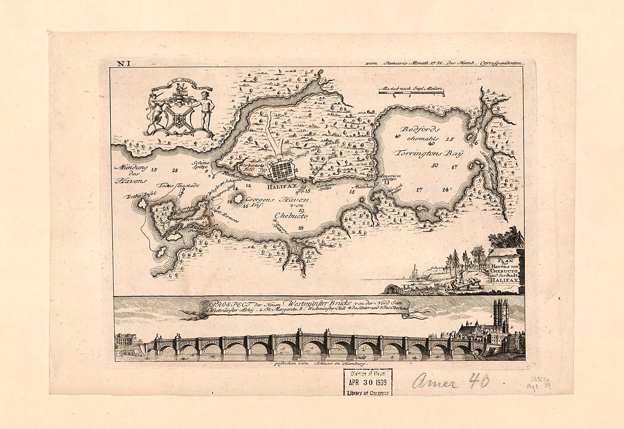
Plan Des Havens Von Chebucto Und Der Stadt Halifax 1751
- Regular price
-
$49.95 - Regular price
-
$34.95 - Sale price
-
$49.95
Shipping calculated at checkout.
Buy one map, get any other map in our collection for 50% OFF! Add to cart to see discount.
Couldn't load pickup availability
About This Map
Old early map / nautical chart of Canada, England, Halifax, London, N. S., Nova Scotia, Westminster Bridge.
- Depths shown by soundings.
- Includes ensign of Nova Scotia, illustrated cartouche, and indexed view of "Prospect der neuen Westmünster Brücke von der Nord Seite".
- In upper right: N. 1.
- Oriented with north to the right.
Map Subjects
Canada
Early Maps
Early Works To 1800
Halifax
Halifax (N. S.)
Harbors
Nautical Charts
Nova Scotia
Views
Westminster Bridge (London England)
England
London
N. S.
Westminster Bridge
Early Maps
Nautical Charts
1751
Map Sizing Information
- For the best legibility, order your map in the original size or larger. Most maps have intricate detail and small text that is best appreciated when the print size hasn't been reduced.
- Sizes labeled "Fits a Standard Frame" will drop right into any frame that you purchase in that size. The sizes that we offer are commonly available online and at most retail stores.
- Our standard sizes are recommendations based on the aspect ratio of the original map, but still may require some added "white space" in one dimension to fit.
- Non-standard sizes will require custom framing, and we suggest taking your print to the frame shop of your choice after you receive it for the best results.
- Custom sizes are available, simply contact us for a quote.
Below is an approximation of the scale of a few standard sizes, and how they might appear in your space.
