
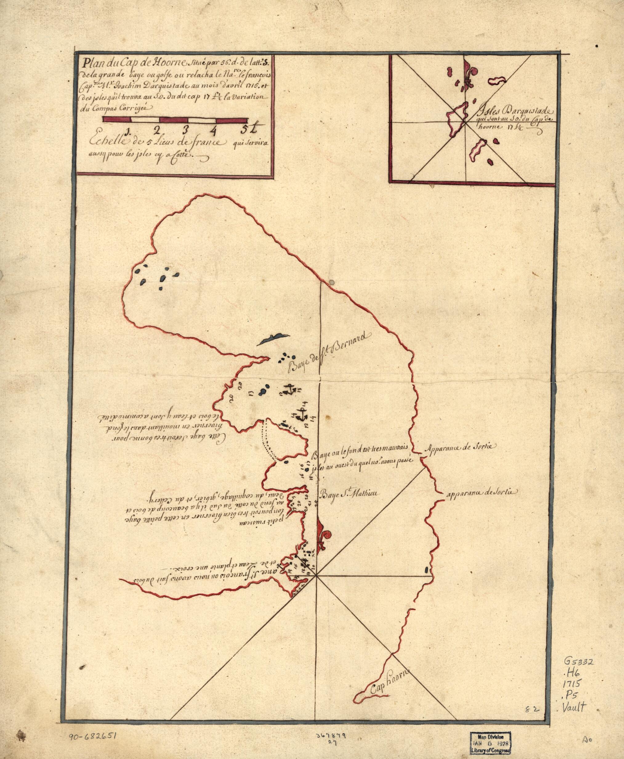
Plan Du Cap De Hoorne Situé Par 56. D. De Latt. S. De La Grande Baye Ou Golfe Ou Relacha Le Nare. Le François Capne. Mr. Ioachim Darquistade Au Mois D'avril 1715 Et Des Isles Qu'il Trouva Au S.O. Du Dit Cap 17 L 1/2 La Variation Du Compas Corriegeé
- Regular price
-
$49.95 - Regular price
-
$29.95 - Sale price
-
$49.95
Shipping calculated at checkout.
Buy one map, get any other map in our collection for 50% OFF! Add to cart to see discount.
Couldn't load pickup availability
About This Map
Old map of Cape Horn, Chile, Horn, Cape, Region, Pacific Coast, Region.
Created by Joachim Darquistade in 1715.
Created by Joachim Darquistade in 1715.
- Shows coasts of Cape Horn region and adjacent islands.
- Depths shown by soundings.
- Watermarks: Cluster of grapes and indecipherable lettering.
- Pen-and-ink and red and blue inks.
- Mounted on cloth backing.
- Includes inset of Darquistade Islands and notes.
- Maggs number annotated in pencil in lower right corner: 82.
- Printed label describing the map mounted on verso. Attributes the provenance of map content to an original plan made by the French Captain Joachim Darquistade during his exploration of the coast of Tierra del Fuego, etc., in 1715.
Map Sizing Information
- For the best legibility, order your map in the original size or larger. Most maps have intricate detail and small text that is best appreciated when the print size hasn't been reduced.
- Sizes labeled "Fits a Standard Frame" will drop right into any frame that you purchase in that size. The sizes that we offer are commonly available online and at most retail stores.
- Our standard sizes are recommendations based on the aspect ratio of the original map, but still may require some added "white space" in one dimension to fit.
- Non-standard sizes will require custom framing, and we suggest taking your print to the frame shop of your choice after you receive it for the best results.
- Custom sizes are available, simply contact us for a quote.
Below is an approximation of the scale of a few standard sizes, and how they might appear in your space.

