
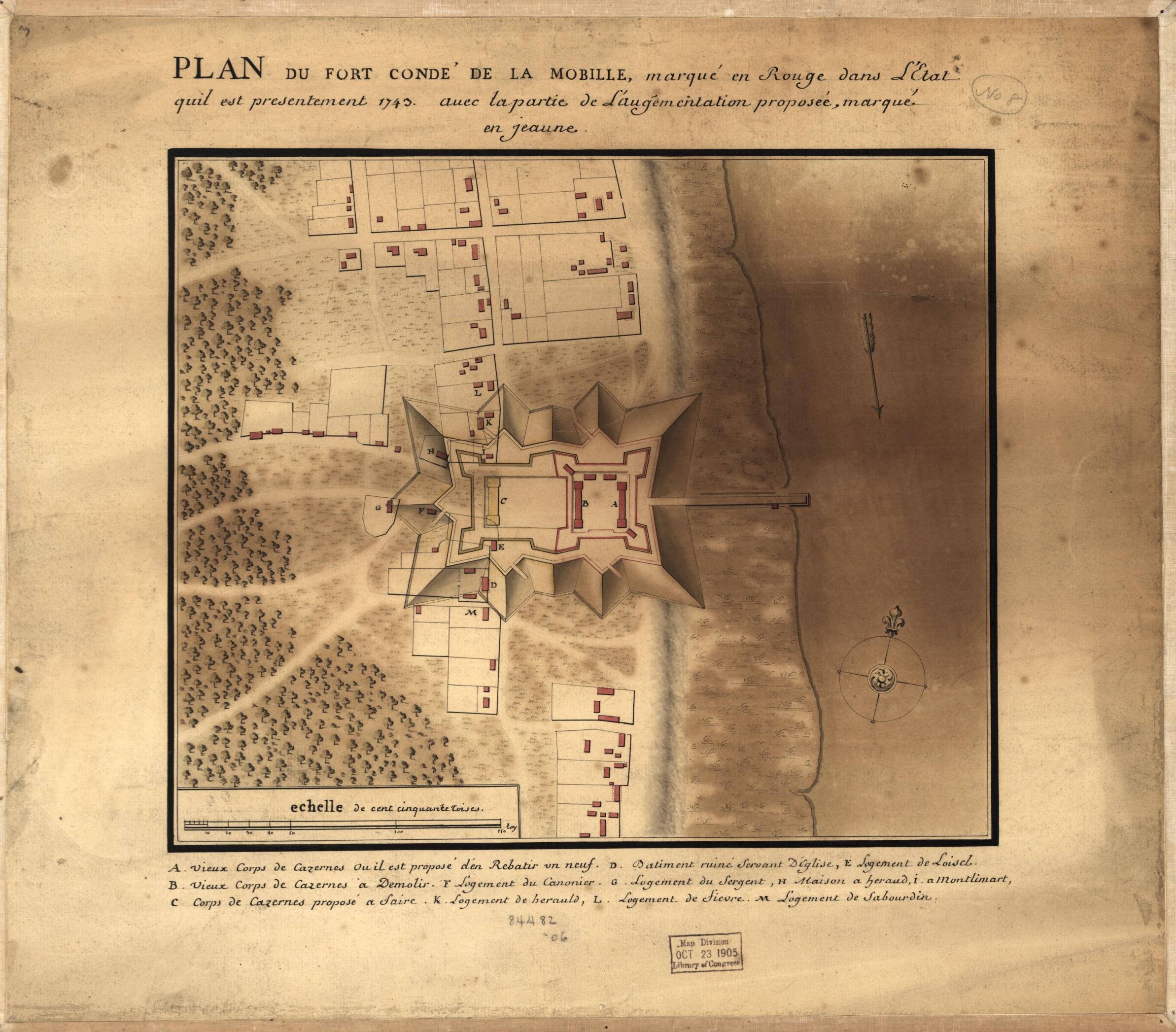
Plan Du Fort Condé De La Mobille, Marqué En Rouge Dans L'Etat Quil Est Presentement 1743, Avec La Partie De L'augementation i.e. L'augmentation Proposée, Marqué En Jeaune i.e. Jaune
- Regular price
-
$49.95 - Regular price
-
$29.95 - Sale price
-
$49.95
Shipping calculated at checkout.
Buy one map, get any other map in our collection for 50% OFF! Add to cart to see discount.
Couldn't load pickup availability
About This Map
Old map of Alabama, Fort Charlotte, Fort Charlotte (Mobile), Mobile, United States.
- Relief shown pictorially and by shading.
- Shows Mobile and Fort Condé (later renamed Fort Charlotte), Alabama.
- "Echelle de cent cinquante toises."
- Pen-and-ink and watercolor (green, brown, red, yellow).
- "This French plan of Mobile shows proposed improvements for Fort Condé. A legend in the plan indicates proposals to repair, demolish, or construct quarters ..."--Luso-Hispanic World, p. 235.
- Oriented with north to the upper right.
- This map has some imperfections: stained along right sheet edge, mounted on cloth backing. We'll do our best to restore the image before printing.
Map Sizing Information
- For the best legibility, order your map in the original size or larger. Most maps have intricate detail and small text that is best appreciated when the print size hasn't been reduced.
- Sizes labeled "Fits a Standard Frame" will drop right into any frame that you purchase in that size. The sizes that we offer are commonly available online and at most retail stores.
- Our standard sizes are recommendations based on the aspect ratio of the original map, but still may require some added "white space" in one dimension to fit.
- Non-standard sizes will require custom framing, and we suggest taking your print to the frame shop of your choice after you receive it for the best results.
- Custom sizes are available, simply contact us for a quote.
Below is an approximation of the scale of a few standard sizes, and how they might appear in your space.

